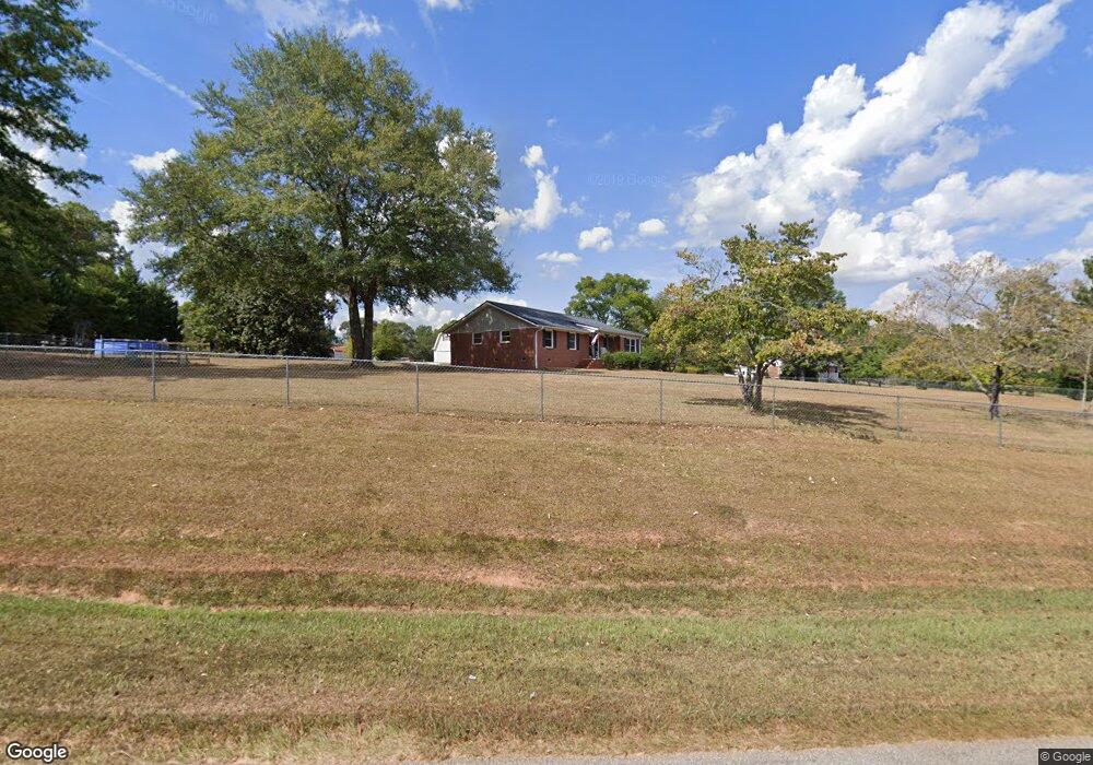
417 Burnette Rd Barnesville, GA 30204
Estimated Value: $224,147 - $425,000
4
Beds
3
Baths
1,616
Sq Ft
$187/Sq Ft
Est. Value
About This Home
This home is located at 417 Burnette Rd, Barnesville, GA 30204 and is currently estimated at $302,037, approximately $186 per square foot. 417 Burnette Rd is a home located in Lamar County with nearby schools including Lamar County Primary School, Lamar County Elementary School, and Lamar County Middle School.
Ownership History
Date
Name
Owned For
Owner Type
Purchase Details
Closed on
Aug 28, 2020
Sold by
Boyt Thomas Greg
Bought by
Boyt Thomas Nicholas and Boyt Tiffany
Current Estimated Value
Home Financials for this Owner
Home Financials are based on the most recent Mortgage that was taken out on this home.
Original Mortgage
$116,250
Outstanding Balance
$103,164
Interest Rate
2.9%
Mortgage Type
New Conventional
Estimated Equity
$198,873
Purchase Details
Closed on
Aug 15, 2005
Sold by
Boyt Angela Martin
Bought by
Boyt Thomas Greg
Purchase Details
Closed on
Feb 12, 2002
Sold by
Boyt Angela
Bought by
Boyt Angela
Purchase Details
Closed on
Aug 1, 1989
Sold by
Martin Betty
Bought by
Boyt Angela
Create a Home Valuation Report for This Property
The Home Valuation Report is an in-depth analysis detailing your home's value as well as a comparison with similar homes in the area
Home Values in the Area
Average Home Value in this Area
Purchase History
| Date | Buyer | Sale Price | Title Company |
|---|---|---|---|
| Boyt Thomas Nicholas | $125,000 | -- | |
| Boyt Thomas Greg | -- | -- | |
| Boyt Angela | $37,000 | -- | |
| Boyt Angela | -- | -- |
Source: Public Records
Mortgage History
| Date | Status | Borrower | Loan Amount |
|---|---|---|---|
| Open | Boyt Thomas Nicholas | $116,250 |
Source: Public Records
Tax History Compared to Growth
Tax History
| Year | Tax Paid | Tax Assessment Tax Assessment Total Assessment is a certain percentage of the fair market value that is determined by local assessors to be the total taxable value of land and additions on the property. | Land | Improvement |
|---|---|---|---|---|
| 2024 | $1,622 | $65,245 | $5,995 | $59,250 |
| 2023 | $1,562 | $58,463 | $5,995 | $52,468 |
| 2022 | $1,403 | $52,698 | $3,116 | $49,582 |
| 2021 | $849 | $28,255 | $3,116 | $25,139 |
| 2020 | $894 | $28,255 | $3,116 | $25,139 |
| 2019 | $897 | $28,255 | $3,116 | $25,139 |
| 2018 | $861 | $28,255 | $3,116 | $25,139 |
| 2017 | $856 | $28,255 | $3,116 | $25,139 |
| 2016 | $856 | $28,255 | $3,116 | $25,139 |
| 2015 | $856 | $28,255 | $3,116 | $25,139 |
| 2014 | $909 | $30,969 | $3,116 | $27,853 |
| 2013 | -- | $30,968 | $3,115 | $27,853 |
Source: Public Records
Map
Nearby Homes
- 254 Needleleaf Dr
- 746 Highway 18 W
- 818 Cannafax Rd
- 0 Old Milner Rd Unit 10630085
- 144 Berry Rd
- 150 Berry Rd
- 146 Berry Rd
- 148 Berry Rd
- 0 Washington Cir
- 0 Perkins Rd Unit 253616
- 0 Perkins Rd Unit 10625263
- 0 Perkins Rd Unit 10635198
- 500 Rose Ave
- 13 Brown St
- 967 Five Points Rd
- 725 Mccollum Rd
- 0 Piedmont Rd Unit 10600733
- 295 Grove St
- 0 Veterns Pkwy Unit 10515268
- 125 Byrd St
- 403 Burnette Rd
- 421 Burnette Rd
- 427 Burnette Rd
- 393 Burnette Rd
- 510 Cannafax Rd
- 540 Cannafax Rd
- 526 Cannafax Rd
- 438 Burnette Rd
- 408 Burnette Rd
- 556 Cannafax Rd
- 558 Cannafax Rd
- 558 Cannafax Rd
- 484 Cannafax Rd
- 505 Cannafax Rd
- 568 Cannafax Rd
- 350 Burnette Rd
- 557 Cannafax Rd
- 493 Cannafax Rd
- 472 Cannafax Rd
- 472 Cannafax Rd Unit 50
