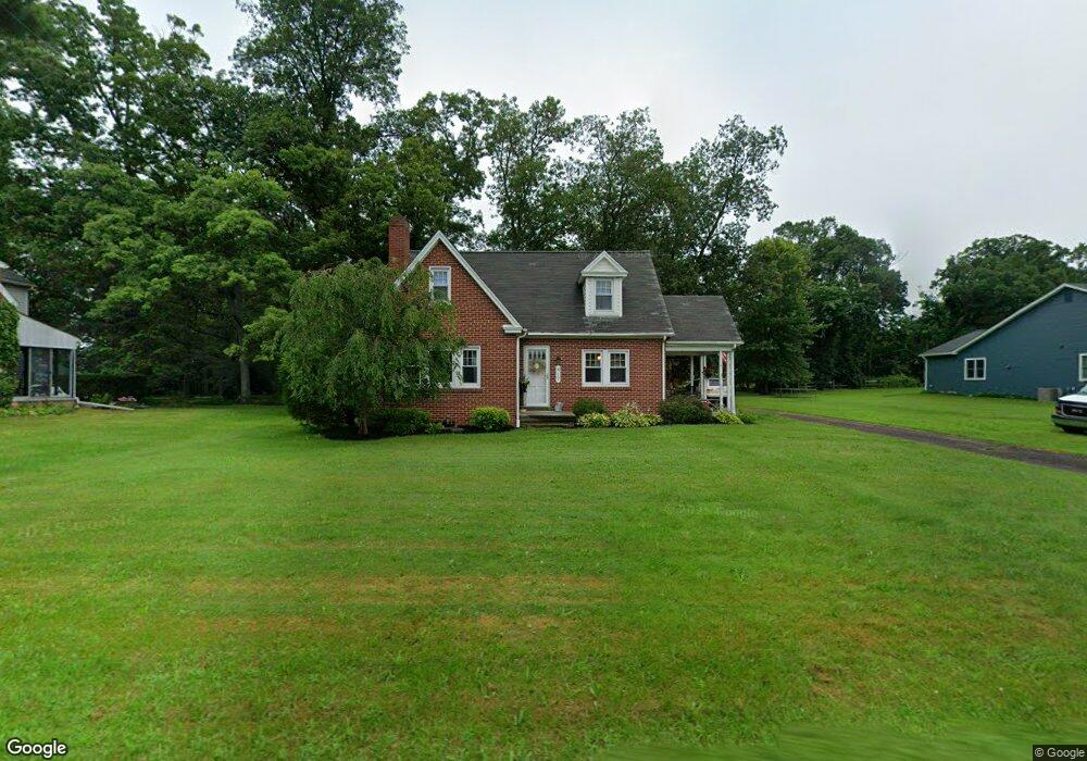
417 Cowpath Rd Souderton, PA 18964
Estimated Value: $487,163 - $496,000
About This Home
This home is located at 417 Cowpath Rd, Souderton, PA 18964 and is currently estimated at $492,791, approximately $290 per square foot. 417 Cowpath Rd is a home located in Montgomery County with nearby schools including Franconia Elementary School, Indian Crest Middle School, and Souderton Area Senior High School.
Ownership History
We collect this data history from publicly available records. To have your information removed, we recommend requesting removal directly through your county’s website.
Purchase Details
Home Financials for this Owner
Home Financials are based on the most recent Mortgage that was taken out on this home.Home Values in the Area
Average Home Value in this Area
Purchase History
We collect this data history from publicly available records. To have your information removed, we recommend requesting removal directly through your county’s website.
| Date | Buyer | Sale Price | Title Company |
|---|---|---|---|
| $260,000 | None Available |
Mortgage History
We collect this data history from publicly available records. To have your information removed, we recommend requesting removal directly through your county’s website.
| Date | Status | Borrower | Loan Amount |
|---|---|---|---|
| Open | $39,000 | ||
| Open | $208,000 |
Tax History
We collect this data history from publicly available records. To have your information removed, we recommend requesting removal directly through your county’s website.
| Year | Tax Paid | Tax Assessment Tax Assessment Total Assessment is a certain percentage of the fair market value that is determined by local assessors to be the total taxable value of land and additions on the property. | Land | Improvement |
|---|---|---|---|---|
| 2026 | $6,458 | $146,050 | -- | -- |
| 2025 | $5,865 | $146,050 | $62,230 | $83,820 |
| 2024 | $5,865 | $146,050 | $62,230 | $83,820 |
| 2023 | $5,597 | $146,050 | $62,230 | $83,820 |
| 2022 | $5,426 | $146,050 | $62,230 | $83,820 |
| 2021 | $5,312 | $146,050 | $62,230 | $83,820 |
| 2020 | $5,240 | $146,050 | $62,230 | $83,820 |
| 2019 | $4,783 | $146,050 | $62,230 | $83,820 |
| 2018 | $5,177 | $146,050 | $62,230 | $83,820 |
| 2017 | $5,047 | $146,050 | $62,230 | $83,820 |
| 2016 | $4,990 | $146,050 | $62,230 | $83,820 |
| 2015 | $4,854 | $146,050 | $62,230 | $83,820 |
| 2014 | $4,854 | $146,050 | $62,230 | $83,820 |
Map
- 372 Oak Dr
- 3473 Devlin Way
- 490 Smokepipe Rd
- 300 Westminster Ln
- 290 Kingsfield Dr Unit 43
- 64 Diamond St
- 37 Green St
- 100 Arlington Ln
- 206 N Main St
- 248 E Summit St
- 104 W Chestnut St
- 129 Catherine St Unit 3
- 140 Central Ave
- 205 Nelis Ct
- 189 Lions Gate Cir Unit 189
- 136 Packham Ct
- 185 Lions Gate Cir Unit 185
- 318 Northview Ave
- 428 Ridge Ave
- 583 Oakmont Dr E
- 411 Cowpath Rd
- 421 Cowpath Rd
- 403 Cowpath Rd
- 376 Oak Dr
- 427 Cowpath Rd
- 397 Cowpath Rd
- 431 Cowpath Rd
- 368 Oak Dr
- 377 Oak Dr
- 405 Smokepipe Rd
- 373 Oak Dr
- 184 Harleysville Pike
- 393 Cowpath Rd
- 180 Harleysville Pike
- 364 Oak Dr
- 174 Harleysville Pike
- 367 Oak Dr
- 384 Cowpath Rd
- 409 Smokepipe Rd
- 196 Harleysville Pike
Ask me questions while you tour the home.