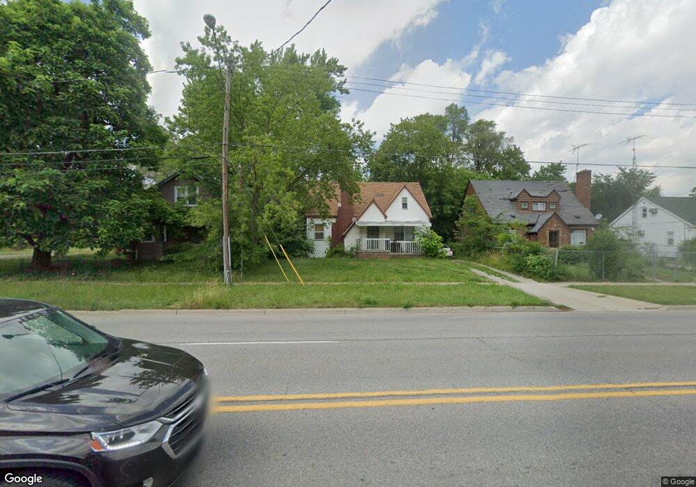
417 E Pierson Rd Flint, MI 48505
MLK Circle NeighborhoodEstimated Value: $34,000 - $70,462
5
Beds
2
Baths
1,776
Sq Ft
$30/Sq Ft
Est. Value
About This Home
This home is located at 417 E Pierson Rd, Flint, MI 48505 and is currently estimated at $53,116, approximately $29 per square foot. 417 E Pierson Rd is a home located in Genesee County with nearby schools including Brownell STEM Academy, The New Standard Academy, and Eagle's Nest Academy.
Ownership History
Date
Name
Owned For
Owner Type
Purchase Details
Closed on
Mar 26, 2012
Sold by
Bailey Kelly
Bought by
Forslund Robin
Current Estimated Value
Purchase Details
Closed on
Oct 14, 2009
Sold by
Donovan Shaun and Secretary Of Housing & Urban D
Bought by
Bailey Kelly
Purchase Details
Closed on
Apr 1, 2009
Sold by
Magna Bank
Bought by
U S Department Of Housing & Urban Develo
Purchase Details
Closed on
May 23, 2008
Sold by
Simpson Leanna
Bought by
Magna Bank and 1St Trust Bank For Savings
Purchase Details
Closed on
Sep 22, 2004
Sold by
Simpson Leanna
Bought by
1St Trust Bank For Savings
Purchase Details
Closed on
Sep 3, 1999
Sold by
Jcm Universal Inc
Bought by
Simpson Leanna
Create a Home Valuation Report for This Property
The Home Valuation Report is an in-depth analysis detailing your home's value as well as a comparison with similar homes in the area
Home Values in the Area
Average Home Value in this Area
Purchase History
| Date | Buyer | Sale Price | Title Company |
|---|---|---|---|
| Forslund Robin | -- | None Available | |
| Bailey Kelly | $4,000 | None Available | |
| U S Department Of Housing & Urban Develo | -- | None Available | |
| Magna Bank | $51,213 | None Available | |
| 1St Trust Bank For Savings | $50,985 | -- | |
| Simpson Leanna | $47,000 | Guaranty Title Company |
Source: Public Records
Tax History
| Year | Tax Paid | Tax Assessment Tax Assessment Total Assessment is a certain percentage of the fair market value that is determined by local assessors to be the total taxable value of land and additions on the property. | Land | Improvement |
|---|---|---|---|---|
| 2025 | $672 | $11,700 | $0 | $0 |
| 2024 | $646 | $9,700 | $0 | $0 |
| 2023 | $648 | $8,600 | $0 | $0 |
| 2022 | $0 | $6,600 | $0 | $0 |
| 2021 | $619 | $6,100 | $0 | $0 |
| 2020 | $593 | $7,600 | $0 | $0 |
| 2019 | $426 | $7,500 | $0 | $0 |
| 2018 | $537 | $7,900 | $0 | $0 |
| 2017 | $530 | $0 | $0 | $0 |
| 2016 | $529 | $0 | $0 | $0 |
| 2015 | -- | $0 | $0 | $0 |
| 2014 | -- | $0 | $0 | $0 |
| 2012 | -- | $4,300 | $0 | $0 |
Source: Public Records
Map
Nearby Homes
- 618 E Parkway Ave
- 680 E Pierson Rd
- 350 E Mott Ave
- 0 E Marengo Ave Unit 50200980
- 124 W Flint Park Blvd
- 225 E Piper Ave
- 329 W Baltimore Blvd
- 345 E Austin Ave
- 802 E Russell Ave
- 525 W Pulaski Ave
- 4028 North St
- 510 W Bishop Ave
- 421 E Lorado Ave
- 425 E Lorado Ave
- 422 E Foss Ave
- 638 E Foss Ave
- 3810 Marvin St
- 418 E Foss Ave
- 426 E Holbrook Ave
- 702/718 W Flint Park Blvd
- 425 E Pierson Rd
- 405 E Pierson Rd
- 406 E Ridgeway Ave
- 410 E Ridgeway Ave
- 435 E Pierson Rd
- 414 E Ridgeway Ave
- 402 E Ridgeway Ave
- 422 E Ridgeway Ave
- 416 E Ridgeway Ave
- 414 E Pierson Rd
- 418 E Pierson Rd
- 410 E Pierson Rd
- 422 E Pierson Rd
- 406 E Pierson Rd
- 402 E Pierson Rd
- 350 E Ridgeway Ave
- 506 E Pierson Rd
- 349 E Pierson Rd
- 511 E Pierson Rd
- 506 E Ridgeway Ave
Your Personal Tour Guide
Ask me questions while you tour the home.