Estimated Value: $725,000 - $939,000
6
Beds
3
Baths
3,661
Sq Ft
$222/Sq Ft
Est. Value
About This Home
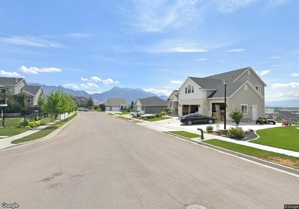
This home is located at 417 W Mountain View Rd, Lehi, UT 84043 and is currently estimated at $813,252, approximately $222 per square foot. 417 W Mountain View Rd is a home located in Utah County with nearby schools including Belmont Elementary, Skyridge High School, and Ignite Entrepreneurship Academy.
Ownership History
Date
Name
Owned For
Owner Type
Purchase Details
Closed on
Nov 25, 2015
Sold by
Wasatch Alnd Comapny Inc
Bought by
Westphal Brook Davis
Current Estimated Value
Home Financials for this Owner
Home Financials are based on the most recent Mortgage that was taken out on this home.
Original Mortgage
$398,938
Outstanding Balance
$313,797
Interest Rate
3.71%
Mortgage Type
New Conventional
Estimated Equity
$499,455
Purchase Details
Closed on
Aug 27, 2014
Sold by
Wasatch Land Co
Bought by
Wasatch Land Co Inc
Home Financials for this Owner
Home Financials are based on the most recent Mortgage that was taken out on this home.
Original Mortgage
$1,848,567
Interest Rate
4.09%
Mortgage Type
Purchase Money Mortgage
Create a Home Valuation Report for This Property
The Home Valuation Report is an in-depth analysis detailing your home's value as well as a comparison with similar homes in the area
Home Values in the Area
Average Home Value in this Area
Purchase History
| Date | Buyer | Sale Price | Title Company |
|---|---|---|---|
| Westphal Brook Davis | -- | Provo Land Title Co | |
| Wasatch Land Co Inc | -- | Affiliated First Title Co |
Source: Public Records
Mortgage History
| Date | Status | Borrower | Loan Amount |
|---|---|---|---|
| Open | Westphal Brook Davis | $398,938 | |
| Previous Owner | Wasatch Land Co Inc | $1,848,567 |
Source: Public Records
Tax History Compared to Growth
Tax History
| Year | Tax Paid | Tax Assessment Tax Assessment Total Assessment is a certain percentage of the fair market value that is determined by local assessors to be the total taxable value of land and additions on the property. | Land | Improvement |
|---|---|---|---|---|
| 2025 | $3,303 | $401,280 | $265,700 | $463,900 |
| 2024 | $3,303 | $386,485 | $0 | $0 |
| 2023 | $3,079 | $391,215 | $0 | $0 |
| 2022 | $2,895 | $356,675 | $0 | $0 |
| 2021 | $2,740 | $510,200 | $182,200 | $328,000 |
| 2020 | $2,581 | $475,200 | $168,700 | $306,500 |
| 2019 | $2,274 | $435,200 | $168,700 | $266,500 |
| 2018 | $2,176 | $393,600 | $161,900 | $231,700 |
| 2017 | $1,828 | $175,780 | $0 | $0 |
| 2016 | $1,928 | $172,040 | $0 | $0 |
| 2015 | $1,155 | $97,800 | $0 | $0 |
Source: Public Records
Map
Nearby Homes
- 4272 N Braiken Ridge Dr
- Oakridge Plan at Inverness
- Harmony Plan at Inverness
- Timberlake Plan at Inverness
- Kirkhill Plan at Inverness
- Hamilton Plan at Inverness
- Sydney Plan at Inverness
- Beechwood Plan at Inverness
- Oakley Plan at Inverness
- Dalton Plan at Inverness
- Maclean Plan at Inverness
- Elgin Plan at Inverness
- Overton Plan at Inverness
- Monroe Plan at Inverness
- Broadford Plan at Inverness
- Cullin Plan at Inverness
- Dunbar Plan at Inverness
- Aviemore Plan at Inverness
- Irvine Plan at Inverness
- Mckenzie Plan at Inverness
- 4211 N 400 W Unit 327
- 4211 N 400 W
- 431 W Mountain View Rd Unit 329
- 4267 N 400 W Unit 316
- 4191 N 400 W Unit 326
- 4191 N 400 W
- 4218 N 400 W Unit 319
- 4266 N 450 W Unit 315
- 4254 N 400 W Unit 317
- 459 W Mountain View Rd Unit 330
- 4202 N 400 W Unit 320
- 4202 N 400 W
- 4272 N 400 W Unit 818
- 4289 N 400 W Unit 812
- 4289 N 400 W
- 4173 N 400 W
- 4173 N 400 W Unit 325
- 4288 N 450 W Unit 811
- 4288 N 450 W
- 4180 N 400 W