Estimated Value: $267,746 - $285,000
3
Beds
1
Bath
864
Sq Ft
$318/Sq Ft
Est. Value
About This Home
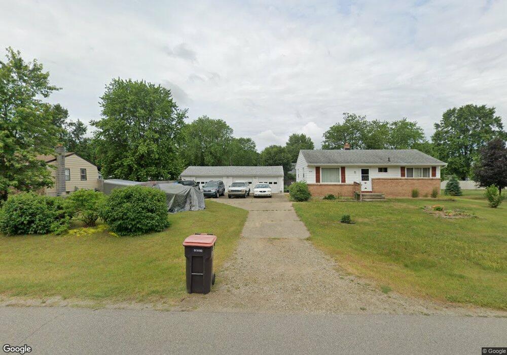
This home is located at 4170 Joan Dr, Dorr, MI 49323 and is currently estimated at $274,437, approximately $317 per square foot. 4170 Joan Dr is a home located in Allegan County with nearby schools including Wayland High School, Moline Christian School, and St. Stanislaus School.
Ownership History
Date
Name
Owned For
Owner Type
Purchase Details
Closed on
Mar 21, 2022
Sold by
Judy Goodrich Mary
Bought by
Goodrich Garry Lee and Goodrich Dennis Ray
Current Estimated Value
Purchase Details
Closed on
Dec 20, 2002
Sold by
Goodrich Garry and Byrne Sandra
Bought by
Goodrich Garry and Goodrich Mary J
Home Financials for this Owner
Home Financials are based on the most recent Mortgage that was taken out on this home.
Original Mortgage
$31,600
Interest Rate
6.23%
Create a Home Valuation Report for This Property
The Home Valuation Report is an in-depth analysis detailing your home's value as well as a comparison with similar homes in the area
Home Values in the Area
Average Home Value in this Area
Purchase History
| Date | Buyer | Sale Price | Title Company |
|---|---|---|---|
| Goodrich Garry Lee | -- | Land Title | |
| Goodrich Garry | -- | Metropolitan Title Company |
Source: Public Records
Mortgage History
| Date | Status | Borrower | Loan Amount |
|---|---|---|---|
| Previous Owner | Goodrich Garry | $31,600 |
Source: Public Records
Tax History Compared to Growth
Tax History
| Year | Tax Paid | Tax Assessment Tax Assessment Total Assessment is a certain percentage of the fair market value that is determined by local assessors to be the total taxable value of land and additions on the property. | Land | Improvement |
|---|---|---|---|---|
| 2025 | $1,976 | $104,200 | $45,400 | $58,800 |
| 2024 | $1,794 | $94,400 | $39,700 | $54,700 |
| 2023 | $1,837 | $84,400 | $36,700 | $47,700 |
| 2022 | $1,794 | $75,300 | $32,900 | $42,400 |
| 2021 | $1,682 | $72,000 | $31,600 | $40,400 |
| 2020 | $1,610 | $69,700 | $30,100 | $39,600 |
| 2019 | $1,610 | $62,800 | $27,400 | $35,400 |
| 2018 | $1,576 | $55,700 | $17,000 | $38,700 |
| 2017 | $0 | $57,800 | $17,000 | $40,800 |
| 2016 | $0 | $51,600 | $17,000 | $34,600 |
| 2015 | -- | $51,600 | $17,000 | $34,600 |
| 2014 | -- | $47,500 | $15,200 | $32,300 |
| 2013 | -- | $46,400 | $15,200 | $31,200 |
Source: Public Records
Map
Nearby Homes
- 1341 142nd Ave
- 1833 Cherry St
- 4318 17th St
- 1683 Slater St
- 1918 Ponderosa Ct
- 4087 Ronalds Rd
- 4175 21st St
- Lot 11 Walnut Dale Dr
- 1178 144th Ave
- 2338 142nd Ave
- 4280 Scarborough Ave
- 3778 22nd St
- Unit 98 Highpoint Dr
- Unit 113 Highpoint Dr
- Unit 112 Highpoint Dr
- 2298 138th Ave
- Freedom Plan at Harvest Meadows
- Sierra Plan at Harvest Meadows
- Vienna Plan at Harvest Meadows
- London Plan at Harvest Meadows