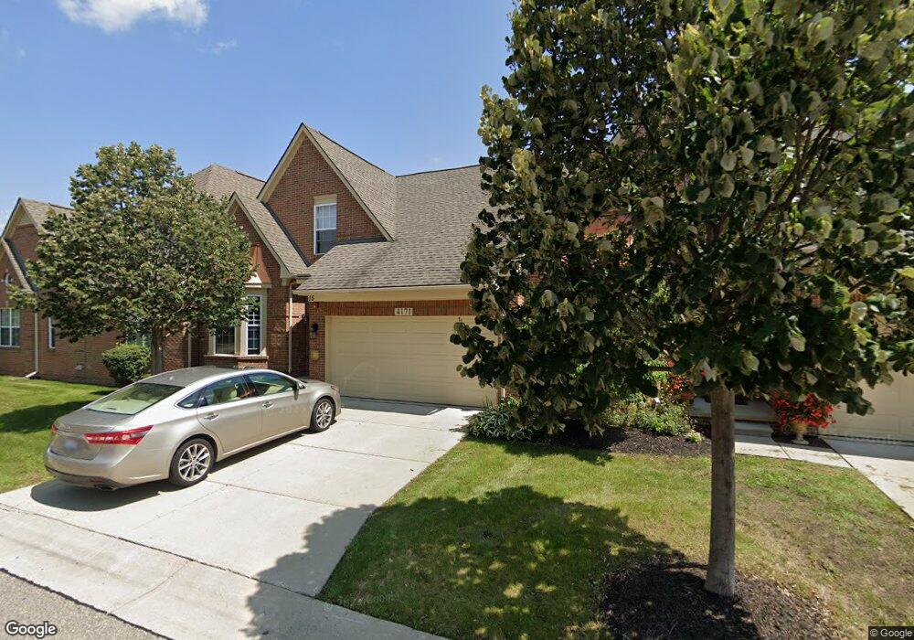
4171 Forest Bridge Dr Unit 58 Canton, MI 48188
Estimated Value: $367,836 - $413,000
--
Bed
3
Baths
1,876
Sq Ft
$206/Sq Ft
Est. Value
About This Home
This home is located at 4171 Forest Bridge Dr Unit 58, Canton, MI 48188 and is currently estimated at $386,709, approximately $206 per square foot. 4171 Forest Bridge Dr Unit 58 is a home located in Wayne County with nearby schools including Rawsonville Elementary School, Owen Intermediate School, and McBride Middle School.
Ownership History
Date
Name
Owned For
Owner Type
Purchase Details
Closed on
Jun 2, 2006
Sold by
Geric Group Llc
Bought by
Larkins Eddie L
Current Estimated Value
Home Financials for this Owner
Home Financials are based on the most recent Mortgage that was taken out on this home.
Original Mortgage
$240,203
Outstanding Balance
$146,999
Interest Rate
1.9%
Mortgage Type
Purchase Money Mortgage
Estimated Equity
$239,710
Create a Home Valuation Report for This Property
The Home Valuation Report is an in-depth analysis detailing your home's value as well as a comparison with similar homes in the area
Home Values in the Area
Average Home Value in this Area
Purchase History
| Date | Buyer | Sale Price | Title Company |
|---|---|---|---|
| Larkins Eddie L | $58,000 | Lawyers Title Ins |
Source: Public Records
Mortgage History
| Date | Status | Borrower | Loan Amount |
|---|---|---|---|
| Open | Larkins Eddie L | $240,203 |
Source: Public Records
Tax History Compared to Growth
Tax History
| Year | Tax Paid | Tax Assessment Tax Assessment Total Assessment is a certain percentage of the fair market value that is determined by local assessors to be the total taxable value of land and additions on the property. | Land | Improvement |
|---|---|---|---|---|
| 2025 | $1,808 | $184,400 | $0 | $0 |
| 2024 | $1,808 | $166,000 | $0 | $0 |
| 2023 | $1,724 | $161,900 | $0 | $0 |
| 2022 | $4,186 | $139,000 | $0 | $0 |
| 2021 | $4,064 | $137,200 | $0 | $0 |
| 2020 | $4,012 | $132,900 | $0 | $0 |
| 2019 | $3,943 | $125,840 | $0 | $0 |
| 2018 | $1,390 | $113,380 | $0 | $0 |
| 2017 | $4,574 | $111,800 | $0 | $0 |
| 2016 | $3,622 | $112,800 | $0 | $0 |
| 2015 | $8,809 | $108,560 | $0 | $0 |
| 2013 | $8,534 | $97,200 | $0 | $0 |
| 2010 | -- | $82,970 | $16,500 | $66,470 |
Source: Public Records
Map
Nearby Homes
- 4095 Cornerstone Dr Unit 179
- 4191 Cornerstone Dr Unit 200
- 4035 Cornerstone Dr Unit 176
- 4029 Cornerstone Dr Unit 177
- 48522 Bridge Way Unit 565
- 48516 Bridge Way Unit 564
- 48510 Bridge Way Unit 563
- 48504 Bridge Way Unit 562
- 48492 Bridge Way Unit 559
- 48486 Bridge Way Unit 560
- 48480 Bridge Way Unit 570
- 48474 Bridge Way Unit 569
- 3956 Cornerstone Dr Unit 568
- 3932 Cornerstone Dr Unit 567
- 3928 Cornerstone Dr Unit 566
- 3913 Ravensfield Dr
- 4160 Wrenwood Ln Unit 29
- 4154 Strathmore Ln
- 4006 Elizabeth Ave Unit 172
- 47909 Cardiff Ave
- 4063 Forest Bridge Dr Unit 82
- 4117 Forest Bridge Dr Unit 79
- 4172 Bridgeview Ln Unit 73
- 4118 Bridgeview Ln Unit 18 70
- 4297 Forest Bridge Dr Unit 51
- 4387 Forest Bridge Dr Unit 46
- 4315 Forest Bridge Dr Unit 50
- 48579 Oak Bridge Dr Unit 60
- 4135 Forest Bridge Dr Unit 78
- 4082 Bridgeview Ln Unit 68
- 4118 Bridgeview Ln Unit 70
- 4100 Bridgeview Ln
- 4225 Forest Bridge Dr Unit 55
- 4009 Forest Bridge Dr Unit 85
- 4099 Forest Bridge Dr Unit 80
- 48636 Oak Bridge Dr Unit 76
- 48608 Oak Bridge Dr Unit 75
- 4207 Forest Bridge Dr Unit 56
- 4243 Forest Bridge Dr Unit 54
- 4243 Forest Bridge Dr Unit 14