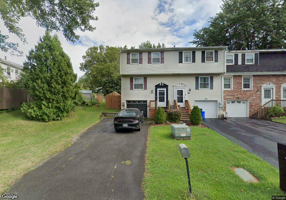
4172B Burningtree Rd Unit 4172 Liverpool, NY 13090
Estimated Value: $179,000 - $185,629
3
Beds
2
Baths
1,008
Sq Ft
$179/Sq Ft
Est. Value
About This Home
This home is located at 4172B Burningtree Rd Unit 4172, Liverpool, NY 13090 and is currently estimated at $180,657, approximately $179 per square foot. 4172B Burningtree Rd Unit 4172 is a home located in Onondaga County with nearby schools including Soule Road Elementary School, Willow Field Elementary School, and Soule Road Middle School.
Ownership History
Date
Name
Owned For
Owner Type
Purchase Details
Closed on
Mar 22, 2022
Sold by
Harris Danielle K and Harris Tammy S
Bought by
Johnson Joseph
Current Estimated Value
Purchase Details
Closed on
Aug 3, 2012
Sold by
Liotta Anthony
Bought by
Harris Danielle
Home Financials for this Owner
Home Financials are based on the most recent Mortgage that was taken out on this home.
Original Mortgage
$81,397
Interest Rate
3.75%
Mortgage Type
FHA
Purchase Details
Closed on
May 29, 2008
Sold by
Bradshaw Richard S and Bradshaw Heather J
Bought by
Liotta Anthony and Liotta Ginamarie
Purchase Details
Closed on
Sep 27, 2005
Sold by
Hall Daniel F
Bought by
Bradshaw Richard S and Bradshaw Heather J
Purchase Details
Closed on
Apr 19, 2001
Sold by
Palmer-Merritt Tawny
Bought by
Hall Daniel F
Purchase Details
Closed on
Jan 25, 1999
Create a Home Valuation Report for This Property
The Home Valuation Report is an in-depth analysis detailing your home's value as well as a comparison with similar homes in the area
Home Values in the Area
Average Home Value in this Area
Purchase History
| Date | Buyer | Sale Price | Title Company |
|---|---|---|---|
| Johnson Joseph | $130,000 | None Available | |
| Harris Danielle | $83,000 | William Bradt | |
| Liotta Anthony | $86,320 | Joyhn Nasto | |
| Bradshaw Richard S | $66,000 | Robert B Cox | |
| Hall Daniel F | $44,270 | Jamie Sutphen | |
| -- | $58,018 | -- |
Source: Public Records
Mortgage History
| Date | Status | Borrower | Loan Amount |
|---|---|---|---|
| Previous Owner | Harris Danielle | $81,397 |
Source: Public Records
Tax History Compared to Growth
Tax History
| Year | Tax Paid | Tax Assessment Tax Assessment Total Assessment is a certain percentage of the fair market value that is determined by local assessors to be the total taxable value of land and additions on the property. | Land | Improvement |
|---|---|---|---|---|
| 2024 | $3,816 | $4,000 | $600 | $3,400 |
| 2023 | $4,741 | $4,000 | $600 | $3,400 |
| 2022 | $3,887 | $3,100 | $600 | $2,500 |
| 2021 | $3,847 | $3,100 | $600 | $2,500 |
| 2020 | $2,903 | $3,100 | $600 | $2,500 |
| 2019 | $1,515 | $3,100 | $600 | $2,500 |
| 2018 | $2,803 | $3,100 | $600 | $2,500 |
| 2017 | $1,459 | $3,100 | $600 | $2,500 |
| 2016 | $2,705 | $3,100 | $600 | $2,500 |
| 2015 | -- | $3,100 | $600 | $2,500 |
| 2014 | -- | $3,100 | $600 | $2,500 |
Source: Public Records
Map
Nearby Homes
- 8409A Shallowcreek Rd
- 8402B Shallowcreek Rd
- 4242 Hunting Creek Dr
- 4124 Buttonwood Trail
- 4298 Old Meadow Rd
- 4287 Amblewood Ln
- 4185 Antler Ln
- 8309 White Cedar Cir
- 4209 State Route 31
- 8323 Falcon Dr
- 3901 Falcon Ct
- 8227 Renfrew Dr
- 8226 Dampier Cir
- 8621 Morgan Rd
- 8195 Laurie Ln
- 8159 Portobello Way
- 3943 Bufflehead Ln
- 8232 Chiffon Path
- 8439 Falcon Dr
- 8279 Dampier Cir
- 4172B Burningtree Rd
- 4170 Burningtree Rd
- 4172A Burningtree Rd
- 4170B Burningtree Rd
- 8406A Shallowcreek Rd
- 8406B Shallowcreek Rd
- 8406 Shallowcreek Rd
- 8406 Shallowcreek Rd Unit B
- 4170A Burningtree Rd
- 8406C Shallowcreek Rd
- 4168 Burningtree Rd
- 4168 Burningtree Rd Unit A
- 4168B Burningtree Rd
- 8404A Shallowcreek Rd
- 8404B Shallowcreek Rd
- 4168A Burningtree Rd
- 4168A Burningtree Rd Unit A
- 4177 Burningtree Rd
- 4177 Burningtree Rd Unit C
- 4177 Burningtree Rd Unit A