Estimated Value: $146,113 - $186,000
Studio
--
Bath
1,144
Sq Ft
$150/Sq Ft
Est. Value
About This Home
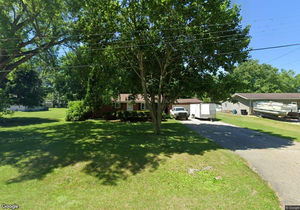
This home is located at 4175 Pheasant Dr, Flint, MI 48506 and is currently estimated at $172,028, approximately $150 per square foot. 4175 Pheasant Dr is a home located in Genesee County with nearby schools including Weston Elementary School, Leota Fiedler Elementary School, and Kate Dowdall Elementary School.
Ownership History
Date
Name
Owned For
Owner Type
Purchase Details
Closed on
Aug 3, 2009
Sold by
Parker Rachel M
Bought by
Parker Randall Earl
Current Estimated Value
Purchase Details
Closed on
Sep 4, 2007
Sold by
Parker Randall Earl
Bought by
Parker Rachel M and Parker Randall Earl
Purchase Details
Closed on
Aug 22, 2006
Sold by
Park Roma J
Bought by
Parker Randall
Create a Home Valuation Report for This Property
The Home Valuation Report is an in-depth analysis detailing your home's value as well as a comparison with similar homes in the area
Home Values in the Area
Average Home Value in this Area
Purchase History
| Date | Buyer | Sale Price | Title Company |
|---|---|---|---|
| Parker Randall Earl | -- | None Available | |
| Parker Rachel M | -- | None Available | |
| Parker Randall | $129,000 | Sargents Title Company |
Source: Public Records
Tax History
| Year | Tax Paid | Tax Assessment Tax Assessment Total Assessment is a certain percentage of the fair market value that is determined by local assessors to be the total taxable value of land and additions on the property. | Land | Improvement |
|---|---|---|---|---|
| 2025 | $2,051 | $68,200 | $0 | $0 |
| 2024 | $387 | $62,800 | $0 | $0 |
| 2023 | $369 | $56,200 | $0 | $0 |
| 2022 | $1,233 | $52,800 | $0 | $0 |
| 2021 | $1,223 | $47,900 | $0 | $0 |
| 2020 | $338 | $44,100 | $0 | $0 |
| 2019 | $332 | $39,200 | $0 | $0 |
| 2018 | $1,521 | $35,100 | $0 | $0 |
| 2017 | $1,139 | $33,900 | $0 | $0 |
| 2016 | $1,115 | $32,600 | $0 | $0 |
| 2015 | $918 | $30,900 | $0 | $0 |
| 2014 | $306 | $27,900 | $0 | $0 |
| 2012 | -- | $25,600 | $25,600 | $0 |
Source: Public Records
Map
Nearby Homes
- 6367 E Pierson Rd
- 3485 N Vassar Rd
- 6312 Tamara Dr
- 6443 Richfield Rd
- 7045 Normandy Ct
- 6161 Finch Ln
- 6054 E Pierson Rd
- 5165 N Irish Rd
- 5177 N Irish Rd
- 6076 E Carpenter Rd
- 0 Whisper Ridge Ct
- 1240 N Irish Rd
- 3179 Gehring Dr
- 3267 Mills Acres St
- 5067 Paro Dr
- 6099 Brookwood Dr
- 6158 Golfview Dr
- 8088 Oreilly Cir
- 4120 Spring Hue Ln
- 4455 N Genesee Rd
- 4183 Pheasant Dr
- 4163 Pheasant Dr
- 4159 Blue Bird Ln
- 4176 Pheasant Dr
- 4186 Pheasant Dr
- 4166 Pheasant Dr
- 6457 Oriole Dr
- 4161 Blue Bird Ln
- 6447 Oriole Dr
- 4158 Pheasant Dr
- 6437 Oriole Dr
- 6467 Oriole Dr
- 4206 Pheasant Dr
- 4162 Blue Bird Ln
- 4213 Pheasant Dr
- 6427 Oriole Dr
- 4158 Blue Bird Ln
- 4185 Red Bird Ln
- 4144 Pheasant Dr
- 4188 Red Bird Ln
Your Personal Tour Guide
Ask me questions while you tour the home.