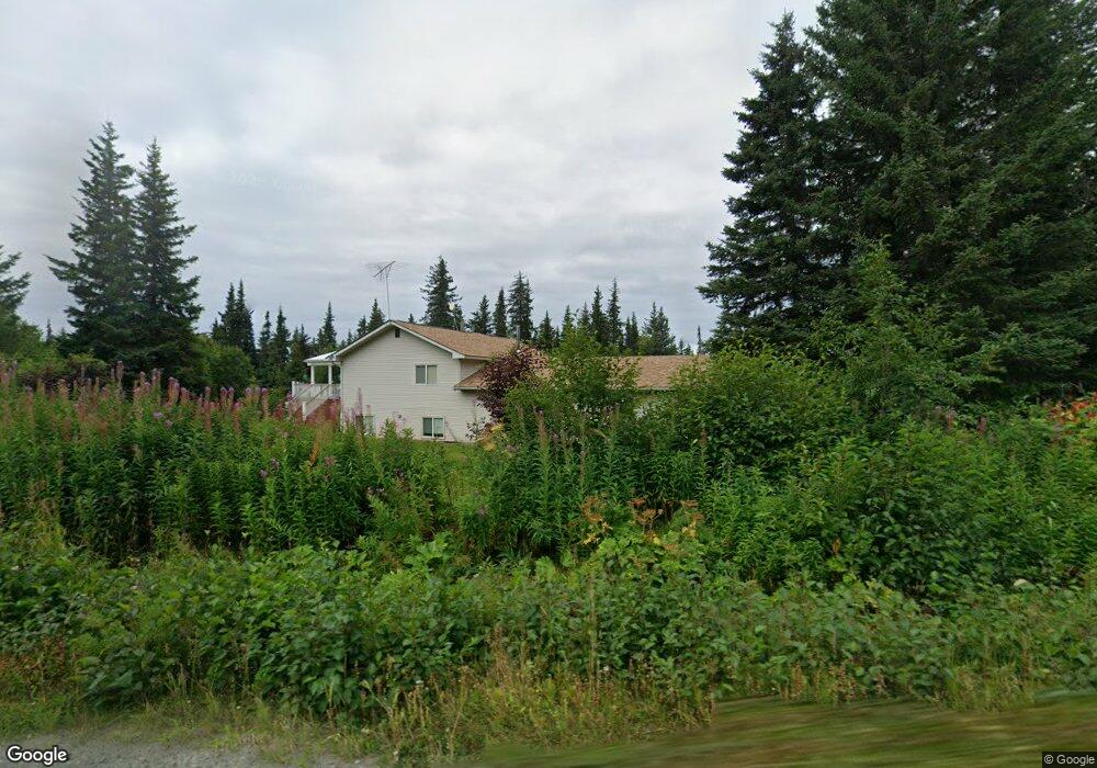
41753 Old Sterling Hwy Anchor Point, AK 99556
Estimated Value: $98,000 - $623,070
--
Bed
1
Bath
2,631
Sq Ft
$153/Sq Ft
Est. Value
About This Home
This home is located at 41753 Old Sterling Hwy, Anchor Point, AK 99556 and is currently estimated at $402,018, approximately $152 per square foot. 41753 Old Sterling Hwy is a home located in Kenai Peninsula Borough with nearby schools including Chapman School and Homer High School.
Ownership History
Date
Name
Owned For
Owner Type
Purchase Details
Closed on
Aug 1, 2024
Sold by
Edens Marle and Edens Brenda
Bought by
Edens Family Trust
Current Estimated Value
Purchase Details
Closed on
Nov 12, 2021
Sold by
Hart Steve
Bought by
Harti Joseph A and Harti Ralph A
Home Financials for this Owner
Home Financials are based on the most recent Mortgage that was taken out on this home.
Original Mortgage
$180,000
Interest Rate
3.01%
Mortgage Type
Credit Line Revolving
Purchase Details
Closed on
Mar 20, 2006
Sold by
Edens Mark D
Bought by
Edens Mark and Edens Brenda
Home Financials for this Owner
Home Financials are based on the most recent Mortgage that was taken out on this home.
Original Mortgage
$208,000
Interest Rate
6.18%
Mortgage Type
Stand Alone Refi Refinance Of Original Loan
Create a Home Valuation Report for This Property
The Home Valuation Report is an in-depth analysis detailing your home's value as well as a comparison with similar homes in the area
Home Values in the Area
Average Home Value in this Area
Purchase History
| Date | Buyer | Sale Price | Title Company |
|---|---|---|---|
| Edens Family Trust | -- | None Listed On Document | |
| Harti Joseph A | -- | First American Title Ins Co | |
| Edens Mark | -- | Kachemak Bay Title Agency In |
Source: Public Records
Mortgage History
| Date | Status | Borrower | Loan Amount |
|---|---|---|---|
| Previous Owner | Harti Joseph A | $180,000 | |
| Previous Owner | Edens Mark | $208,000 |
Source: Public Records
Tax History Compared to Growth
Tax History
| Year | Tax Paid | Tax Assessment Tax Assessment Total Assessment is a certain percentage of the fair market value that is determined by local assessors to be the total taxable value of land and additions on the property. | Land | Improvement |
|---|---|---|---|---|
| 2025 | $4,711 | $593,000 | $40,400 | $552,600 |
| 2024 | $4,711 | $506,900 | $40,100 | $466,800 |
| 2023 | $4,184 | $438,500 | $33,400 | $405,100 |
| 2022 | $3,582 | $373,000 | $23,900 | $349,100 |
| 2021 | $3,551 | $364,500 | $23,200 | $341,300 |
| 2020 | $4,049 | $411,800 | $23,200 | $388,600 |
| 2019 | $3,793 | $390,200 | $15,800 | $374,400 |
| 2018 | $3,646 | $377,000 | $15,800 | $361,200 |
Source: Public Records
Map
Nearby Homes
- 69288 Melody Way
- 41350 Old Sterling Hwy Unit L2B
- 41350 Old Sterling Hwy Unit L2A
- 14 Lots Hard Rock St
- 42706 Old Sterling Hwy
- 39047 Sayer Rd
- 68062 Jolly Ave
- 68021 Jolly Ave
- 39720 Sterling Hwy
- 40285 Sterling Hwy
- 67225 Endless View Loop
- 67777 Endless View Loop
- 69783 Tipton Ave
- 38593 Taylor St
- 40854 Ruth Way
- 41110 Sterling Hwy
- Tract 5 Tice Acres Sub
- 000 Misty Ridge Rd
- 26935 Sterling Hwy
- 33135 Sterling Hwy
- Mi 7 Old Sterling Hwy
- 69160 Melody Way
- 41795 Old Sterling Hwy
- Tr 3 & 4 W Melody Way
- 69305 Melody Way
- 38715 Lyric Cir
- 38660 Lyric Cir
- 38525 Lyric Cir
- 38570 Lyric Cir
- 41552 Old Sterling Hwy
- 41985 Old Sterling Hwy
- 41080 Old Sterling Hwy
- 42212 Old Sterling Hwy
- 42138 Old Sterling Hwy
- 69180 Karen Cir
- 42225 Old Sterling Hwy
- 39035 Dusty St
- 69067 Dusty Ave
- 38755 Sterling Hwy
- 41290 Old Sterling Hwy