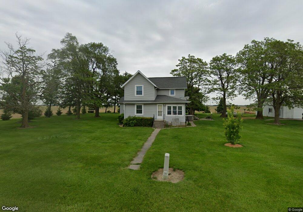
4177 State Route 111 Antwerp, OH 45813
Estimated Value: $244,000 - $307,000
3
Beds
1
Bath
1,484
Sq Ft
$185/Sq Ft
Est. Value
About This Home
This home is located at 4177 State Route 111, Antwerp, OH 45813 and is currently estimated at $273,951, approximately $184 per square foot. 4177 State Route 111 is a home located in Paulding County with nearby schools including Antwerp Local Elementary School and Antwerp Local High School.
Ownership History
Date
Name
Owned For
Owner Type
Purchase Details
Closed on
Dec 22, 2006
Sold by
Clem Jack R and Mock Linda R
Bought by
Poulson Bryan and Poulson Jodi
Current Estimated Value
Purchase Details
Closed on
May 19, 1998
Sold by
Zirkelbach Doris J Trstee
Bought by
Poulson Bryan Poulson Jodi
Purchase Details
Closed on
May 6, 1998
Sold by
Clem Jack R
Bought by
Poulson Bryan Poulson Jodi
Purchase Details
Closed on
May 22, 1997
Bought by
Poulson Bryan Poulson Jodi
Create a Home Valuation Report for This Property
The Home Valuation Report is an in-depth analysis detailing your home's value as well as a comparison with similar homes in the area
Home Values in the Area
Average Home Value in this Area
Purchase History
| Date | Buyer | Sale Price | Title Company |
|---|---|---|---|
| Poulson Bryan | -- | None Available | |
| Poulson Bryan Poulson Jodi | -- | -- | |
| Poulson Bryan Poulson Jodi | -- | -- | |
| Poulson Bryan Poulson Jodi | $65,000 | -- |
Source: Public Records
Tax History Compared to Growth
Tax History
| Year | Tax Paid | Tax Assessment Tax Assessment Total Assessment is a certain percentage of the fair market value that is determined by local assessors to be the total taxable value of land and additions on the property. | Land | Improvement |
|---|---|---|---|---|
| 2024 | $2,598 | $75,470 | $9,070 | $66,400 |
| 2023 | $2,598 | $75,470 | $9,070 | $66,400 |
| 2022 | $2,534 | $75,470 | $9,070 | $66,400 |
| 2021 | $2,233 | $60,520 | $8,510 | $52,010 |
| 2020 | $2,319 | $60,520 | $8,510 | $52,010 |
| 2019 | $2,350 | $55,800 | $8,510 | $47,290 |
| 2018 | $2,125 | $55,800 | $8,510 | $47,290 |
| 2017 | $2,127 | $55,800 | $8,510 | $47,290 |
| 2016 | $2,128 | $55,800 | $8,510 | $47,290 |
| 2015 | $1,749 | $46,340 | $7,280 | $39,060 |
| 2014 | $1,734 | $46,340 | $7,280 | $39,060 |
| 2013 | $2,109 | $50,680 | $7,280 | $43,400 |
Source: Public Records
Map
Nearby Homes
- 13149 Road 27b
- 5092 Road 176
- 208 W River St
- 309 N Madison St
- 25812 Maumee Center Rd
- 136 Maumee Ln
- 1258 Road 192
- 100 Proxmire St
- 820 Brian Dr
- 412 S Laura St
- 3190 Road 204
- 24212 River Rd
- 4783 Legacy Cove
- 4602 Indiana 101
- 5038 Chickadee Dr
- 4974 Chickadee Dr
- 22428 Ash St Unit 25
- 22489 Ash St Unit 21
- 22457 Ash St Unit 22
- 22476 Ash St Unit 29
- 4116 State Route 111
- 4068 State Route 111
- 4355 State Route 111
- 4032 Ohio 111
- 4446 State Route 111
- 4844 State Route 111
- 4782 State Route 111
- 4876 State Route 111
- 4938 State Route 111
- 10815 State Route 49
- 0 State Route 49s
- 10653 State Route 49
- 10579 State Route 49
- 10610 State Route 49
- 11436 State Route 49
- 10512 State Route 49