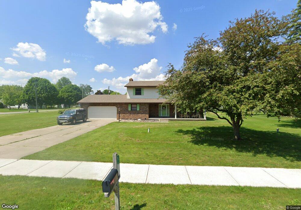
418 Harding Dr Swanton, OH 43558
Estimated Value: $306,000 - $337,044
4
Beds
3
Baths
2,072
Sq Ft
$155/Sq Ft
Est. Value
About This Home
This home is located at 418 Harding Dr, Swanton, OH 43558 and is currently estimated at $320,511, approximately $154 per square foot. 418 Harding Dr is a home located in Fulton County with nearby schools including Swanton High School, Swanton Middle School, and St. Richard School.
Ownership History
Date
Name
Owned For
Owner Type
Purchase Details
Closed on
Jun 24, 2016
Sold by
Moore Gary L
Bought by
Gary L Moore
Current Estimated Value
Purchase Details
Closed on
Sep 9, 2005
Sold by
Redd Thomas M and Redd Sharon S
Bought by
Moore Gary L and Moore Jennifer E
Home Financials for this Owner
Home Financials are based on the most recent Mortgage that was taken out on this home.
Original Mortgage
$140,000
Interest Rate
6.01%
Mortgage Type
Fannie Mae Freddie Mac
Purchase Details
Closed on
Jan 1, 1990
Bought by
Redd Thomas M and Redd Sharon
Create a Home Valuation Report for This Property
The Home Valuation Report is an in-depth analysis detailing your home's value as well as a comparison with similar homes in the area
Home Values in the Area
Average Home Value in this Area
Purchase History
| Date | Buyer | Sale Price | Title Company |
|---|---|---|---|
| Gary L Moore | -- | -- | |
| Moore Gary L | $180,000 | -- | |
| Redd Thomas M | -- | -- |
Source: Public Records
Mortgage History
| Date | Status | Borrower | Loan Amount |
|---|---|---|---|
| Previous Owner | Moore Gary L | $140,000 |
Source: Public Records
Tax History Compared to Growth
Tax History
| Year | Tax Paid | Tax Assessment Tax Assessment Total Assessment is a certain percentage of the fair market value that is determined by local assessors to be the total taxable value of land and additions on the property. | Land | Improvement |
|---|---|---|---|---|
| 2024 | $3,920 | $99,510 | $8,680 | $90,830 |
| 2023 | $3,957 | $99,510 | $8,680 | $90,830 |
| 2022 | $3,226 | $74,520 | $7,250 | $67,270 |
| 2021 | $3,428 | $74,520 | $7,250 | $67,270 |
| 2020 | $3,352 | $74,520 | $7,250 | $67,270 |
| 2019 | $2,947 | $63,670 | $7,140 | $56,530 |
| 2018 | $2,714 | $63,670 | $7,140 | $56,530 |
| 2017 | $2,731 | $63,670 | $7,140 | $56,530 |
| 2016 | $2,635 | $54,460 | $7,140 | $47,320 |
| 2015 | $2,499 | $54,460 | $7,140 | $47,320 |
| 2014 | $2,556 | $54,460 | $7,140 | $47,320 |
| 2013 | $2,593 | $53,840 | $7,040 | $46,800 |
Source: Public Records
Map
Nearby Homes
- 7893 County Road 2
- 227 Kierra Ln
- 103 Cherry St
- 510 S Main St
- 214 Franklin Ave
- 404 E Garfield Ave
- 407 E Garfield Ave
- 433 Church St
- 0 Waterwood Dr
- 225 Kierra Ln
- 204 Hickory St
- 215 Hickory St
- 4303 S Berkey Southern Rd
- 6854 County Road 3
- 6042 County Road 1-1
- 1200 County Road F
- 13645 Shaffer Rd
- 4555 S Fulton Lucas Rd
- 12922 Airport Hwy
- 3121 County Road Ef
- 109 Browning Rd
- 410 Harding Dr
- 7263 Browning Rd
- 111 Browning Rd
- 204 Browning Rd
- 107 Browning Rd
- 0 Browning Rd
- 408 Harding Dr
- 7233 County Road 1 3
- 505 Mettabrook Dr
- 105 Browning Rd
- 108 Browning Rd
- 7245 County Road 1 3
- 507 Mettabrook Dr
- 104 Browning Rd
- 506 Mettabrook Dr
- 509 Mettabrook Dr
- 411 W Garfield Ave
- 7204 County Road 1 3
- 508 Mettabrook Dr