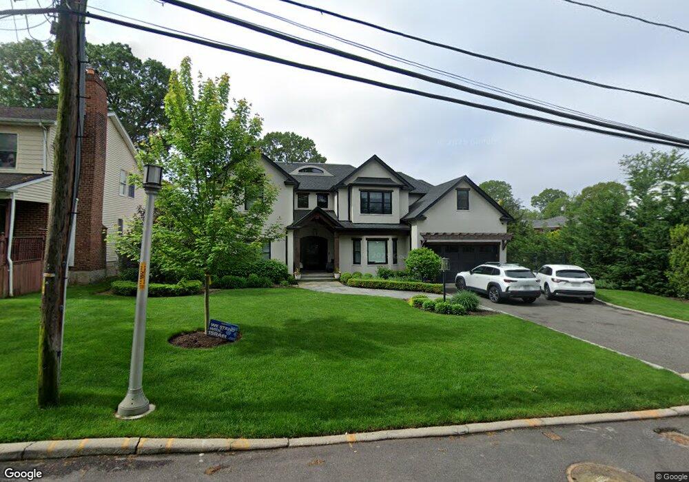
418 Maple St West Hempstead, NY 11552
Estimated Value: $1,404,000 - $1,669,634
--
Bed
1
Bath
4,079
Sq Ft
$377/Sq Ft
Est. Value
About This Home
This home is located at 418 Maple St, West Hempstead, NY 11552 and is currently estimated at $1,536,817, approximately $376 per square foot. 418 Maple St is a home located in Nassau County with nearby schools including Chestnut Street School, West Hempstead Secondary School, and Hebrew Academy of Nassau County (HANC).
Ownership History
Date
Name
Owned For
Owner Type
Purchase Details
Closed on
Mar 22, 2012
Sold by
Hart Ruth F
Bought by
Perl Shlomo and Perl Aliza
Current Estimated Value
Home Financials for this Owner
Home Financials are based on the most recent Mortgage that was taken out on this home.
Original Mortgage
$130,000
Outstanding Balance
$89,641
Interest Rate
3.95%
Mortgage Type
New Conventional
Estimated Equity
$1,447,176
Create a Home Valuation Report for This Property
The Home Valuation Report is an in-depth analysis detailing your home's value as well as a comparison with similar homes in the area
Home Values in the Area
Average Home Value in this Area
Purchase History
| Date | Buyer | Sale Price | Title Company |
|---|---|---|---|
| Perl Shlomo | $289,000 | Mkm Abstract Services Inc 29 | |
| Perl Shlomo | $289,000 | Mkm Abstract Services Inc 29 |
Source: Public Records
Mortgage History
| Date | Status | Borrower | Loan Amount |
|---|---|---|---|
| Open | Perl Shlomo | $130,000 | |
| Closed | Perl Shlomo | $130,000 |
Source: Public Records
Tax History Compared to Growth
Tax History
| Year | Tax Paid | Tax Assessment Tax Assessment Total Assessment is a certain percentage of the fair market value that is determined by local assessors to be the total taxable value of land and additions on the property. | Land | Improvement |
|---|---|---|---|---|
| 2025 | $16,730 | $891 | $372 | $519 |
| 2024 | $4,609 | $907 | $379 | $528 |
| 2023 | $12,701 | $907 | $379 | $528 |
| 2022 | $12,701 | $907 | $379 | $528 |
| 2021 | $14,137 | $696 | $379 | $317 |
| 2020 | $20,035 | $514 | $514 | $0 |
| 2019 | $9,245 | $514 | $513 | $1 |
| 2018 | $8,713 | $549 | $0 | $0 |
| 2017 | $6,140 | $583 | $582 | $1 |
| 2016 | $8,949 | $617 | $544 | $73 |
| 2015 | $3,687 | $823 | $726 | $97 |
| 2014 | $3,687 | $823 | $726 | $97 |
| 2013 | $4,273 | $823 | $726 | $97 |
Source: Public Records
Map
Nearby Homes
- 513 Washington Ave
- 321 Oakford St
- 757 Harrison St
- 596 Lincoln Ave
- 647 Jennings Ave
- 467 Susan Ct
- 686 Tanwood Dr
- 639 Robin Ct
- 629 Park Ave
- 635 Hempstead Ave
- 590 Langley Ave
- 853 Arthur St
- 613 Adams Ave
- 815 Sunshine Ave
- 518 Nassau Blvd
- 537 Madison Ave
- 582 Gaynor Place
- 899 Cleveland St
- 218 Colony St
- 841 Woodfield Rd
- 424 Maple St
- 0 Dogwood Ave Unit 2876458
- 14421 Old Sheridan St
- 217 Hemp Gardens Dr
- 561 Woodfield Rd
- 428 Maple St
- 566 Mulberry Ln
- 556 Mulberry Ln
- 573 Woodfield Rd
- 544 Mulberry Ln
- 391 Maple St
- 413 Maple St
- 419 Maple St
- 427 Maple St
- 554 Woodfield Rd
- 535 Woodfield Rd
- 392 Maple St
- 560 Woodfield Rd
- 579 Woodfield Rd
- 540 Mulberry Ln