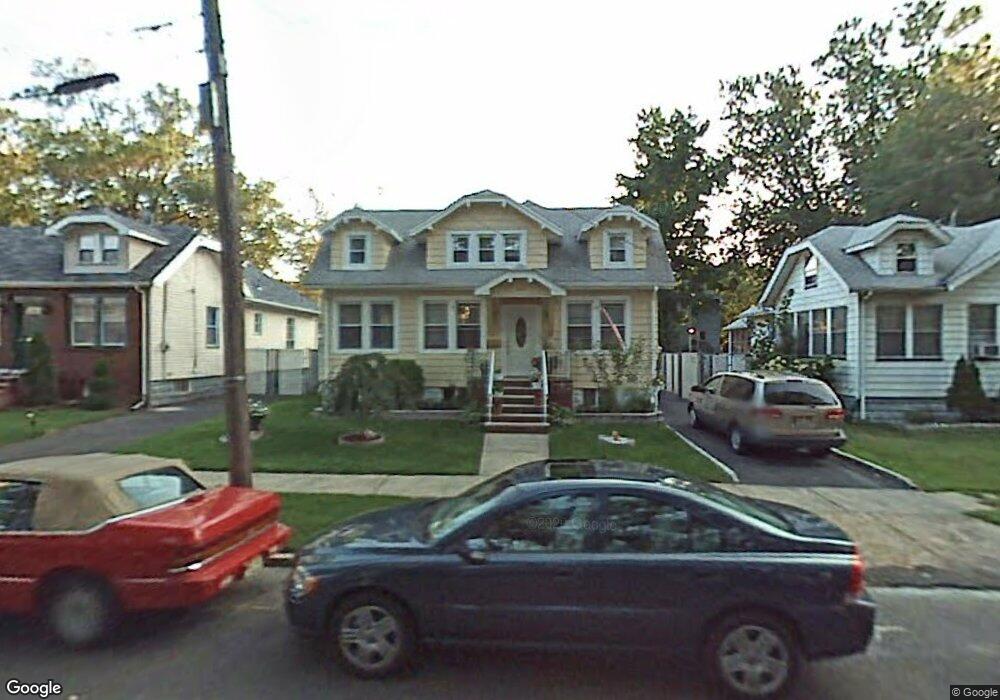
418 Martin St Roselle, NJ 07203
Estimated Value: $377,000 - $475,000
--
Bed
--
Bath
1,080
Sq Ft
$395/Sq Ft
Est. Value
About This Home
This home is located at 418 Martin St, Roselle, NJ 07203 and is currently estimated at $426,093, approximately $394 per square foot. 418 Martin St is a home located in Union County with nearby schools including Washington Elementary School, Leonard V. Moore Middle School, and Grace Wilday Junior High School.
Ownership History
Date
Name
Owned For
Owner Type
Purchase Details
Closed on
Mar 15, 2005
Sold by
Griffith Burgess L
Bought by
Martinez Silvio
Current Estimated Value
Home Financials for this Owner
Home Financials are based on the most recent Mortgage that was taken out on this home.
Original Mortgage
$201,600
Outstanding Balance
$106,507
Interest Rate
6.25%
Mortgage Type
Adjustable Rate Mortgage/ARM
Estimated Equity
$319,586
Purchase Details
Closed on
Sep 15, 1999
Sold by
Bowman Melvin and Bowman Lynn
Bought by
Griffith Burgess L
Home Financials for this Owner
Home Financials are based on the most recent Mortgage that was taken out on this home.
Original Mortgage
$87,500
Interest Rate
7.68%
Create a Home Valuation Report for This Property
The Home Valuation Report is an in-depth analysis detailing your home's value as well as a comparison with similar homes in the area
Home Values in the Area
Average Home Value in this Area
Purchase History
| Date | Buyer | Sale Price | Title Company |
|---|---|---|---|
| Martinez Silvio | $252,000 | -- | |
| Griffith Burgess L | $112,500 | -- |
Source: Public Records
Mortgage History
| Date | Status | Borrower | Loan Amount |
|---|---|---|---|
| Open | Martinez Silvio | $201,600 | |
| Previous Owner | Griffith Burgess L | $87,500 |
Source: Public Records
Tax History Compared to Growth
Tax History
| Year | Tax Paid | Tax Assessment Tax Assessment Total Assessment is a certain percentage of the fair market value that is determined by local assessors to be the total taxable value of land and additions on the property. | Land | Improvement |
|---|---|---|---|---|
| 2025 | $9,460 | $108,800 | $62,000 | $46,800 |
| 2024 | $9,223 | $108,800 | $62,000 | $46,800 |
| 2023 | $9,223 | $108,800 | $62,000 | $46,800 |
| 2022 | $9,287 | $108,800 | $62,000 | $46,800 |
| 2021 | $9,232 | $108,800 | $62,000 | $46,800 |
| 2020 | $9,202 | $108,800 | $62,000 | $46,800 |
| 2019 | $9,085 | $108,800 | $62,000 | $46,800 |
| 2018 | $9,035 | $108,800 | $62,000 | $46,800 |
| 2017 | $8,987 | $108,800 | $62,000 | $46,800 |
| 2016 | $8,789 | $108,800 | $62,000 | $46,800 |
| 2015 | $8,788 | $108,800 | $62,000 | $46,800 |
| 2014 | $8,543 | $108,800 | $62,000 | $46,800 |
Source: Public Records
Map
Nearby Homes
- 443 Wheatsheaf Rd
- 403 John St
- 217 Grace St
- 446 W 6th Ave
- 448 Cristiani St
- 215 Floral St
- 38 Independence Dr
- 13 Independence Dr
- 206 Amsterdam Ave
- 203 Vine St
- 431 W 1st Ave
- 538 Dietz St
- 323 Dermody St
- 201 Sterling Place
- 248 W 3rd Ave
- 216 W 6th Ave
- 569 Berlant Ave
- 540 W 7th Ave
- 826 Amsterdam Ave
- 210 W 7th Ave
- 414 Martin St
- 414 Martin St Unit 1
- 420 Martin St
- 479 Aldene Rd
- 481 Aldene Rd
- 421 Wheatsheaf Rd
- 477 Aldene Rd
- 483 Aldene Rd
- 427 Wheatsheaf Rd
- 428 Martin St
- 419 Martin St
- 487 Aldene Rd
- 475 Aldene Rd
- 415 Wheatsheaf Rd
- 429 Wheatsheaf Rd
- 423 Martin St
- 431 Wheatsheaf Rd
- 413 Wheatsheaf Rd
- 420 W 5th Ave
- 416 W 5th Ave