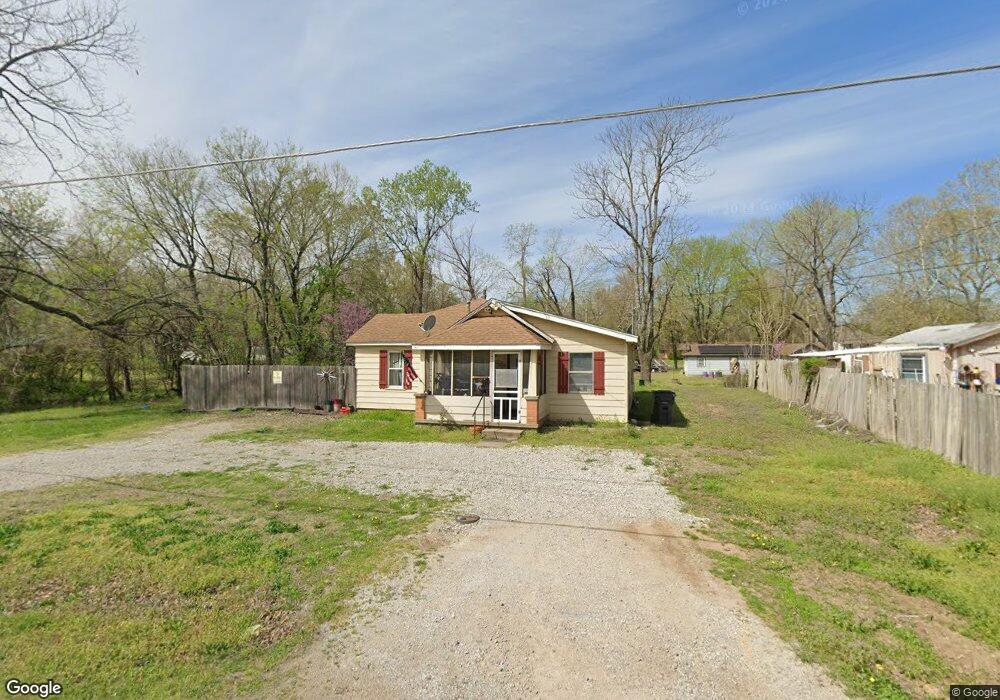
418 S 12th St Collinsville, OK 74021
Estimated Value: $144,584 - $185,000
--
Bed
2
Baths
1,164
Sq Ft
$141/Sq Ft
Est. Value
About This Home
This home is located at 418 S 12th St, Collinsville, OK 74021 and is currently estimated at $163,646, approximately $140 per square foot. 418 S 12th St is a home located in Tulsa County with nearby schools including Herald Elementary School, Collinsville Middle School, and Collinsville High School.
Ownership History
Date
Name
Owned For
Owner Type
Purchase Details
Closed on
Nov 10, 2021
Sold by
Black Joshua James
Bought by
Sandoval Alejandro Mejia and De Lorena Reyes
Current Estimated Value
Purchase Details
Closed on
Aug 30, 2021
Sold by
Glann Ryan E
Bought by
Black Joshua James
Purchase Details
Closed on
May 6, 2015
Sold by
Mclaughlin Phyliss Clydean
Bought by
Glann Ryan E
Purchase Details
Closed on
May 10, 2011
Sold by
Twenty First Properties Inc
Bought by
Route 66 Development Llc
Purchase Details
Closed on
Mar 23, 2005
Sold by
Bradford Clyde Oliver
Bought by
Bradford Clyde Oliver and Mclaughlin Phyliss Clydean
Create a Home Valuation Report for This Property
The Home Valuation Report is an in-depth analysis detailing your home's value as well as a comparison with similar homes in the area
Home Values in the Area
Average Home Value in this Area
Purchase History
| Date | Buyer | Sale Price | Title Company |
|---|---|---|---|
| Sandoval Alejandro Mejia | $45,000 | First American Title Ins Co | |
| Black Joshua James | -- | None Available | |
| Glann Ryan E | -- | None Available | |
| Route 66 Development Llc | $1,269,000 | None Available | |
| Bradford Clyde Oliver | -- | -- |
Source: Public Records
Tax History Compared to Growth
Tax History
| Year | Tax Paid | Tax Assessment Tax Assessment Total Assessment is a certain percentage of the fair market value that is determined by local assessors to be the total taxable value of land and additions on the property. | Land | Improvement |
|---|---|---|---|---|
| 2024 | $855 | $7,883 | $961 | $6,922 |
| 2023 | $855 | $7,508 | $930 | $6,578 |
| 2022 | $813 | $7,150 | $1,709 | $5,441 |
| 2021 | $819 | $7,095 | $1,696 | $5,399 |
| 2020 | $781 | $6,757 | $1,615 | $5,142 |
| 2019 | $733 | $6,437 | $1,539 | $4,898 |
| 2018 | $705 | $6,129 | $1,465 | $4,664 |
| 2017 | $660 | $5,838 | $1,222 | $4,616 |
| 2016 | $615 | $5,559 | $1,258 | $4,301 |
| 2015 | $503 | $5,559 | $1,258 | $4,301 |
| 2014 | $473 | $5,346 | $1,210 | $4,136 |
Source: Public Records
Map
Nearby Homes
- 1219 W High St
- 1210 W State St
- 1706 W Spring St
- 11759 N Garnett Rd
- 1001 W Maple St
- 307 S 22nd St
- 608 N 11th St
- 610 N 14th St
- 614 N 13th St
- 0 N 15th St
- 708 N 13th St
- 619 N 9th St
- 714 N 11th St
- 2117 W Oak St
- 309 N 23rd St
- 1725 W Union Place
- 2011 W Union St
- Lindsay Plan at Georgetowne - Wellington Collection
- Ford Plan at Georgetowne - Sonoma Collection
- Abigail Plan at Georgetowne - Wellington Collection