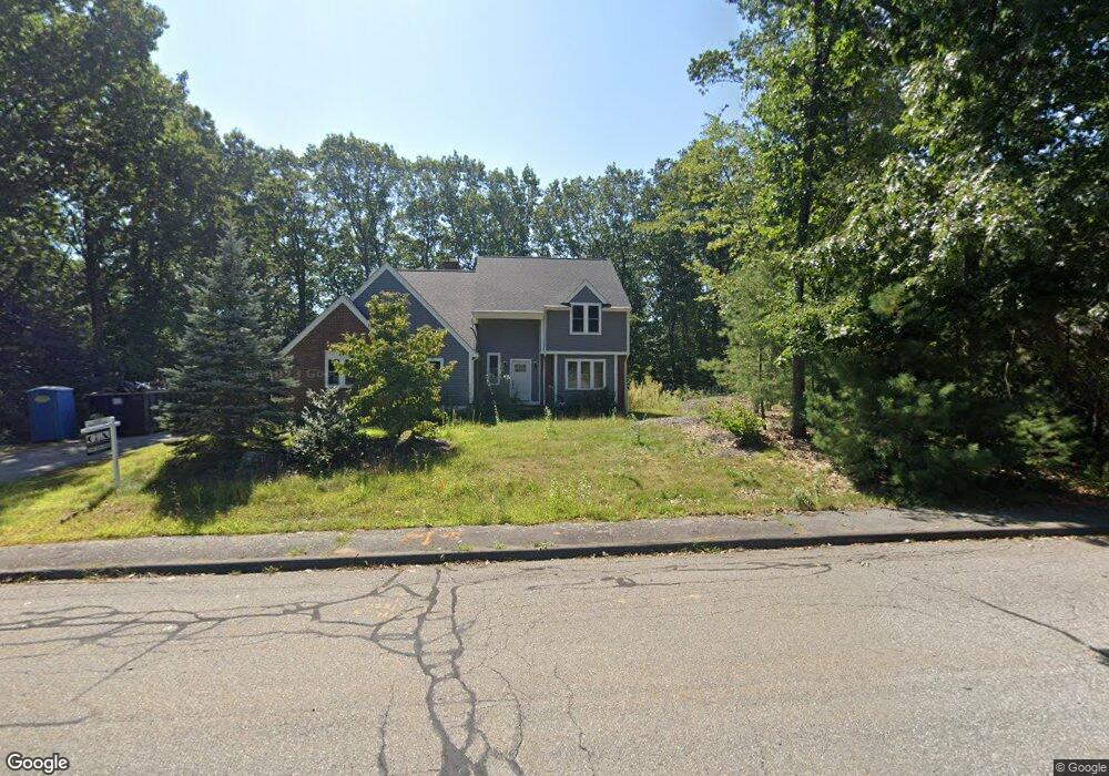
418 Stearns Rd Marlborough, MA 01752
Estimated Value: $791,867 - $954,000
3
Beds
3
Baths
2,538
Sq Ft
$334/Sq Ft
Est. Value
About This Home
This home is located at 418 Stearns Rd, Marlborough, MA 01752 and is currently estimated at $848,717, approximately $334 per square foot. 418 Stearns Rd is a home located in Middlesex County with nearby schools including Marlborough High School, Advanced Math & Science Academy, and New Covenant Christian School.
Ownership History
Date
Name
Owned For
Owner Type
Purchase Details
Closed on
Dec 28, 1994
Sold by
Jannusik Peter P and Jannuski Teresa D
Bought by
Hediger Mark E and Hediger Theresa L
Current Estimated Value
Purchase Details
Closed on
Mar 31, 1993
Sold by
Cote Kathleen A
Bought by
Jannusik Peter P and Jannusik Teresa D
Purchase Details
Closed on
Oct 18, 1988
Sold by
Barberry Fms Rt
Bought by
Ram Rt
Create a Home Valuation Report for This Property
The Home Valuation Report is an in-depth analysis detailing your home's value as well as a comparison with similar homes in the area
Home Values in the Area
Average Home Value in this Area
Purchase History
| Date | Buyer | Sale Price | Title Company |
|---|---|---|---|
| Hediger Mark E | $260,000 | -- | |
| Jannusik Peter P | $240,000 | -- | |
| Ram Rt | $118,750 | -- |
Source: Public Records
Mortgage History
| Date | Status | Borrower | Loan Amount |
|---|---|---|---|
| Open | Ram Rt | $202,500 | |
| Closed | Ram Rt | $207,000 | |
| Closed | Ram Rt | $208,000 |
Source: Public Records
Tax History Compared to Growth
Tax History
| Year | Tax Paid | Tax Assessment Tax Assessment Total Assessment is a certain percentage of the fair market value that is determined by local assessors to be the total taxable value of land and additions on the property. | Land | Improvement |
|---|---|---|---|---|
| 2025 | $7,055 | $715,500 | $260,100 | $455,400 |
| 2024 | $6,871 | $671,000 | $236,500 | $434,500 |
| 2023 | $6,892 | $597,200 | $198,700 | $398,500 |
| 2022 | $6,640 | $506,100 | $189,200 | $316,900 |
| 2021 | $3,423 | $487,500 | $160,700 | $326,800 |
| 2020 | $6,553 | $462,100 | $147,600 | $314,500 |
| 2019 | $6,355 | $451,700 | $144,600 | $307,100 |
| 2018 | $5,466 | $373,600 | $127,300 | $246,300 |
| 2017 | $5,910 | $385,800 | $126,000 | $259,800 |
| 2016 | $5,814 | $379,000 | $126,000 | $253,000 |
| 2015 | $6,284 | $398,700 | $130,200 | $268,500 |
Source: Public Records
Map
Nearby Homes
- 43 Stearns Rd
- 11 Whispering Brook Rd Unit 55
- 120 Airport Blvd
- 39 Desimone Dr
- 8 Saint Mary's Way Unit 8
- lot 1 Sears Rd
- 30A Winter Ave
- 30 Broad St Unit 104
- 76 Broad St
- 11 Paris St
- 58 Walker St
- 115 W Main St
- 102 Liberty St
- 14 Wolfpen Ln
- 156 Chestnut St
- 2 Adams St
- 32 Water St
- 61 Fairmount St Unit 11
- 146 Framingham Rd
- 87 Neil St
- 428 Stearns Rd
- 406 Stearns Rd
- 419 Stearns Rd
- 405 Stearns Rd
- 427 Stearns Rd
- 394 Stearns Rd
- 391 Stearns Rd
- 19 Stearns Rd
- 42 Whispering Brook Rd Unit 34
- 40 Whispering Brook Rd Unit 33
- 48 Whispering Brook Rd
- 46 Whispering Brook Rd
- 44 Whispering Brook Rd
- 42 Whispering Brook Rd
- 40 Whispering Brook Rd
- 44 Whispering Brook Rd Unit 35
- 44 Whispering Brook Rd Unit 44
- 31 Stearns Rd
- 5 Stearns Rd
- 382 Stearns Rd