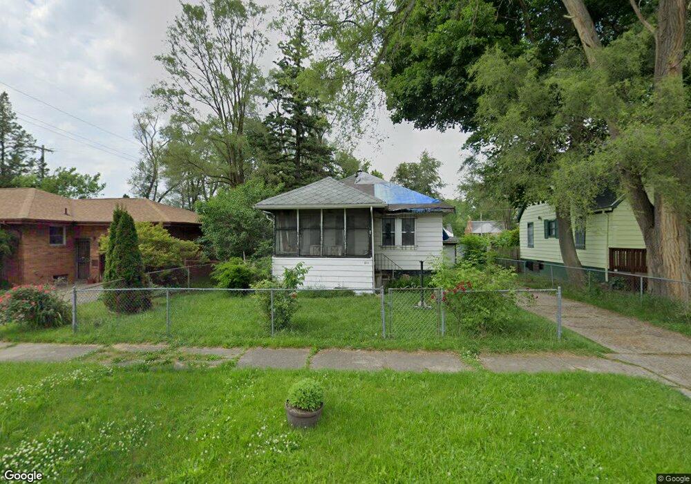
418 W Baker St Flint, MI 48505
King Avenue Plus NeighborhoodEstimated Value: $28,000 - $44,128
2
Beds
1
Bath
862
Sq Ft
$44/Sq Ft
Est. Value
About This Home
This home is located at 418 W Baker St, Flint, MI 48505 and is currently estimated at $38,282, approximately $44 per square foot. 418 W Baker St is a home located in Genesee County with nearby schools including Brownell STEM Academy, Greater Heights Academy, and Eagle's Nest Academy.
Ownership History
Date
Name
Owned For
Owner Type
Purchase Details
Closed on
Apr 20, 2021
Sold by
Genesee County Land Bank Authority
Bought by
Franklin Sandra Fay
Current Estimated Value
Purchase Details
Closed on
Jan 24, 2018
Sold by
The Genesee County Land Bank Authority
Bought by
Franklin Sandra Fay
Purchase Details
Closed on
Dec 20, 2017
Sold by
Cherry Deborah L
Bought by
Genesee County Land Bank Authority
Create a Home Valuation Report for This Property
The Home Valuation Report is an in-depth analysis detailing your home's value as well as a comparison with similar homes in the area
Home Values in the Area
Average Home Value in this Area
Purchase History
| Date | Buyer | Sale Price | Title Company |
|---|---|---|---|
| Franklin Sandra Fay | $3,500 | None Available | |
| Franklin Sandra Fay | -- | None Available | |
| Genesee County Land Bank Authority | -- | None Available |
Source: Public Records
Mortgage History
| Date | Status | Borrower | Loan Amount |
|---|---|---|---|
| Closed | Franklin Sandra Fay | $0 |
Source: Public Records
Tax History Compared to Growth
Tax History
| Year | Tax Paid | Tax Assessment Tax Assessment Total Assessment is a certain percentage of the fair market value that is determined by local assessors to be the total taxable value of land and additions on the property. | Land | Improvement |
|---|---|---|---|---|
| 2025 | $509 | $9,100 | $0 | $0 |
| 2024 | $478 | $8,800 | $0 | $0 |
| 2023 | $479 | $8,500 | $0 | $0 |
| 2022 | $0 | $7,300 | $0 | $0 |
| 2021 | $487 | $6,800 | $0 | $0 |
| 2020 | $456 | $4,400 | $0 | $0 |
| 2019 | $455 | $3,900 | $0 | $0 |
| 2018 | $221 | $0 | $0 | $0 |
| 2017 | $648 | $0 | $0 | $0 |
| 2016 | $628 | $0 | $0 | $0 |
| 2015 | -- | $0 | $0 | $0 |
| 2014 | -- | $0 | $0 | $0 |
| 2012 | -- | $8,000 | $0 | $0 |
Source: Public Records
Map
Nearby Homes
- 506 Green St
- 409 W Genesee St
- 311 W Genesee St
- 115 W Baker St
- 2718 N Chevrolet Ave
- 317 W Witherbee St
- 2913
- 2913 Martin Luther King Ave
- 200 W Mcclellan St
- 3002 N Chevrolet Ave
- 325 W Dewey St
- 2245 Milbourne Ave
- 1101 W Rankin St
- 218 E Jackson Ave
- 325 W Paterson St
- 3002 Proctor St
- 3418 Keyes St
- 1209 W Mcclellan St
- 2414 Delmar St
- 2318 Delmar St
- 414 W Baker St
- 2558 Iroquois Ave
- 426 W Baker St
- 410 W Baker St
- 2562 Iroquois Ave
- 413 W Rankin St
- 409 W Rankin St
- 2566 Iroquois Ave
- 406 W Baker St
- 417 W Baker St
- 413 W Baker St
- 425 W Baker St
- 405 W Rankin St
- 409 W Baker St
- 402 W Baker St
- 401 W Rankin St
- 405 W Baker St
- 332 W Baker St
- 2551 Iroquois Ave
- 2557 Iroquois Ave