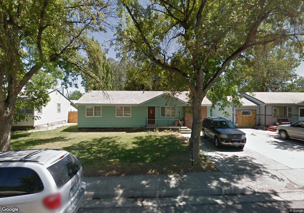
418 West Ln Worland, WY 82401
Estimated Value: $183,000 - $234,000
3
Beds
2
Baths
1,440
Sq Ft
$146/Sq Ft
Est. Value
About This Home
This home is located at 418 West Ln, Worland, WY 82401 and is currently estimated at $209,660, approximately $145 per square foot. 418 West Ln is a home located in Washakie County with nearby schools including East Side Elementary School, West Side Elementary School, and South Side Elementary School.
Create a Home Valuation Report for This Property
The Home Valuation Report is an in-depth analysis detailing your home's value as well as a comparison with similar homes in the area
Home Values in the Area
Average Home Value in this Area
Tax History Compared to Growth
Tax History
| Year | Tax Paid | Tax Assessment Tax Assessment Total Assessment is a certain percentage of the fair market value that is determined by local assessors to be the total taxable value of land and additions on the property. | Land | Improvement |
|---|---|---|---|---|
| 2025 | $964 | $12,662 | $2,071 | $10,591 |
| 2024 | $1,241 | $16,292 | $2,713 | $13,579 |
| 2023 | $1,248 | $16,387 | $1,781 | $14,606 |
| 2022 | $1,069 | $14,038 | $1,781 | $12,257 |
| 2021 | $895 | $11,752 | $1,425 | $10,327 |
| 2020 | $939 | $12,325 | $2,185 | $10,140 |
| 2019 | $709 | $9,312 | $2,185 | $7,127 |
| 2018 | $611 | $8,021 | $1,710 | $6,311 |
| 2017 | $627 | $8,235 | $1,995 | $6,240 |
| 2016 | $629 | $8,254 | $1,805 | $6,449 |
| 2015 | -- | $10,431 | $1,805 | $8,626 |
| 2014 | -- | $10,193 | $1,995 | $8,198 |
Source: Public Records
Map
Nearby Homes
- 2396 U S 20
- 2386 U S 20
- 2366 U S 20
- 1301 Pulliam Ave
- 814 Conant Ave
- 1012 Pulliam Ave
- 1015 Robertson Ave
- 1542 Cloud Peak Dr
- 1205 Coburn Ave
- 1300 Coburn Ave
- 821 Obie Sue Ave
- 408 S 16th St
- 2007 Harkins Ave
- 624 S 5th St
- 520 Obie Sue Ave
- 501 Obie Sue Ave
- 225 S 22nd St
- 739 S 13th St
- 708 S 16th St
- 813 S 15th St