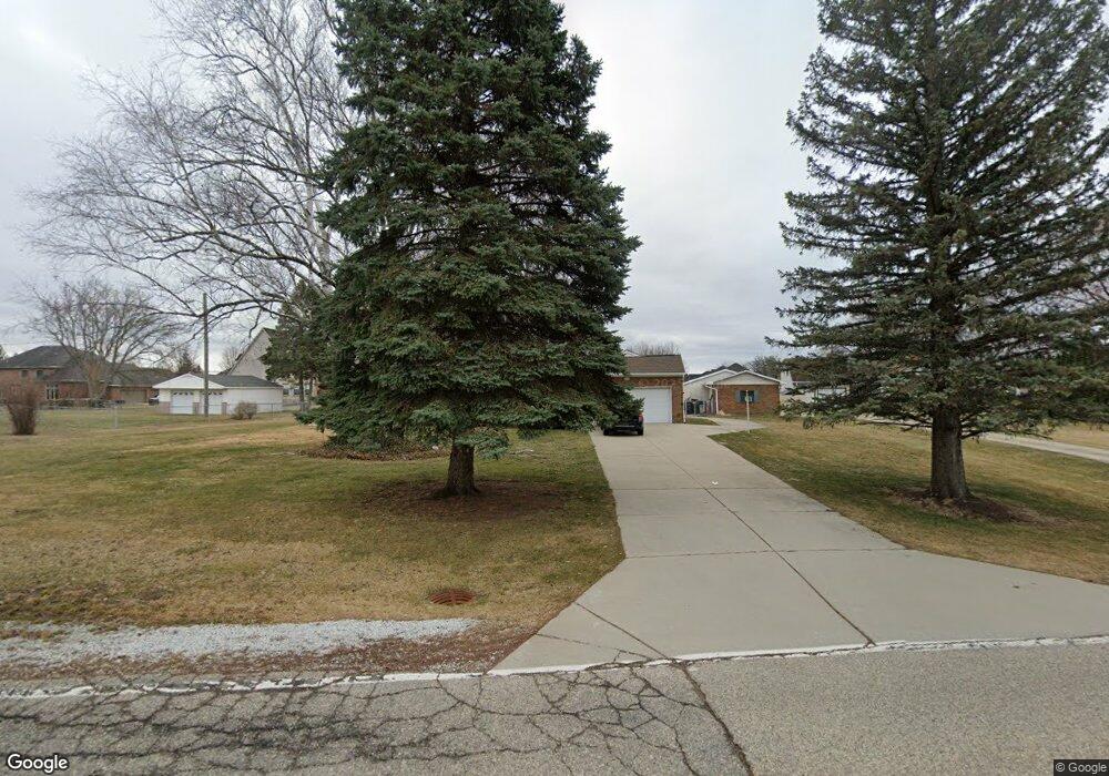
4180 18 1/2 Mile Rd Sterling Heights, MI 48314
Estimated Value: $299,330 - $428,000
--
Bed
--
Bath
1,958
Sq Ft
$182/Sq Ft
Est. Value
About This Home
This home is located at 4180 18 1/2 Mile Rd, Sterling Heights, MI 48314 and is currently estimated at $355,833, approximately $181 per square foot. 4180 18 1/2 Mile Rd is a home located in Macomb County with nearby schools including Burr Elementary School, Frank Jeannette Junior High School, and Adlai Stevenson High School.
Ownership History
Date
Name
Owned For
Owner Type
Purchase Details
Closed on
Oct 3, 2017
Sold by
Robb Jay M and Robb Carolynn
Bought by
Robb Jay M and Robb Carolyn P
Current Estimated Value
Home Financials for this Owner
Home Financials are based on the most recent Mortgage that was taken out on this home.
Original Mortgage
$76,008
Interest Rate
3.78%
Mortgage Type
New Conventional
Purchase Details
Closed on
Mar 28, 2012
Sold by
Robb Jay M and Robb Carolynn P
Bought by
Robb Jay M and Robb Carolynn P
Purchase Details
Closed on
May 22, 2008
Sold by
Robb Jay M and Robb Carolynn P
Bought by
The Jay M & Carolynn P Robb Living Trust
Create a Home Valuation Report for This Property
The Home Valuation Report is an in-depth analysis detailing your home's value as well as a comparison with similar homes in the area
Home Values in the Area
Average Home Value in this Area
Purchase History
| Date | Buyer | Sale Price | Title Company |
|---|---|---|---|
| Robb Jay M | -- | Title Source Inc | |
| Robb Jay M | -- | Title Source Inc | |
| Robb Jay M | -- | None Available | |
| The Jay M & Carolynn P Robb Living Trust | -- | None Available |
Source: Public Records
Mortgage History
| Date | Status | Borrower | Loan Amount |
|---|---|---|---|
| Closed | Robb Jay M | $76,008 |
Source: Public Records
Tax History Compared to Growth
Tax History
| Year | Tax Paid | Tax Assessment Tax Assessment Total Assessment is a certain percentage of the fair market value that is determined by local assessors to be the total taxable value of land and additions on the property. | Land | Improvement |
|---|---|---|---|---|
| 2025 | $3,623 | $144,100 | $0 | $0 |
| 2024 | $3,313 | $140,000 | $0 | $0 |
| 2023 | $3,261 | $124,800 | $0 | $0 |
| 2022 | $3,261 | $114,800 | $0 | $0 |
| 2021 | $3,194 | $111,700 | $0 | $0 |
| 2020 | $2,848 | $103,500 | $0 | $0 |
| 2019 | $2,918 | $99,000 | $0 | $0 |
| 2018 | $2,954 | $94,600 | $0 | $0 |
| 2017 | $2,819 | $90,500 | $31,300 | $59,200 |
| 2016 | $2,724 | $90,500 | $0 | $0 |
| 2015 | -- | $83,700 | $0 | $0 |
| 2014 | -- | $74,400 | $0 | $0 |
Source: Public Records
Map
Nearby Homes
- 42040 Ryan Rd
- 4054 Jayden Ct
- 4092 Blossom Dr
- 4060 Blossom Dr
- 42435 Magnolia Dr
- 4076 Spring Meadow Dr
- 4118 Spring Meadow Dr
- 42419 Magnolia Dr
- 4044 Blossom Dr
- 4123 Blossom Dr
- 4430 Bayleaf Dr
- 3715 Knightbridge Cir
- 42480 Saddle Ln
- 42512 Saddle Ln
- 3550 Kirkton Dr
- 43134 Napa Dr Unit 35
- 40665 Drury Rd
- 4539 Carlton Rd
- 40663 Drury Rd
- 3849 Barg Dr
- 4140 Eighteen 1 2 Mile
- 4140 18 1/2 Mile Rd
- 4227 Damson Dr
- 4068 18 1/2 Mile Rd
- 4068 18 1 2 Mile Rd
- 4230 Damson Dr
- 4075 18 1/2 Mile Rd
- 41920 Ryan Rd
- 4141 18 1/2 Mile Rd
- 4243 Damson Dr
- 4274 18 1/2 Mile Rd
- 41886 Ryan Rd
- 4244 Damson Dr
- 4152 Jayden Ct
- 4135 Jayden Ct
- 41931 Plumtree Dr
- 41909 Plumtree Dr
- 4255 18 1/2 Mile Rd
- 41953 Plumtree Dr
- 4138 Jayden Ct