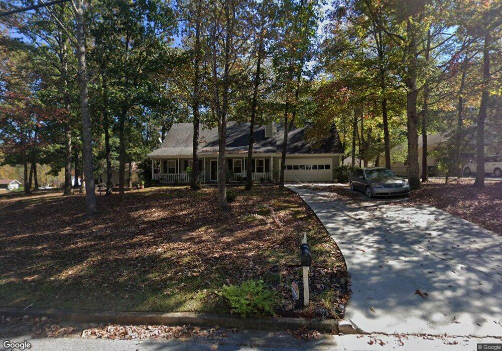
4180 Lance Cir SE Unit 4 Conyers, GA 30013
Estimated Value: $266,063 - $280,000
3
Beds
2
Baths
1,941
Sq Ft
$140/Sq Ft
Est. Value
About This Home
This home is located at 4180 Lance Cir SE Unit 4, Conyers, GA 30013 and is currently estimated at $272,016, approximately $140 per square foot. 4180 Lance Cir SE Unit 4 is a home located in Rockdale County with nearby schools including Barksdale Elementary School, Memorial Middle School, and Salem High School.
Ownership History
Date
Name
Owned For
Owner Type
Purchase Details
Closed on
Apr 19, 2004
Sold by
Malcom Juliete
Bought by
Payne Heather G
Current Estimated Value
Home Financials for this Owner
Home Financials are based on the most recent Mortgage that was taken out on this home.
Original Mortgage
$120,750
Outstanding Balance
$56,392
Interest Rate
5.88%
Mortgage Type
VA
Estimated Equity
$215,624
Purchase Details
Closed on
Jul 25, 2002
Sold by
Burns David T
Bought by
Jenkins Juliet M
Home Financials for this Owner
Home Financials are based on the most recent Mortgage that was taken out on this home.
Original Mortgage
$111,600
Interest Rate
6.67%
Mortgage Type
New Conventional
Purchase Details
Closed on
May 21, 1996
Sold by
Haulk Larry Eugene and Haulk Rebecca
Bought by
Burns David Thomas and Burns Juliet M
Create a Home Valuation Report for This Property
The Home Valuation Report is an in-depth analysis detailing your home's value as well as a comparison with similar homes in the area
Home Values in the Area
Average Home Value in this Area
Purchase History
| Date | Buyer | Sale Price | Title Company |
|---|---|---|---|
| Payne Heather G | $122,900 | -- | |
| Jenkins Juliet M | -- | -- | |
| Burns David Thomas | $89,000 | -- |
Source: Public Records
Mortgage History
| Date | Status | Borrower | Loan Amount |
|---|---|---|---|
| Open | Payne Heather G | $120,750 | |
| Previous Owner | Jenkins Juliet M | $111,600 | |
| Closed | Burns David Thomas | $0 |
Source: Public Records
Tax History
| Year | Tax Paid | Tax Assessment Tax Assessment Total Assessment is a certain percentage of the fair market value that is determined by local assessors to be the total taxable value of land and additions on the property. | Land | Improvement |
|---|---|---|---|---|
| 2025 | $2,848 | $119,520 | $18,440 | $101,080 |
| 2024 | $2,620 | $108,640 | $17,800 | $90,840 |
| 2023 | $2,221 | $96,400 | $18,600 | $77,800 |
| 2022 | $1,741 | $77,720 | $12,960 | $64,760 |
| 2021 | $1,493 | $64,560 | $11,600 | $52,960 |
| 2020 | $1,175 | $53,600 | $9,600 | $44,000 |
| 2019 | $1,061 | $48,920 | $6,000 | $42,920 |
| 2018 | $966 | $45,640 | $6,000 | $39,640 |
| 2017 | $862 | $41,920 | $6,000 | $35,920 |
| 2016 | $702 | $38,640 | $7,200 | $31,440 |
| 2015 | $641 | $36,480 | $5,040 | $31,440 |
| 2014 | $480 | $32,720 | $4,560 | $28,160 |
| 2013 | -- | $40,920 | $8,320 | $32,600 |
Source: Public Records
Map
Nearby Homes
- 4175 Lance Cir SE
- 720 Berkeley Dr
- 1296 Carman Ct SE
- 1303 Carman Ct SE Unit 3
- 1155 Christian Cir SE
- 1790 Brandy Woods Trail SE
- 1145 Christian Cir SE
- 3950 Joyce Ct SE
- 1580 Christian Cir SE
- 1104 Brookfield Dr SE
- 165 Christian Woods Dr SE
- 3661 Cherry Creek Dr SE Unit 1
- 217 Limestone Cir
- 2256 Christian Cir
- 225 Hardwood Dr
- 244 Thorn Berry Way
- 958 Sweet Briar Trail SE
- 768 Lynn Milam Ln
- 4629 S Woodlake Ln SE
- 122 Shadow Lake Dr
- 1967 Brandy Woods Dr SE
- 4190 Lance Cir SE
- 4200 Lance Cir SE
- 1978 Brandy Woods Dr
- 1978 Brandy Woods Dr SE
- 2027 Brandy Woods Dr SE
- 4195 Stephanie Cir SE
- 1947 Brandy Woods Dr SE
- 4185 Lance Cir SE
- 1998 Brandy Woods Dr SE
- 1958 Brandy Woods Dr SE
- 4210 Lance Cir SE Unit 4
- 2018 Brandy Woods Dr SE
- 4195 Lance Cir SE
- 1938 Brandy Woods Dr SE
- 2047 Brandy Woods Dr SE Unit 4
- 2038 Brandy Woods Dr SE
- 4233 Lindsey Way
- 4155 Stephanie Cir SE
- 4233 Lindsey Way SE
Your Personal Tour Guide
Ask me questions while you tour the home.