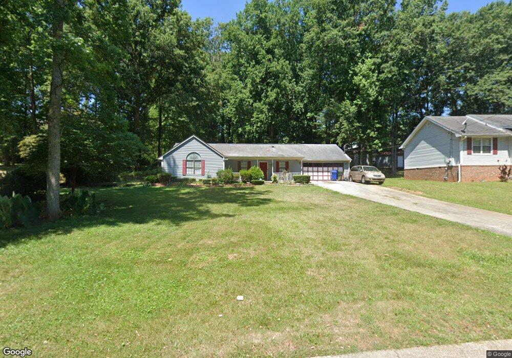
4181 S Fork Dr Unit 70 Snellville, GA 30039
Estimated Value: $296,000 - $309,000
3
Beds
2
Baths
1,472
Sq Ft
$205/Sq Ft
Est. Value
About This Home
This home is located at 4181 S Fork Dr Unit 70, Snellville, GA 30039 and is currently estimated at $301,549, approximately $204 per square foot. 4181 S Fork Dr Unit 70 is a home located in Gwinnett County with nearby schools including Anderson-Livsey Elementary School, Shiloh Middle School, and Shiloh High School.
Ownership History
Date
Name
Owned For
Owner Type
Purchase Details
Closed on
Aug 23, 2023
Sold by
Depina Sonia M
Bought by
Velez Chantel and Velez Kenneth
Current Estimated Value
Home Financials for this Owner
Home Financials are based on the most recent Mortgage that was taken out on this home.
Original Mortgage
$297,000
Outstanding Balance
$290,232
Interest Rate
6.81%
Mortgage Type
New Conventional
Estimated Equity
$11,317
Purchase Details
Closed on
Jul 18, 2018
Sold by
Grogan
Bought by
Depina Sonia M
Purchase Details
Closed on
Jun 21, 1996
Sold by
Talbott Arthur B Roberta
Bought by
Grogan Allen R Doris H
Create a Home Valuation Report for This Property
The Home Valuation Report is an in-depth analysis detailing your home's value as well as a comparison with similar homes in the area
Home Values in the Area
Average Home Value in this Area
Purchase History
| Date | Buyer | Sale Price | Title Company |
|---|---|---|---|
| Velez Chantel | $297,000 | -- | |
| Depina Sonia M | $146,500 | -- | |
| Grogan Allen R Doris H | $88,000 | -- |
Source: Public Records
Mortgage History
| Date | Status | Borrower | Loan Amount |
|---|---|---|---|
| Open | Velez Chantel | $297,000 |
Source: Public Records
Tax History Compared to Growth
Tax History
| Year | Tax Paid | Tax Assessment Tax Assessment Total Assessment is a certain percentage of the fair market value that is determined by local assessors to be the total taxable value of land and additions on the property. | Land | Improvement |
|---|---|---|---|---|
| 2024 | $3,854 | $108,760 | $23,720 | $85,040 |
| 2023 | $3,854 | $95,600 | $18,400 | $77,200 |
| 2022 | $2,739 | $89,000 | $18,400 | $70,600 |
| 2021 | $2,336 | $68,320 | $14,000 | $54,320 |
| 2020 | $2,157 | $59,400 | $11,200 | $48,200 |
| 2019 | $1,899 | $50,360 | $11,200 | $39,160 |
| 2018 | $2,047 | $50,360 | $11,200 | $39,160 |
| 2016 | $629 | $36,040 | $8,400 | $27,640 |
| 2015 | $576 | $28,160 | $6,000 | $22,160 |
| 2014 | $490 | $28,160 | $6,000 | $22,160 |
Source: Public Records
Map
Nearby Homes
- 4211 Crestside Ridge
- 4212 Medlock River Ct
- 4237 Shoreside Cir Unit 1
- 4111 Wrexham Dr
- 4357 James Wade Dr
- 4107 Round Stone Trail
- 3909 Laurens Ln
- 4311 Marci St
- 3992 Wrexham Dr
- 3926 Yosemite Park Ln
- 4216 Preserve Trail
- 4341 Horder Ct
- 4462 Lee Rd
- 4092 Arabian Way
- 0 Anderson Livsey Ln Unit 10624770
- 0 Anderson Livsey Ln Unit 10621987
- 3885 Laurens Ln
- 4181 S Fork Dr
- 4171 S Fork Dr
- 4191 S Fork Dr
- 4198 Castle Gate Dr
- 4188 Castle Gate Dr
- 4208 Castle Gate Dr
- 4180 S Fork Dr Unit 1
- 4066 Round Stone Dr
- 4076 Round Stone Dr
- 4170 S Fork Dr Unit 1
- 4218 Castle Gate Dr
- 4160 S Fork Dr Unit 1
- 4086 Round Stone Dr Unit 3
- 4075 Round Stone Dr
- 4189 S Fork Dr
- 4228 Castle Gate Dr
- 4199 Castle Gate Dr
- 4440 Flat Stone Dr Unit 3
- 4450 Flat Stone Dr Unit 3
- 4150 S Fork Dr