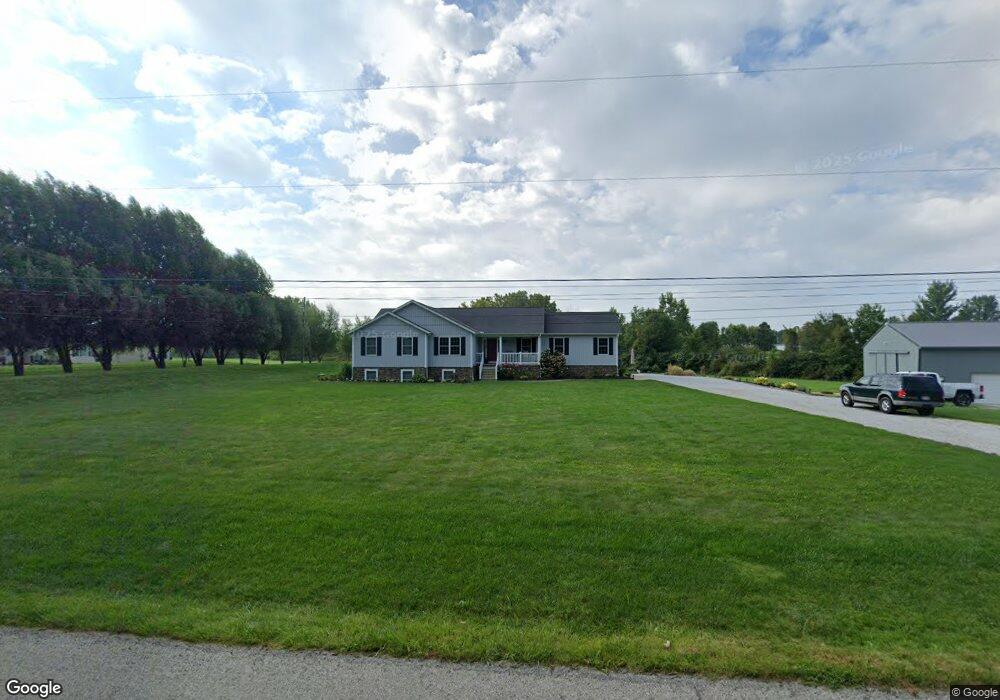
41825 Whitney Rd Lagrange, OH 44050
Estimated Value: $525,000 - $624,000
6
Beds
5
Baths
3,468
Sq Ft
$171/Sq Ft
Est. Value
About This Home
This home is located at 41825 Whitney Rd, Lagrange, OH 44050 and is currently estimated at $594,553, approximately $171 per square foot. 41825 Whitney Rd is a home with nearby schools including Keystone Elementary School, Keystone Middle School, and Keystone High School.
Ownership History
Date
Name
Owned For
Owner Type
Purchase Details
Closed on
Aug 5, 2014
Sold by
Hrnchar John
Bought by
Smith Verlan D and Smith Roberta L
Current Estimated Value
Purchase Details
Closed on
Dec 2, 2009
Sold by
Victory Lane Land Company
Bought by
Hrnchar John
Purchase Details
Closed on
Jan 27, 2005
Sold by
Victory Lane Land Co
Bought by
Victory Lane Land Co
Create a Home Valuation Report for This Property
The Home Valuation Report is an in-depth analysis detailing your home's value as well as a comparison with similar homes in the area
Home Values in the Area
Average Home Value in this Area
Purchase History
| Date | Buyer | Sale Price | Title Company |
|---|---|---|---|
| Smith Verlan D | $12,000 | Fidelity Natl Title Co Llc | |
| Hrnchar John | $18,000 | Lawyers Title Co | |
| Victory Lane Land Co | -- | Lorain County Title Co Inc |
Source: Public Records
Tax History
| Year | Tax Paid | Tax Assessment Tax Assessment Total Assessment is a certain percentage of the fair market value that is determined by local assessors to be the total taxable value of land and additions on the property. | Land | Improvement |
|---|---|---|---|---|
| 2024 | $7,624 | $183,474 | $23,618 | $159,856 |
| 2023 | $7,289 | $146,787 | $22,607 | $124,180 |
| 2022 | $7,238 | $146,787 | $22,607 | $124,180 |
| 2021 | $7,240 | $146,787 | $22,607 | $124,180 |
| 2020 | $6,643 | $120,120 | $18,500 | $101,620 |
| 2019 | $6,603 | $120,120 | $18,500 | $101,620 |
| 2018 | $6,452 | $120,120 | $18,500 | $101,620 |
| 2017 | $5,453 | $95,700 | $16,870 | $78,830 |
| 2016 | $4,886 | $86,300 | $16,870 | $69,430 |
| 2015 | $788 | $13,930 | $13,930 | $0 |
| 2014 | $728 | $13,930 | $13,930 | $0 |
| 2013 | $672 | $13,930 | $13,930 | $0 |
Source: Public Records
Map
Nearby Homes
- 42113 Meadow Ln
- 704 Black Bear Run
- 110 Railroad St
- 305 W Main St
- 510 Arabian Ct
- 476 Stallion Ct
- 468 Stallion Ct
- 317 Church St
- 40260 Whitney Rd
- 0 Dill Ct Unit 5072837
- 516 Appomattox Ct
- 567 Vicksburg Ct
- 548 William St
- 340 Granger Dr
- 43902 State Route 303
- 808 Buckingham Dr
- 800 Buckingham Dr
- 829 Robinson Dr
- 0 West Rd Unit 5125531
- 801 Willich Ct
- 41840 Whitney Rd
- 41821 Whitney Rd
- 41817 Whitney Rd
- 17925 Whitehead Rd
- 18121 Whitehead Rd
- 41813 Whitney Rd
- 18108 Whitehead Rd
- 17865 Whitehead Rd
- 17918 Whitehead Rd
- 42077 Whitney Rd
- 17896 Whitehead Rd
- 18271 Whitehead Rd
- 42070 Whitney Rd
- 41811 Whitney Rd
- 42124 Whitney Rd
- 18273 Whitehead Rd
- 41809 Whitney Rd
- 18168 Whitehead Rd
- 42157 Whitney Rd
- 18230 Whitehead Rd
Your Personal Tour Guide
Ask me questions while you tour the home.