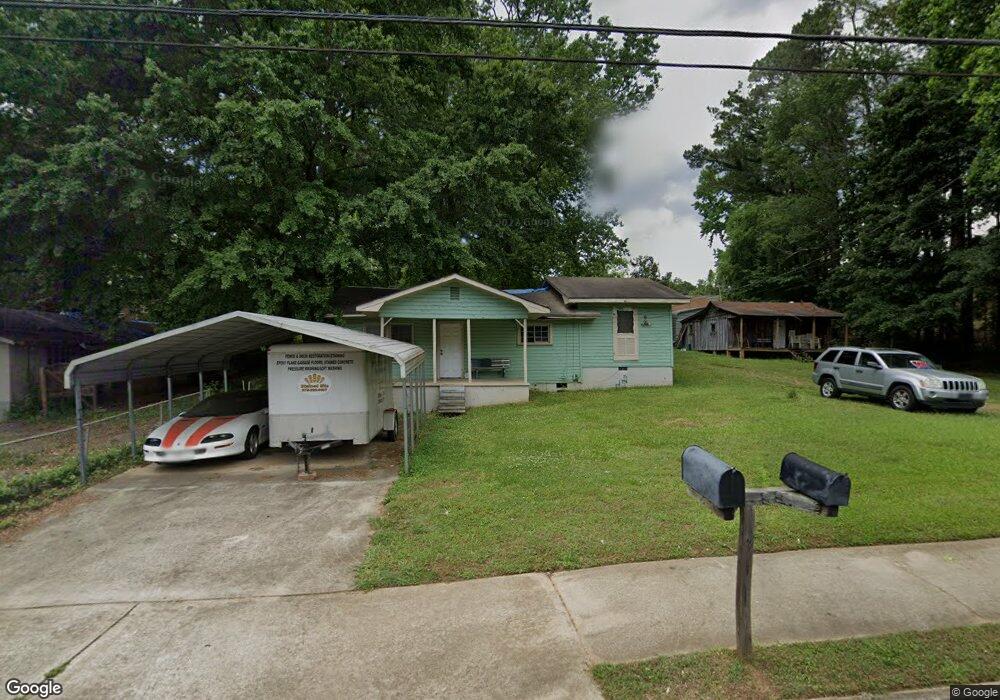
4183 S Main St Acworth, GA 30101
Estimated Value: $217,345 - $308,000
2
Beds
1
Bath
1,008
Sq Ft
$254/Sq Ft
Est. Value
About This Home
This home is located at 4183 S Main St, Acworth, GA 30101 and is currently estimated at $255,586, approximately $253 per square foot. 4183 S Main St is a home located in Cobb County with nearby schools including Acworth Intermediate School, McCall Primary School, and Barber Middle School.
Ownership History
Date
Name
Owned For
Owner Type
Purchase Details
Closed on
Jun 26, 2012
Sold by
Brooks Tammie J
Bought by
Brooks Glenn T
Current Estimated Value
Purchase Details
Closed on
Apr 4, 2002
Sold by
Brooks Glenn
Bought by
Brooks Glenn T and Brooks Shirley A
Home Financials for this Owner
Home Financials are based on the most recent Mortgage that was taken out on this home.
Original Mortgage
$47,632
Interest Rate
6.89%
Mortgage Type
New Conventional
Create a Home Valuation Report for This Property
The Home Valuation Report is an in-depth analysis detailing your home's value as well as a comparison with similar homes in the area
Home Values in the Area
Average Home Value in this Area
Purchase History
| Date | Buyer | Sale Price | Title Company |
|---|---|---|---|
| Brooks Glenn T | -- | -- | |
| Brooks Glenn T | -- | -- |
Source: Public Records
Mortgage History
| Date | Status | Borrower | Loan Amount |
|---|---|---|---|
| Previous Owner | Brooks Glenn T | $47,632 |
Source: Public Records
Tax History Compared to Growth
Tax History
| Year | Tax Paid | Tax Assessment Tax Assessment Total Assessment is a certain percentage of the fair market value that is determined by local assessors to be the total taxable value of land and additions on the property. | Land | Improvement |
|---|---|---|---|---|
| 2024 | $1,788 | $59,312 | $37,920 | $21,392 |
| 2023 | $1,426 | $47,312 | $28,440 | $18,872 |
| 2022 | $1,311 | $43,204 | $24,332 | $18,872 |
| 2021 | $1,120 | $36,900 | $18,960 | $17,940 |
| 2020 | $1,074 | $26,720 | $17,380 | $9,340 |
| 2019 | $914 | $30,104 | $17,380 | $12,724 |
| 2018 | $565 | $18,600 | $15,800 | $2,800 |
| 2017 | $535 | $18,600 | $15,800 | $2,800 |
| 2016 | $444 | $15,440 | $12,640 | $2,800 |
| 2015 | $437 | $14,848 | $12,640 | $2,208 |
| 2014 | $689 | $23,180 | $0 | $0 |
Source: Public Records
Map
Nearby Homes
- 4128 Worth St NW
- 4270 S Main St
- 4269 Westside Dr
- 4384 Westside Dr
- 3615 High Battery Bluff NW
- 4478 Pelham Dr
- 4329 Park St
- 4091 Fort Sumter Landing NW
- 4199 Elderberry Dr NW
- 4553 Spring St
- 3949 Golflinks Dr NW
- 4562 Spring St
- 3937 Golflinks Dr NW
- 4610 Old Cowan Rd
- 4146 McEver Park Dr
- 4304 Hill View Dr
- 4160 McEver Park Dr
- 4157 S Main St
- 4174 Grogan St
- 4168 Grogan St NW
- 4184 Grogan St
- 4180 Grogan St
- 4158 Grogan St NW
- 3827 & 3821 Old 41 Hwy NW Unit 8&9
- 4167 Grogan St NW
- 4157 Grogan St NW
- 4130 Grogan St NW
- 4179 Grogan St NW
- 4198 Grogan St NW
- 4145 Grogan St NW
- 4137 Grogan St
- 4193 Grogan St NW
- 0 Grogan St Unit 7461090
- 0 Grogan St Unit 7388530
- 0 Grogan St Unit 8681167
- 0 Grogan St Unit 8664197
- 0 Grogan St Unit 8562306