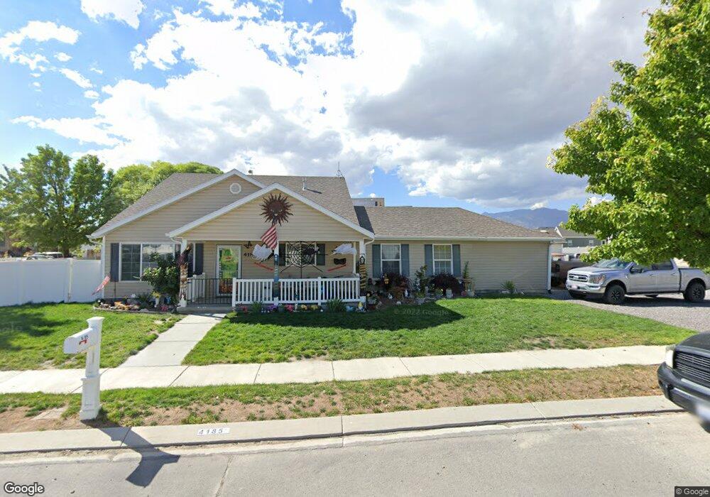
4185 NE Pinion Cir Eagle Mountain, UT 84005
Estimated Value: $441,907 - $485,000
5
Beds
4
Baths
2,336
Sq Ft
$201/Sq Ft
Est. Value
About This Home
This home is located at 4185 NE Pinion Cir, Eagle Mountain, UT 84005 and is currently estimated at $468,977, approximately $200 per square foot. 4185 NE Pinion Cir is a home located in Utah County with nearby schools including Eagle Valley Elementary School, Frontier Middle School, and Cedar Valley High School.
Ownership History
Date
Name
Owned For
Owner Type
Purchase Details
Closed on
Jul 19, 2017
Sold by
Securtiy Natinal Life Insurance Compnay
Bought by
Grow Matthew T
Current Estimated Value
Home Financials for this Owner
Home Financials are based on the most recent Mortgage that was taken out on this home.
Original Mortgage
$220,924
Outstanding Balance
$183,550
Interest Rate
3.89%
Mortgage Type
FHA
Estimated Equity
$285,427
Purchase Details
Closed on
Jan 24, 2011
Sold by
Haycock Jim F
Bought by
Security National Life Insurance Company
Purchase Details
Closed on
Dec 19, 2008
Sold by
Haycock Michelle D
Bought by
Haycock Jim F
Purchase Details
Closed on
Sep 12, 2002
Sold by
Antonello Rose C
Bought by
Lundell Paige
Create a Home Valuation Report for This Property
The Home Valuation Report is an in-depth analysis detailing your home's value as well as a comparison with similar homes in the area
Home Values in the Area
Average Home Value in this Area
Purchase History
| Date | Buyer | Sale Price | Title Company |
|---|---|---|---|
| Grow Matthew T | -- | Integrated Title Ins Svcs | |
| Security National Life Insurance Company | $224,193 | Guardian Title Company Of U | |
| Haycock Jim F | -- | Executive Title Orem | |
| Lundell Paige | -- | Meridian Title |
Source: Public Records
Mortgage History
| Date | Status | Borrower | Loan Amount |
|---|---|---|---|
| Open | Grow Matthew T | $220,924 |
Source: Public Records
Tax History Compared to Growth
Tax History
| Year | Tax Paid | Tax Assessment Tax Assessment Total Assessment is a certain percentage of the fair market value that is determined by local assessors to be the total taxable value of land and additions on the property. | Land | Improvement |
|---|---|---|---|---|
| 2025 | $1,995 | $218,515 | $164,700 | $232,600 |
| 2024 | $1,995 | $215,600 | $0 | $0 |
| 2023 | $1,956 | $228,305 | $0 | $0 |
| 2022 | $2,062 | $235,070 | $0 | $0 |
| 2021 | $1,820 | $311,300 | $81,100 | $230,200 |
| 2020 | $1,732 | $289,200 | $75,100 | $214,100 |
| 2019 | $1,589 | $274,900 | $71,600 | $203,300 |
| 2018 | $1,475 | $241,500 | $61,400 | $180,100 |
| 2017 | $1,370 | $120,670 | $0 | $0 |
| 2016 | $1,323 | $109,010 | $0 | $0 |
| 2015 | $1,317 | $102,905 | $0 | $0 |
| 2014 | $1,169 | $90,200 | $0 | $0 |
Source: Public Records
Map
Nearby Homes
- 1897 E Magnolia Cir
- 1852 E Magnolia Cir
- 1817 E Juniper Dr Unit 102
- 2013 E Swallow Dr Unit 4064
- 1848 E American Way Unit 2
- 1848 E American Way Unit 5
- 1857 E American Way N Unit 13
- 1786 E Eagle Ln
- 1990 E Hummingbird Dr
- 1990 Hummingbird Dr Unit 4097
- 1862 E Kern Mountain
- 3948 N Cougar Ln
- 3944 N Eagle Point Ln
- 3894 N Cougar Ln
- 1843 E Cosmos Dr Unit D5
- 1754 E Cedar Trails Way
- 1997 E Abbey Way
- 1999 E Abbey Way
- 1702 E Stone Creek Way
- 1771 E Skyline Dr Unit 4
- 1905 Juniper Dr
- 1905 E Juniper Dr
- 1914 E Magnolia Cir Unit 418
- 1891 E Juniper Dr Unit 95
- 1891 E Juniper Dr Unit 95
- 1891 E Juniper Dr
- 4192 NE Pinion Cir
- 4206 NE Pinion Cir
- 1912 Juniper Dr
- 1914 Juniper Dr
- 1914 Juniper Dr Unit 88
- 1906 Juniper Dr
- 1906 E Juniper Dr
- 1902 E Magnolia Cir
- 1902 E Magnolia Cir Unit 419
- 1881 E Juniper Dr Unit 96
- 1881 E Juniper Dr
- 1896 E Juniper Dr Unit 86
- 1896 E Juniper Dr
- 1896 E Juniper Dr Unit 86