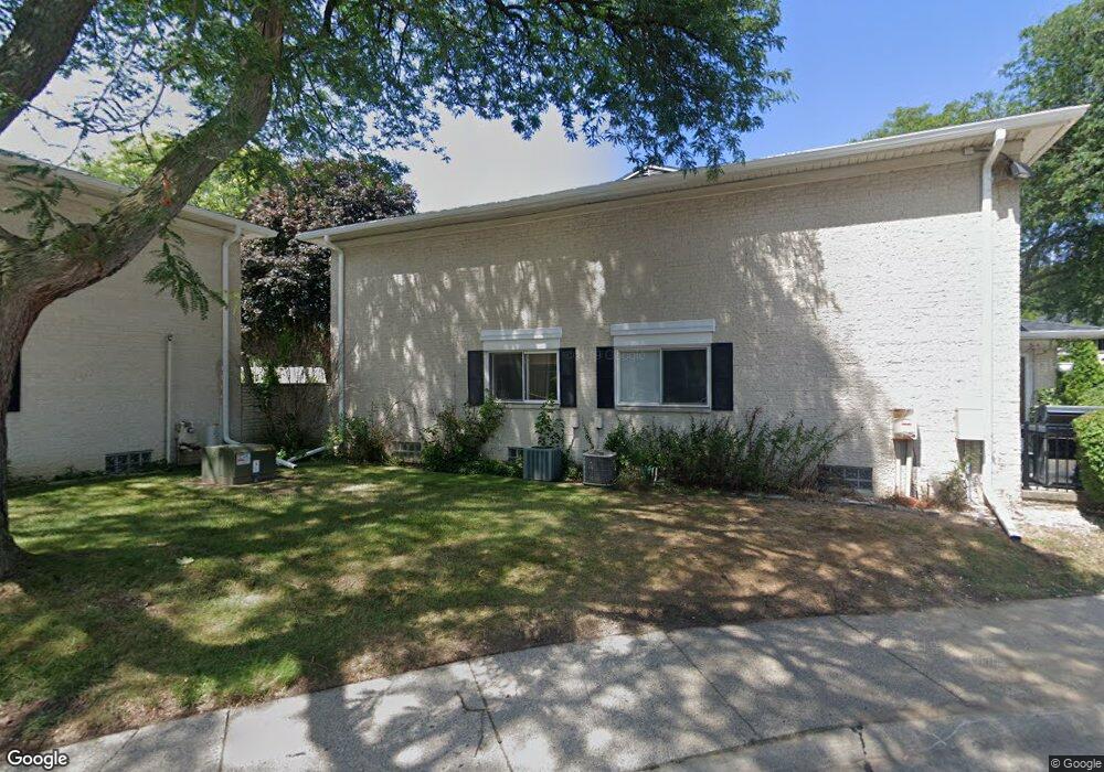
41852 Langley Dr Unit B, 4 Sterling Heights, MI 48313
Estimated Value: $158,000 - $190,000
3
Beds
2
Baths
1,321
Sq Ft
$134/Sq Ft
Est. Value
About This Home
This home is located at 41852 Langley Dr Unit B, 4, Sterling Heights, MI 48313 and is currently estimated at $177,114, approximately $134 per square foot. 41852 Langley Dr Unit B, 4 is a home located in Macomb County with nearby schools including Schwarzkoff Elementary School, Davis Junior High School, and Adlai Stevenson High School.
Ownership History
Date
Name
Owned For
Owner Type
Purchase Details
Closed on
Jun 24, 2011
Sold by
Kowalski Campbell Cassie L
Bought by
Golat Jan and Golat Cristina
Current Estimated Value
Purchase Details
Closed on
Jun 3, 2005
Sold by
Benedetto Brittan J L and Benedetto Barbara
Bought by
Kowalski Campbell Cassie L
Home Financials for this Owner
Home Financials are based on the most recent Mortgage that was taken out on this home.
Original Mortgage
$119,700
Interest Rate
8%
Mortgage Type
Fannie Mae Freddie Mac
Purchase Details
Closed on
May 31, 2002
Sold by
Bow John S
Bought by
Bendetto Brittan J
Purchase Details
Closed on
Jun 7, 2001
Sold by
Resource Bancshares Mort
Bought by
Us Secretary Housing & Urban Dev
Purchase Details
Closed on
Sep 14, 1999
Sold by
Degain Edward C
Bought by
Buraleh Mohamud A
Create a Home Valuation Report for This Property
The Home Valuation Report is an in-depth analysis detailing your home's value as well as a comparison with similar homes in the area
Home Values in the Area
Average Home Value in this Area
Purchase History
| Date | Buyer | Sale Price | Title Company |
|---|---|---|---|
| Golat Jan | $42,000 | Title Connect Llc | |
| Kowalski Campbell Cassie L | $126,000 | Title One Inc | |
| Bendetto Brittan J | $121,500 | -- | |
| Us Secretary Housing & Urban Dev | -- | -- | |
| Buraleh Mohamud A | $97,900 | -- |
Source: Public Records
Mortgage History
| Date | Status | Borrower | Loan Amount |
|---|---|---|---|
| Previous Owner | Kowalski Campbell Cassie L | $119,700 |
Source: Public Records
Tax History Compared to Growth
Tax History
| Year | Tax Paid | Tax Assessment Tax Assessment Total Assessment is a certain percentage of the fair market value that is determined by local assessors to be the total taxable value of land and additions on the property. | Land | Improvement |
|---|---|---|---|---|
| 2025 | $1,884 | $72,800 | $0 | $0 |
| 2024 | $1,472 | $67,100 | $0 | $0 |
| 2023 | $1,392 | $63,900 | $0 | $0 |
| 2022 | $1,662 | $60,100 | $0 | $0 |
| 2021 | $1,627 | $56,100 | $0 | $0 |
| 2020 | $1,252 | $54,300 | $0 | $0 |
| 2019 | $1,520 | $49,600 | $0 | $0 |
| 2018 | $1,526 | $48,000 | $0 | $0 |
| 2017 | $1,475 | $50,000 | $5,000 | $45,000 |
| 2016 | $1,441 | $50,000 | $0 | $0 |
| 2015 | -- | $37,500 | $0 | $0 |
| 2014 | -- | $25,900 | $0 | $0 |
Source: Public Records
Map
Nearby Homes
- 41515 Hamilton Dr
- 41371 Hamilton Dr
- 8125 Ogden Dr
- 42790 Utica Rd
- 42049 Farm Lane Ct
- 11716 Clinton River Rd
- 40309 Lexington Park Dr
- 11401 19 Mile Rd
- 11615 Diehl Dr
- 8644 Independence Dr
- 8273 Independence Dr
- 11898 Lewlund Dr
- 8641 Alwardt Dr
- 8341 Clay Ct
- 39856 Parklawn Dr
- 8147 Clay Ct
- 8133 Clay Ct
- 41744 Mae Wood Dr
- 11423 Delvin Dr
- 43240 Frontenac Ave Unit 502
- 8719 George F Bunker Blvd Unit 7
- 8721 George F Bunker Blvd
- 8719 George F Bunker Blvd Unit B7
- 8717 George F Bunker Blvd
- 8715 George F Bunker Blvd
- 41852 Langley Dr Unit 4
- 41854 Langley Dr
- 41856 Langley Dr
- 41858 Langley Dr Unit B1
- 8719 George F Bunker Blvd
- 41866 Langley Dr Unit 6
- 8522 Hampshire Dr Unit A 2
- 41862 Langley Dr
- 41864 Langley Dr Unit A7
- 41866 Langley Dr Unit A6
- 41868 Langley Dr Unit A5
- 8526 Hampshire Dr
- 8524 Hampshire Dr
- 8522 Hampshire Dr
- 8522 Hampshire Dr Unit 2