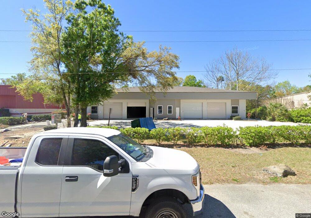
4186 Dairy Ct Port Orange, FL 32127
Estimated Value: $611,031
--
Bed
4
Baths
6,165
Sq Ft
$99/Sq Ft
Est. Value
About This Home
This home is located at 4186 Dairy Ct, Port Orange, FL 32127 and is currently estimated at $611,031, approximately $99 per square foot. 4186 Dairy Ct is a home located in Volusia County with nearby schools including Sugar Mill Elementary School, Silver Sands Middle School, and Spruce Creek High School.
Ownership History
Date
Name
Owned For
Owner Type
Purchase Details
Closed on
Jul 1, 2020
Sold by
Keefer Albert R
Bought by
4186 Dairy Llc
Current Estimated Value
Home Financials for this Owner
Home Financials are based on the most recent Mortgage that was taken out on this home.
Original Mortgage
$300,000
Interest Rate
3.2%
Mortgage Type
Commercial
Purchase Details
Closed on
Oct 15, 1988
Bought by
Keefer Albert R
Create a Home Valuation Report for This Property
The Home Valuation Report is an in-depth analysis detailing your home's value as well as a comparison with similar homes in the area
Home Values in the Area
Average Home Value in this Area
Purchase History
| Date | Buyer | Sale Price | Title Company |
|---|---|---|---|
| 4186 Dairy Llc | $415,000 | Adams Cameron Title Svcs Inc | |
| Keefer Albert R | $42,000 | -- |
Source: Public Records
Mortgage History
| Date | Status | Borrower | Loan Amount |
|---|---|---|---|
| Previous Owner | 4186 Dairy Llc | $300,000 |
Source: Public Records
Tax History Compared to Growth
Tax History
| Year | Tax Paid | Tax Assessment Tax Assessment Total Assessment is a certain percentage of the fair market value that is determined by local assessors to be the total taxable value of land and additions on the property. | Land | Improvement |
|---|---|---|---|---|
| 2025 | $8,171 | $470,457 | $67,500 | $402,957 |
| 2024 | $8,171 | $458,661 | $67,500 | $391,161 |
| 2023 | $8,171 | $432,563 | $57,375 | $375,188 |
| 2022 | $7,458 | $394,501 | $49,500 | $345,001 |
| 2021 | $7,192 | $353,817 | $45,000 | $308,817 |
| 2020 | $6,135 | $300,941 | $45,000 | $255,941 |
| 2019 | $5,585 | $273,302 | $45,000 | $228,302 |
| 2018 | $5,441 | $259,231 | $36,000 | $223,231 |
| 2017 | $5,325 | $245,582 | $33,750 | $211,832 |
| 2016 | $5,060 | $227,395 | $0 | $0 |
| 2015 | $5,274 | $224,292 | $0 | $0 |
| 2014 | $5,241 | $219,602 | $0 | $0 |
Source: Public Records
Map
Nearby Homes
- 6480 Roseberry Ct
- 550 Locust St
- 607 Powers Ave
- 412 Virginia Ave
- 406 Oak St
- 532 Lafayette St
- 309 Lafayette St
- 312 Dunlawton Ave
- 525 Monroe St
- 403 Herbert St
- 315 Herbert St
- 218 Herbert St
- 239 Freeman St
- 265 Bern St
- 827 Railroad St
- 268 Bern St
- 310 Legion Place
- 816 Stonybrook Cir
- 271 Bern St
- 3644 Dame St
- 4184 Dairy Ct Unit C
- 4187 Dairy Ct Unit 4187-b
- 4187 Dairy Ct
- 4191 Dairy Ct Unit D
- 4191 Dairy Ct
- 0 Dairy Ct Unit 1019557
- 0 Dairy Ct Unit 1022970
- 0 Dairy Ct Unit 1022984
- 0 Dairy Ct Unit 1015149
- 0 Dairy Ct Unit 1013184
- 0 Dairy Ct
- 601 Oak St Unit 17E
- 601 Oak St Unit 17 D & E
- 601 Oak St
- 601 Oak St Unit Bldg. 4 Unit H
- 4170 Dairy Ct Unit 105
- 4170 Dairy Ct Unit 106
- 4170 Dairy Ct Unit 103
- 413 Oak Place Unit 4O
- 413 Oak Place Unit 3P