Estimated Value: $227,000 - $253,954
Studio
1
Bath
1,680
Sq Ft
$146/Sq Ft
Est. Value
About This Home
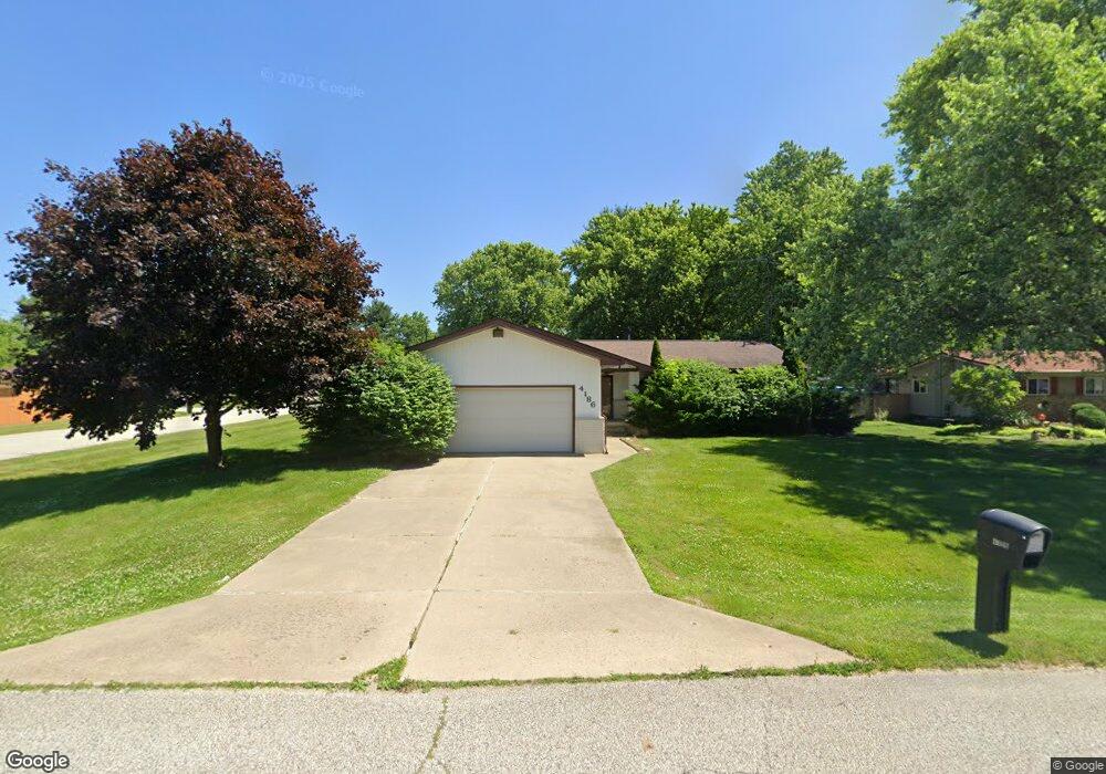
This home is located at 4186 Pheasant Dr, Flint, MI 48506 and is currently estimated at $245,489, approximately $146 per square foot. 4186 Pheasant Dr is a home located in Genesee County with nearby schools including Weston Elementary School, Leota Fiedler Elementary School, and Kate Dowdall Elementary School.
Ownership History
Date
Name
Owned For
Owner Type
Purchase Details
Closed on
Apr 20, 2020
Sold by
Eason Edward E
Bought by
Eason Edward E and Eason Eric John
Current Estimated Value
Home Financials for this Owner
Home Financials are based on the most recent Mortgage that was taken out on this home.
Original Mortgage
$67,000
Outstanding Balance
$46,521
Interest Rate
3.3%
Mortgage Type
New Conventional
Estimated Equity
$198,968
Purchase Details
Closed on
Dec 2, 2015
Sold by
Eason Edward E and Eason Matilda A
Bought by
Eason Edward E
Purchase Details
Closed on
Apr 9, 2004
Sold by
Gary A & Drusila M Godmar Trust
Bought by
Eason Edward E and Eason Matilda A
Purchase Details
Closed on
Feb 15, 2000
Sold by
Godmar Gary A and Godmar Drusilla
Bought by
Gary A & Drusilla M Godmar Trust
Create a Home Valuation Report for This Property
The Home Valuation Report is an in-depth analysis detailing your home's value as well as a comparison with similar homes in the area
Home Values in the Area
Average Home Value in this Area
Purchase History
| Date | Buyer | Sale Price | Title Company |
|---|---|---|---|
| Eason Edward E | -- | Amrock Inc | |
| Eason Edward E | -- | Attorney | |
| Eason Edward E | $170,000 | Guaranty Title Company | |
| Gary A & Drusilla M Godmar Trust | -- | -- |
Source: Public Records
Mortgage History
| Date | Status | Borrower | Loan Amount |
|---|---|---|---|
| Open | Eason Edward E | $67,000 |
Source: Public Records
Tax History
| Year | Tax Paid | Tax Assessment Tax Assessment Total Assessment is a certain percentage of the fair market value that is determined by local assessors to be the total taxable value of land and additions on the property. | Land | Improvement |
|---|---|---|---|---|
| 2025 | $2,423 | $146,800 | $0 | $0 |
| 2024 | $668 | $134,600 | $0 | $0 |
| 2023 | $637 | $119,200 | $0 | $0 |
| 2022 | $2,002 | $111,700 | $0 | $0 |
| 2021 | $1,984 | $100,700 | $0 | $0 |
| 2020 | $583 | $93,400 | $0 | $0 |
| 2019 | $574 | $82,500 | $0 | $0 |
| 2018 | $1,879 | $73,600 | $0 | $0 |
| 2017 | $1,824 | $70,800 | $0 | $0 |
| 2016 | $1,794 | $68,000 | $0 | $0 |
| 2015 | $1,585 | $63,900 | $0 | $0 |
| 2014 | $529 | $58,800 | $0 | $0 |
| 2012 | -- | $44,200 | $44,200 | $0 |
Source: Public Records
Map
Nearby Homes
- 6367 E Pierson Rd
- 6312 Tamara Dr
- 7045 Normandy Ct
- 6443 Richfield Rd
- 6054 E Pierson Rd
- 4126 N Belsay Rd
- 5101 Arbor Ln
- 3424 N Irish Rd
- 5411 Squire Ln
- 5165 N Irish Rd
- 5177 N Irish Rd
- 1240 N Irish Rd
- 6076 E Carpenter Rd
- 0 Whisper Ridge Ct
- 7200 E Potter Rd
- 2411 Briar Creek Ln
- 6490 E Coldwater Rd
- 3267 Mills Acres St
- 2401 Mcclellan Blvd
- 2363 Willowdale Dr
- 4176 Pheasant Dr
- 4206 Pheasant Dr
- 4166 Pheasant Dr
- 4185 Red Bird Ln
- 4188 Red Bird Ln
- 4183 Pheasant Dr
- 4190 Red Bird Ln
- 4175 Pheasant Dr
- 4158 Pheasant Dr
- 4226 Pheasant Dr
- 4187 Red Bird Ln
- 4163 Pheasant Dr
- 4213 Pheasant Dr
- 4191 Red Bird Ln
- 4144 Pheasant Dr
- 4179 N Vassar Rd
- 4159 Blue Bird Ln
- 4238 Pheasant Dr
- 4163 N Vassar Rd
- 4223 Pheasant Dr
Your Personal Tour Guide
Ask me questions while you tour the home.