Estimated Value: $415,000 - $439,000
3
Beds
1
Bath
1,502
Sq Ft
$282/Sq Ft
Est. Value
About This Home
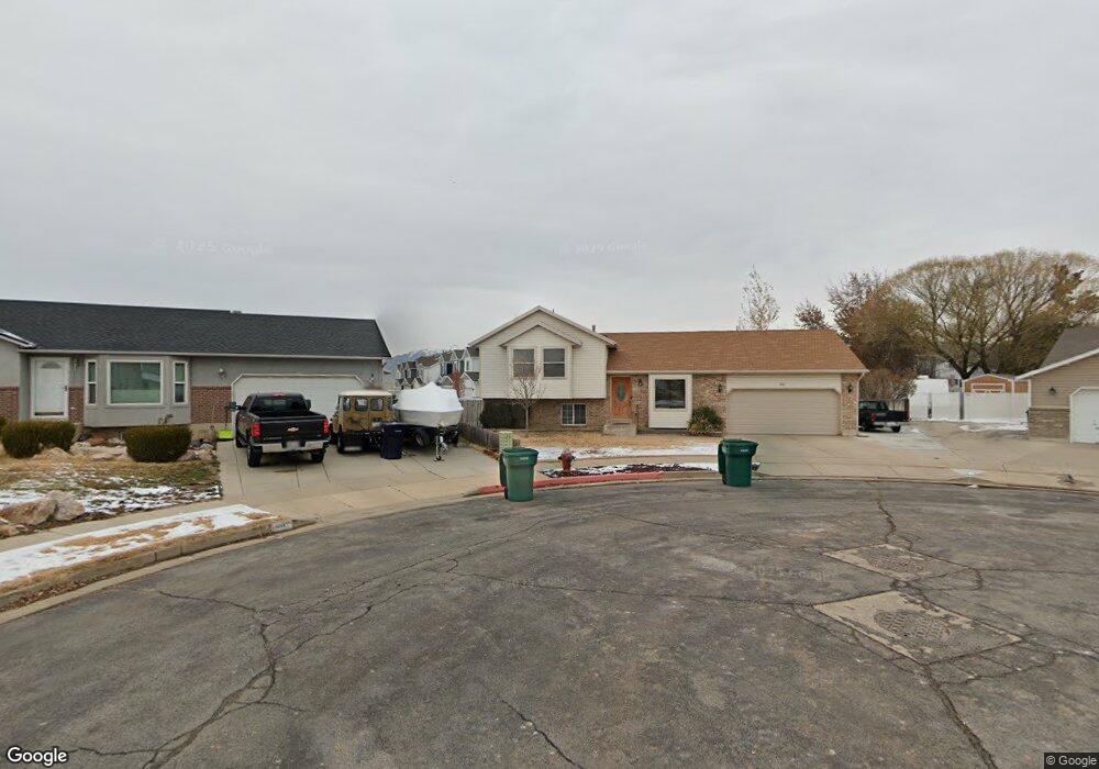
This home is located at 4186 S 2825 W, Roy, UT 84067 and is currently estimated at $423,091, approximately $281 per square foot. 4186 S 2825 W is a home located in Weber County with nearby schools including Midland School, Sand Ridge Junior High School, and Roy High School.
Ownership History
Date
Name
Owned For
Owner Type
Purchase Details
Closed on
Nov 12, 2022
Sold by
Linford Kari Ann
Bought by
Reed Kari Ann
Current Estimated Value
Purchase Details
Closed on
Dec 7, 2017
Sold by
Oldham Troy Leon
Bought by
Linford Karl Ann
Home Financials for this Owner
Home Financials are based on the most recent Mortgage that was taken out on this home.
Original Mortgage
$149,500
Interest Rate
3.94%
Mortgage Type
New Conventional
Purchase Details
Closed on
Jan 17, 1996
Sold by
Koz Construction Inc
Bought by
Oldham Troy Leon and Oldham Lois W
Home Financials for this Owner
Home Financials are based on the most recent Mortgage that was taken out on this home.
Original Mortgage
$99,182
Interest Rate
7.18%
Mortgage Type
FHA
Create a Home Valuation Report for This Property
The Home Valuation Report is an in-depth analysis detailing your home's value as well as a comparison with similar homes in the area
Home Values in the Area
Average Home Value in this Area
Purchase History
| Date | Buyer | Sale Price | Title Company |
|---|---|---|---|
| Reed Kari Ann | -- | -- | |
| Linford Karl Ann | -- | Mountain View Title | |
| Oldham Troy Leon | -- | Mountain View Title | |
| Koz Construction Inc | -- | Mountain View Title |
Source: Public Records
Mortgage History
| Date | Status | Borrower | Loan Amount |
|---|---|---|---|
| Previous Owner | Linford Karl Ann | $149,500 | |
| Previous Owner | Oldham Troy Leon | $99,182 |
Source: Public Records
Tax History
| Year | Tax Paid | Tax Assessment Tax Assessment Total Assessment is a certain percentage of the fair market value that is determined by local assessors to be the total taxable value of land and additions on the property. | Land | Improvement |
|---|---|---|---|---|
| 2025 | $2,522 | $396,866 | $147,990 | $248,876 |
| 2024 | $2,421 | $210,649 | $81,394 | $129,255 |
| 2023 | $2,212 | $191,400 | $74,501 | $116,899 |
| 2022 | $2,530 | $228,801 | $63,564 | $165,237 |
| 2021 | $1,992 | $294,000 | $80,658 | $213,342 |
| 2020 | $1,907 | $259,000 | $80,658 | $178,342 |
| 2019 | $1,797 | $229,000 | $54,619 | $174,381 |
| 2018 | $1,645 | $196,000 | $49,572 | $146,428 |
| 2017 | $1,490 | $165,000 | $47,625 | $117,375 |
| 2016 | $1,446 | $86,160 | $26,463 | $59,697 |
| 2015 | $1,348 | $82,060 | $26,463 | $55,597 |
| 2014 | $1,233 | $73,283 | $23,685 | $49,598 |
Source: Public Records
Map
Nearby Homes
- 2778 W 4175 S Unit 237
- 4270 S 2900 W
- 2815 W 4275 S
- 4374 S 2900 W
- 4297 Westlake Dr
- 2979 W 4275 S
- 3931 S 2950 W
- 3860 S Midland Dr Unit B 51
- 4248 S 2400 W
- 3114 S 3175 W Unit 21
- 3229 W 3855 S
- 3763 S 3175 W
- 3222 W 3825 S Unit SPL350
- 3721 S 3175 W
- 3713 S 3175 W
- 3835 S 3250 W
- 3716 S 3195 W
- 3750 S Midland Dr Unit 80
- 3750 S Midland Dr Unit 189
- 3750 S Midland Dr
- 4192 S 2825 W
- 4187 S 2825 W
- 4189 S 2800 W
- 4179 S 2800 W
- 4179 S 2800 W Unit 233
- 4179 S 2800 W Unit 223
- 4179 S 2800 W Unit 224
- 2822 W 4200 S
- 4183 S 2800 W
- 4193 S 2825 W
- 4173 S 2825 W Unit 206
- 4173 S 2825 W Unit 208
- 4173 S 2825 W Unit 205
- 2806 W 4200 S
- 2870 W 4200 S
- 2830 W 4200 S
- 2887 W 4200 S
- 2889 W 4200 S
- 4156 S 2825 W Unit 215
- 4156 S 2825 W Unit 218
Your Personal Tour Guide
Ask me questions while you tour the home.