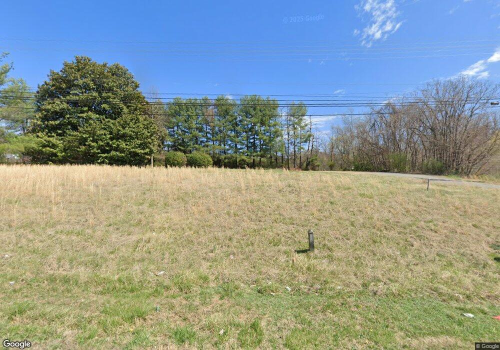
4187 N Patterson Ave Winston Salem, NC 27105
Montview-Ogburn Station NeighborhoodEstimated Value: $311,000 - $448,000
10
Beds
4
Baths
6,880
Sq Ft
$52/Sq Ft
Est. Value
About This Home
This home is located at 4187 N Patterson Ave, Winston Salem, NC 27105 and is currently estimated at $359,166, approximately $52 per square foot. 4187 N Patterson Ave is a home located in Forsyth County with nearby schools including Mineral Springs Elementary, Mineral Springs Middle School, and Carver High.
Ownership History
Date
Name
Owned For
Owner Type
Purchase Details
Closed on
Feb 15, 2024
Sold by
Perimeter Point Properties Llc
Bought by
Cc Winston-Salem Llc
Current Estimated Value
Purchase Details
Closed on
Feb 26, 2015
Sold by
Wingo Daniel A and Wingo Marjorie Ellen
Bought by
Perimeter Point Properties Llc
Purchase Details
Closed on
Sep 1, 2005
Sold by
Moore Wyatt J and Moore Juanita Smith
Bought by
Church Benny M
Create a Home Valuation Report for This Property
The Home Valuation Report is an in-depth analysis detailing your home's value as well as a comparison with similar homes in the area
Home Values in the Area
Average Home Value in this Area
Purchase History
| Date | Buyer | Sale Price | Title Company |
|---|---|---|---|
| Cc Winston-Salem Llc | -- | Chicago Title | |
| Perimeter Point Properties Llc | $146,000 | None Available | |
| Church Benny M | $250,000 | -- |
Source: Public Records
Tax History Compared to Growth
Tax History
| Year | Tax Paid | Tax Assessment Tax Assessment Total Assessment is a certain percentage of the fair market value that is determined by local assessors to be the total taxable value of land and additions on the property. | Land | Improvement |
|---|---|---|---|---|
| 2025 | $2,141 | -- | -- | -- |
| 2024 | $2,141 | $159,900 | $117,600 | $42,300 |
| 2023 | $2,141 | $159,900 | $117,600 | $42,300 |
| 2022 | $2,101 | $159,900 | $117,600 | $42,300 |
| 2021 | $2,063 | $159,900 | $117,600 | $42,300 |
| 2020 | $1,991 | $144,200 | $101,000 | $43,200 |
| 2019 | $2,006 | $144,200 | $101,000 | $43,200 |
| 2018 | $1,905 | $144,200 | $101,000 | $43,200 |
| 2016 | $1,678 | $127,480 | $100,967 | $26,513 |
| 2015 | $1,652 | $127,480 | $100,967 | $26,513 |
| 2014 | $1,602 | $127,480 | $100,967 | $26,513 |
Source: Public Records
Map
Nearby Homes
- 228 Barlow Cir
- 106 Azalea Dr
- 4967 Trent Hill Dr
- 5550 Brookfield Ridge Dr
- 0 Barlow Cir Unit 1191383
- 205 Beechwood Cir
- 4798 Cherry St
- 168 Oak Summit Rd
- 0 Stonewall St Unit 1187672
- 4507 Heatherly Rd
- 4915 Rumley Cir
- 5472 Shirley Jean Ct
- 0 Methodist Dr
- 651 Motor Rd
- 0 University Pkwy Unit 1131791
- 4656 Walcott St
- 133 Lodge St
- 4954 Home Rd NW
- 229 Creeksedge Ct
- 177 Dillingham Rd
- 5390 Northridge Dr
- 5382 Northridge Dr
- 5398 Northridge Dr
- 5209 & 5217 Germanton Rd
- 5370 Northridge Dr
- 5376 Northridge Dr
- 5217 Germanton Rd
- 5364 Northridge Dr
- 395 Azalea Dr
- 5393 Northridge Dr
- 5387 Northridge Dr
- 0 Patterson Ave
- 5358 Northridge Dr
- 5221 Germanton Rd
- 5462 Northridge Dr
- 387 Azalea Dr
- 5352 Northridge Dr
- 5375 Northridge Dr
- 5466 Northridge Dr
- 376 Azalea Dr
