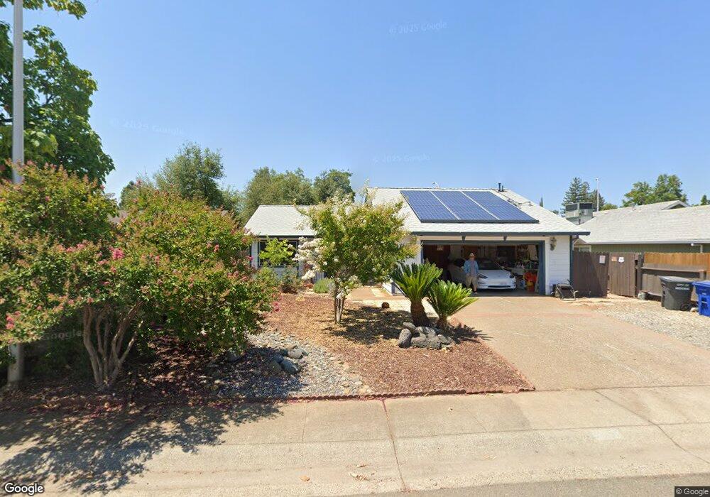
4188 Cirrus St Redding, CA 96002
Starview NeighborhoodEstimated Value: $336,000 - $352,000
3
Beds
2
Baths
1,318
Sq Ft
$260/Sq Ft
Est. Value
About This Home
This home is located at 4188 Cirrus St, Redding, CA 96002 and is currently estimated at $342,154, approximately $259 per square foot. 4188 Cirrus St is a home located in Shasta County with nearby schools including Alta Mesa Elementary School, Parsons Junior High School, and Enterprise High School.
Ownership History
Date
Name
Owned For
Owner Type
Purchase Details
Closed on
Mar 16, 2009
Sold by
Tholen Randy and Tholen Carol
Bought by
Tholen Randolph M
Current Estimated Value
Home Financials for this Owner
Home Financials are based on the most recent Mortgage that was taken out on this home.
Original Mortgage
$157,600
Outstanding Balance
$100,318
Interest Rate
5.15%
Mortgage Type
Stand Alone Refi Refinance Of Original Loan
Estimated Equity
$241,836
Purchase Details
Closed on
Mar 9, 2009
Sold by
Department Of Veterans Affairs Of The St
Bought by
Tholen Randy and Tholen Carol
Home Financials for this Owner
Home Financials are based on the most recent Mortgage that was taken out on this home.
Original Mortgage
$157,600
Outstanding Balance
$100,318
Interest Rate
5.15%
Mortgage Type
Stand Alone Refi Refinance Of Original Loan
Estimated Equity
$241,836
Purchase Details
Closed on
Dec 5, 2005
Sold by
Stewart Dean M and Stewart Carol A
Bought by
Va
Create a Home Valuation Report for This Property
The Home Valuation Report is an in-depth analysis detailing your home's value as well as a comparison with similar homes in the area
Home Values in the Area
Average Home Value in this Area
Purchase History
| Date | Buyer | Sale Price | Title Company |
|---|---|---|---|
| Tholen Randolph M | -- | Metro National Title | |
| Tholen Randy | -- | None Available | |
| Va | $265,000 | First American Title Company |
Source: Public Records
Mortgage History
| Date | Status | Borrower | Loan Amount |
|---|---|---|---|
| Open | Tholen Randolph M | $157,600 |
Source: Public Records
Tax History
| Year | Tax Paid | Tax Assessment Tax Assessment Total Assessment is a certain percentage of the fair market value that is determined by local assessors to be the total taxable value of land and additions on the property. | Land | Improvement |
|---|---|---|---|---|
| 2025 | $3,684 | $345,000 | $60,000 | $285,000 |
| 2024 | $3,485 | $340,000 | $60,000 | $280,000 |
| 2023 | $3,485 | $320,000 | $60,000 | $260,000 |
| 2022 | $3,454 | $320,000 | $60,000 | $260,000 |
| 2021 | $2,972 | $280,000 | $60,000 | $220,000 |
| 2020 | $2,503 | $235,000 | $55,000 | $180,000 |
| 2019 | $2,422 | $225,000 | $55,000 | $170,000 |
| 2018 | $2,276 | $210,000 | $50,000 | $160,000 |
| 2017 | $2,212 | $196,900 | $42,800 | $154,100 |
| 2016 | $1,969 | $184,000 | $40,000 | $144,000 |
| 2015 | $1,883 | $175,000 | $35,000 | $140,000 |
| 2014 | $1,850 | $170,000 | $30,000 | $140,000 |
Source: Public Records
Map
Nearby Homes
- 1827 Bembow Dr
- 3985 Cirrus St
- 3732 Mercury Dr
- 2185 Galaxy Way
- 2068 Solar Way
- 4001 Alta Mesa Dr
- 3466 Silverwood St
- 1785 Soda Springs Cir
- 3425 Silverwood St
- 2332 Venus Way
- 1922 Eddy Way
- 1513 Harpole Rd
- 3778 Scorpius Way
- 3341 Timbercreek Dr
- 1959 Alexis Ct
- 3759 Alma Ave
- 1397 Empress Ln
- 3688 Polaris Way
- 3594 Laramie St
- 1354 Harpole Rd
- 4176 Cirrus St
- 4192 Cirrus St
- 1905 Galaxy Way
- 4181 Cirrus St
- 4152 Cirrus St
- 4173 Cirrus St
- 3905 Sunwood Dr
- 3919 Sunwood Dr
- 1923 Galaxy Way
- 1832 Galaxy Way
- 4155 Cirrus St
- 1810 Galaxy Way
- 3933 Sunwood Dr
- 4140 Cirrus St
- 1854 Galaxy Way
- 3947 Sunwood Dr
- 1900 Carol Jean Ct
- 1941 Galaxy Way
- 4143 Cirrus St
- 3897 Sunwood Dr Unit 3
Your Personal Tour Guide
Ask me questions while you tour the home.