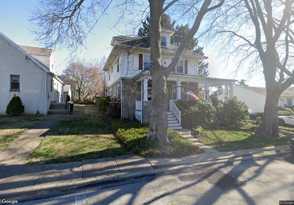
419 Bartram Rd Willow Grove, PA 19090
Estimated Value: $403,000 - $450,000
3
Beds
2
Baths
1,572
Sq Ft
$274/Sq Ft
Est. Value
About This Home
This home is located at 419 Bartram Rd, Willow Grove, PA 19090 and is currently estimated at $431,352, approximately $274 per square foot. 419 Bartram Rd is a home located in Montgomery County with nearby schools including Upper Moreland Intermediate School, Upper Moreland Primary School, and Upper Moreland Middle School.
Ownership History
Date
Name
Owned For
Owner Type
Purchase Details
Closed on
Mar 19, 2018
Sold by
Tinsley Lynn C
Bought by
Rose Gregory A
Current Estimated Value
Home Financials for this Owner
Home Financials are based on the most recent Mortgage that was taken out on this home.
Original Mortgage
$20,000
Outstanding Balance
$17,114
Interest Rate
4.32%
Mortgage Type
New Conventional
Estimated Equity
$414,238
Create a Home Valuation Report for This Property
The Home Valuation Report is an in-depth analysis detailing your home's value as well as a comparison with similar homes in the area
Home Values in the Area
Average Home Value in this Area
Purchase History
| Date | Buyer | Sale Price | Title Company |
|---|---|---|---|
| Rose Gregory A | -- | None Available |
Source: Public Records
Mortgage History
| Date | Status | Borrower | Loan Amount |
|---|---|---|---|
| Open | Rose Gregory A | $20,000 |
Source: Public Records
Tax History Compared to Growth
Tax History
| Year | Tax Paid | Tax Assessment Tax Assessment Total Assessment is a certain percentage of the fair market value that is determined by local assessors to be the total taxable value of land and additions on the property. | Land | Improvement |
|---|---|---|---|---|
| 2025 | $6,126 | $128,880 | $51,850 | $77,030 |
| 2024 | $6,126 | $128,880 | $51,850 | $77,030 |
| 2023 | $5,872 | $128,880 | $51,850 | $77,030 |
| 2022 | $5,522 | $128,880 | $51,850 | $77,030 |
| 2021 | $5,448 | $128,880 | $51,850 | $77,030 |
| 2020 | $5,268 | $128,880 | $51,850 | $77,030 |
| 2019 | $5,152 | $128,880 | $51,850 | $77,030 |
| 2018 | $5,152 | $128,880 | $51,850 | $77,030 |
| 2017 | $4,922 | $128,880 | $51,850 | $77,030 |
| 2016 | $4,872 | $128,880 | $51,850 | $77,030 |
| 2015 | $4,623 | $128,880 | $51,850 | $77,030 |
| 2014 | $4,623 | $128,880 | $51,850 | $77,030 |
Source: Public Records
Map
Nearby Homes
- 121 Dallas Rd
- 310 Dallas Rd
- 510 Grant Ave
- 1948 Lukens Ave
- 1972 Coolidge Ave
- 16 Lawnton Rd
- 509 Lincoln Ave
- 605 Crown St
- 505 Crown St
- 605 Fairhill St
- 24 Twin Brooks Dr
- 22 Fitzwatertown Rd Unit F-4
- 61 Twin Brooks Dr
- 612 Brook St
- 1838 Lukens Ave
- 885 N York Rd Unit 12C
- 1822 Osbourne Ave
- 14 Knock N Knoll Cir Unit L-14
- 1006 N York Rd Unit 1
- 1014 N York Rd
- 217 Barrett Rd
- 417 Bartram Rd Unit A
- 417 Bartram Rd Unit B
- 417 Bartram Rd
- 214 Barrett Rd
- 216 Barrett Rd
- 208 Barrett Rd
- 412 Bartram Rd
- 204 Barrett Rd
- 410 Bartram Rd
- 415 Bartram Rd
- 218 Barrett Rd
- 408 Bartram Rd
- 200 Barrett Rd
- 404 Bartram Rd
- 214 Allison Rd
- 135 Barrett Rd
- 221 Barrett Rd
- 219 Cameron Rd
- 217 Cameron Rd