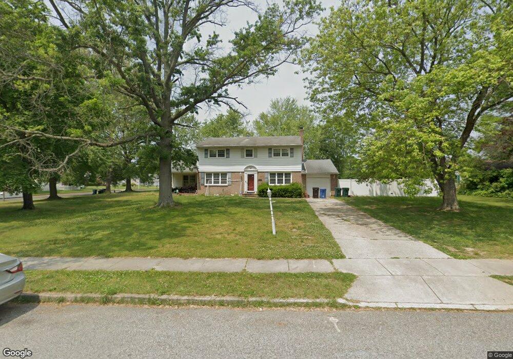
419 Birch Dr Mickleton, NJ 08056
Estimated Value: $501,186 - $578,000
4
Beds
2
Baths
2,686
Sq Ft
$201/Sq Ft
Est. Value
About This Home
This home is located at 419 Birch Dr, Mickleton, NJ 08056 and is currently estimated at $541,047, approximately $201 per square foot. 419 Birch Dr is a home located in Gloucester County with nearby schools including Jeffrey Clark School, Samuel Mickle School, and Kingsway Regional Middle School.
Ownership History
Date
Name
Owned For
Owner Type
Purchase Details
Closed on
Jun 20, 2018
Sold by
West Michael E and West Constance M
Bought by
West Michaele E
Current Estimated Value
Home Financials for this Owner
Home Financials are based on the most recent Mortgage that was taken out on this home.
Original Mortgage
$197,598
Interest Rate
4.87%
Mortgage Type
FHA
Purchase Details
Closed on
Apr 8, 1999
Sold by
Mcshane Neil J and Mcshane Elisabeth S
Bought by
West Michael E and West Constance M
Home Financials for this Owner
Home Financials are based on the most recent Mortgage that was taken out on this home.
Original Mortgage
$132,925
Interest Rate
7.04%
Mortgage Type
FHA
Create a Home Valuation Report for This Property
The Home Valuation Report is an in-depth analysis detailing your home's value as well as a comparison with similar homes in the area
Home Values in the Area
Average Home Value in this Area
Purchase History
| Date | Buyer | Sale Price | Title Company |
|---|---|---|---|
| West Michaele E | $66,699 | None Available | |
| West Michael E | $145,000 | Fidelity National Title |
Source: Public Records
Mortgage History
| Date | Status | Borrower | Loan Amount |
|---|---|---|---|
| Previous Owner | West Michaele E | $197,598 | |
| Previous Owner | West Michael E | $132,925 |
Source: Public Records
Tax History
| Year | Tax Paid | Tax Assessment Tax Assessment Total Assessment is a certain percentage of the fair market value that is determined by local assessors to be the total taxable value of land and additions on the property. | Land | Improvement |
|---|---|---|---|---|
| 2025 | $8,806 | $277,000 | $75,200 | $201,800 |
| 2024 | $8,526 | $277,000 | $75,200 | $201,800 |
Source: Public Records
Map
Nearby Homes
- 415 Country Way
- 424 Country Way
- 241 Gaunt Dr
- 432 Country Way
- 18 Millwood Dr
- 200 David Mills Ln
- 552 Hereford Ln
- 120 Jubilee Dr
- 118 Timberlane Rd
- 209 Charles Corliss Blvd
- 355 Friendship Rd
- 255 Genesee Rd
- 2701 Lamington Ct
- 276-280 County House Rd
- 67 E Rattling Run Rd
- 1224 Heddon Ave
- 1265 Walter Ave
- 253 Jessups Mill Rd
- 71 W Tomlin Station Rd
- 0 Lodge Ave
Your Personal Tour Guide
Ask me questions while you tour the home.