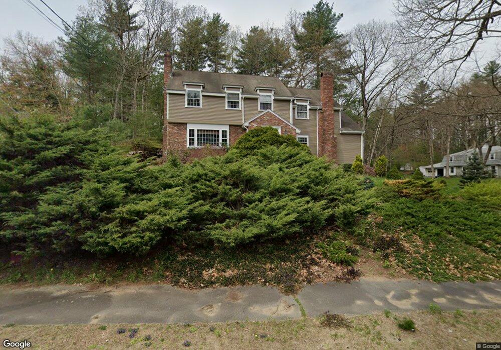
419 Border Rd Concord, MA 01742
Estimated Value: $1,115,000 - $1,239,650
5
Beds
3
Baths
2,901
Sq Ft
$416/Sq Ft
Est. Value
About This Home
This home is located at 419 Border Rd, Concord, MA 01742 and is currently estimated at $1,206,663, approximately $415 per square foot. 419 Border Rd is a home located in Middlesex County with nearby schools including Thoreau Elementary School, Concord Middle School, and Concord Carlisle High School.
Ownership History
Date
Name
Owned For
Owner Type
Purchase Details
Closed on
Aug 28, 2009
Sold by
Rideout Leonard B and Rideout Heather J
Bought by
Schmidt Christopher and Sherbovich Natalia
Current Estimated Value
Home Financials for this Owner
Home Financials are based on the most recent Mortgage that was taken out on this home.
Original Mortgage
$521,926
Outstanding Balance
$340,991
Interest Rate
5.17%
Mortgage Type
Purchase Money Mortgage
Estimated Equity
$865,672
Purchase Details
Closed on
Dec 30, 2003
Sold by
Carey Donna Marie and Carey William L
Bought by
Rideout Heather J and Rideout Leonard B
Home Financials for this Owner
Home Financials are based on the most recent Mortgage that was taken out on this home.
Original Mortgage
$492,000
Interest Rate
6.01%
Mortgage Type
Purchase Money Mortgage
Create a Home Valuation Report for This Property
The Home Valuation Report is an in-depth analysis detailing your home's value as well as a comparison with similar homes in the area
Home Values in the Area
Average Home Value in this Area
Purchase History
| Date | Buyer | Sale Price | Title Company |
|---|---|---|---|
| Schmidt Christopher | $540,000 | -- | |
| Rideout Heather J | $615,000 | -- |
Source: Public Records
Mortgage History
| Date | Status | Borrower | Loan Amount |
|---|---|---|---|
| Open | Schmidt Christopher | $521,926 | |
| Previous Owner | Rideout Heather J | $492,000 |
Source: Public Records
Tax History
| Year | Tax Paid | Tax Assessment Tax Assessment Total Assessment is a certain percentage of the fair market value that is determined by local assessors to be the total taxable value of land and additions on the property. | Land | Improvement |
|---|---|---|---|---|
| 2025 | $125 | $939,700 | $394,500 | $545,200 |
| 2024 | $12,338 | $939,700 | $394,500 | $545,200 |
| 2023 | $10,923 | $842,800 | $328,800 | $514,000 |
| 2022 | $10,636 | $720,600 | $291,600 | $429,000 |
| 2021 | $10,320 | $701,100 | $291,600 | $409,500 |
| 2020 | $9,989 | $702,000 | $291,600 | $410,400 |
| 2019 | $9,797 | $690,400 | $311,000 | $379,400 |
| 2018 | $9,903 | $693,000 | $309,400 | $383,600 |
| 2017 | $9,306 | $661,400 | $277,800 | $383,600 |
| 2016 | $9,159 | $658,000 | $277,800 | $380,200 |
| 2015 | $8,651 | $605,400 | $257,200 | $348,200 |
Source: Public Records
Map
Nearby Homes
- 96 Forest Ridge Rd Unit 96
- 1201 Old Marlboro Rd
- 23 Deer Path Unit 5
- 2 Skyview Ln
- 57 Longfellow Rd
- 26 Field Rd
- 100 Harrington Ave
- 42 Dakin Rd
- 1844 Main St Unit 1844
- 70 Powder Mill Rd
- 68 Powder Mill Rd
- 66 Powder Mill Rd
- 377 Willis Rd
- 27 Water St
- 37 Water St
- 1 Drummer Rd Unit A5
- 22 Douglas Ave Unit 2
- 22 Douglas Ave Unit 1
- 20 Westvale Meadows Unit C
- 31-33 Roosevelt St
Your Personal Tour Guide
Ask me questions while you tour the home.