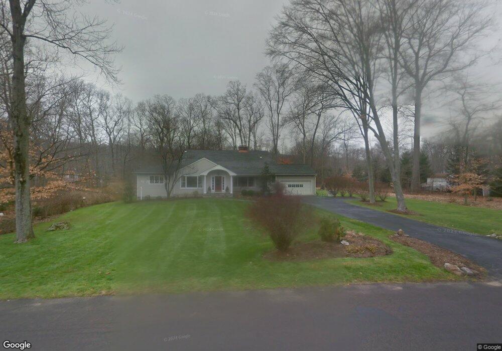
419 Cedar Ln New Canaan, CT 06840
Estimated Value: $1,681,000 - $2,293,434
5
Beds
6
Baths
4,787
Sq Ft
$411/Sq Ft
Est. Value
About This Home
This home is located at 419 Cedar Ln, New Canaan, CT 06840 and is currently estimated at $1,969,609, approximately $411 per square foot. 419 Cedar Ln is a home located in Fairfield County with nearby schools including East Elementary School, Saxe Middle School, and New Canaan High School.
Ownership History
Date
Name
Owned For
Owner Type
Purchase Details
Closed on
Jul 31, 2020
Sold by
Margaret Frankling Ret
Bought by
Cohen Kathleen and Cohen Gordon
Current Estimated Value
Home Financials for this Owner
Home Financials are based on the most recent Mortgage that was taken out on this home.
Original Mortgage
$805,760
Outstanding Balance
$716,085
Interest Rate
3.1%
Mortgage Type
Purchase Money Mortgage
Estimated Equity
$1,253,524
Purchase Details
Closed on
Jan 21, 2014
Sold by
Franklin Margaret H
Bought by
Franklin Tr Margaret H and Franklin Edward A
Purchase Details
Closed on
Aug 2, 1991
Sold by
Jennings William C and Jennings Judith
Bought by
Franklin Edward and Franklin Margaret
Home Financials for this Owner
Home Financials are based on the most recent Mortgage that was taken out on this home.
Original Mortgage
$200,000
Interest Rate
8.75%
Mortgage Type
Unknown
Create a Home Valuation Report for This Property
The Home Valuation Report is an in-depth analysis detailing your home's value as well as a comparison with similar homes in the area
Home Values in the Area
Average Home Value in this Area
Purchase History
| Date | Buyer | Sale Price | Title Company |
|---|---|---|---|
| Cohen Kathleen | $1,007,200 | None Available | |
| Franklin Tr Margaret H | -- | -- | |
| Franklin Margaret H | -- | -- | |
| Franklin Edward | $365,000 | -- |
Source: Public Records
Mortgage History
| Date | Status | Borrower | Loan Amount |
|---|---|---|---|
| Open | Cohen Kathleen | $805,760 | |
| Previous Owner | Franklin Edward | $225,000 | |
| Previous Owner | Franklin Edward | $200,000 |
Source: Public Records
Tax History
| Year | Tax Paid | Tax Assessment Tax Assessment Total Assessment is a certain percentage of the fair market value that is determined by local assessors to be the total taxable value of land and additions on the property. | Land | Improvement |
|---|---|---|---|---|
| 2025 | $19,205 | $1,150,660 | $600,950 | $549,710 |
| 2024 | $18,572 | $1,150,660 | $600,950 | $549,710 |
| 2023 | $12,554 | $662,830 | $544,180 | $118,650 |
| 2022 | $12,176 | $662,830 | $544,180 | $118,650 |
| 2021 | $12,037 | $662,830 | $544,180 | $118,650 |
| 2020 | $12,037 | $662,830 | $544,180 | $118,650 |
| 2019 | $12,090 | $662,830 | $544,180 | $118,650 |
| 2018 | $11,826 | $697,270 | $535,430 | $161,840 |
| 2017 | $11,623 | $697,270 | $535,430 | $161,840 |
| 2016 | $11,372 | $697,270 | $535,430 | $161,840 |
| 2015 | $11,149 | $697,270 | $535,430 | $161,840 |
| 2014 | $10,836 | $697,270 | $535,430 | $161,840 |
Source: Public Records
Map
Nearby Homes
- 135 Comstock Hill Rd
- 106A Comstock Hill Ave
- 89 Pastures Ln
- 158L Carter St
- 152L Carter St
- 140L Carter St
- 136L Carter St
- 239 Silvermine Ave
- 4 Nursery St
- 10 Purdy Rd
- 67 Carter St
- 48 Green Meadow Ln
- 24 Grey Hollow Rd
- 6 Down River Rd Unit B
- 377 Main St Unit 17
- 35 Canoe Hill Rd
- 164 Summer St Unit A
- 105 White Oak Shade Rd
- 119 Harrison Ave
- 42 Sturbridge Hill Rd
Your Personal Tour Guide
Ask me questions while you tour the home.