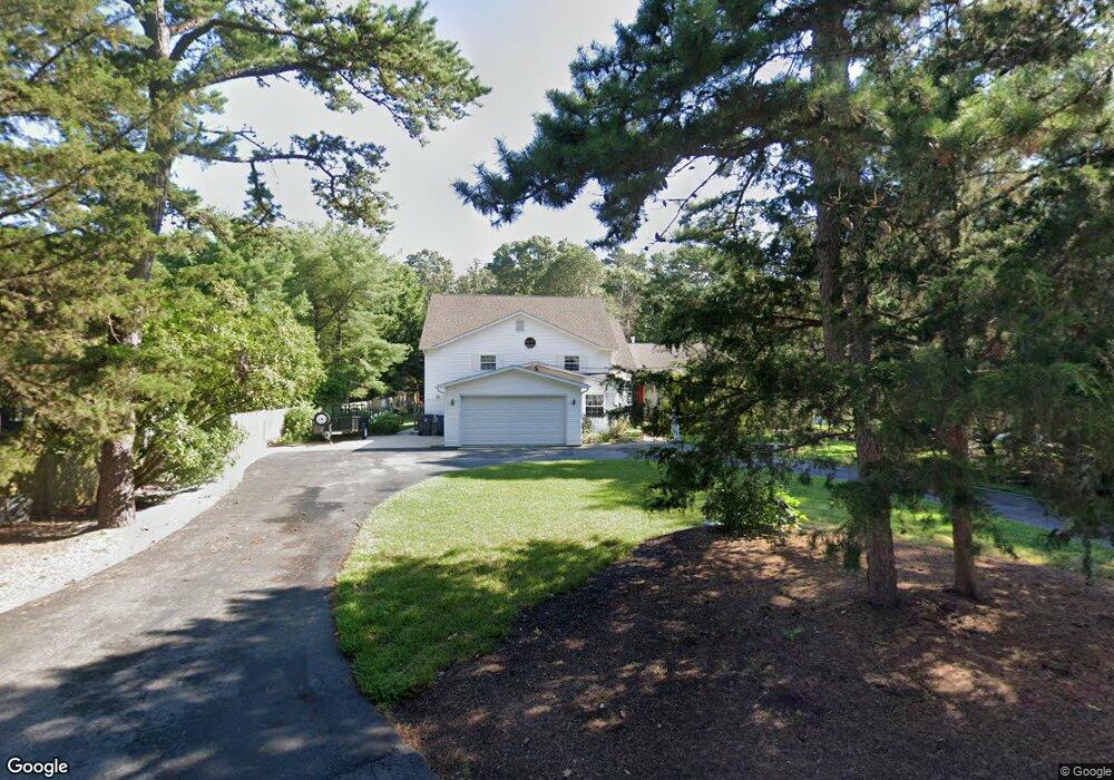
419 Clarkstown Rd Mays Landing, NJ 08330
Estimated Value: $370,816 - $478,000
--
Bed
--
Bath
1,938
Sq Ft
$221/Sq Ft
Est. Value
About This Home
This home is located at 419 Clarkstown Rd, Mays Landing, NJ 08330 and is currently estimated at $427,605, approximately $220 per square foot. 419 Clarkstown Rd is a home located in Atlantic County with nearby schools including George L. Hess Educational Complex, Joseph Shaner School, and William Davies Middle School.
Ownership History
Date
Name
Owned For
Owner Type
Purchase Details
Closed on
Jun 28, 1996
Sold by
Delilah Oaks Construction Company Inc
Bought by
Peace Carol Satera
Current Estimated Value
Home Financials for this Owner
Home Financials are based on the most recent Mortgage that was taken out on this home.
Original Mortgage
$65,000
Interest Rate
7.47%
Mortgage Type
Balloon
Purchase Details
Closed on
Feb 26, 1996
Sold by
Gervato John and Gervato Denise
Bought by
Bonafield James J and Bonafield Barbara
Purchase Details
Closed on
Dec 4, 1995
Sold by
Peace Carol Satera
Bought by
Delilah Oaks Construction Co Inc
Create a Home Valuation Report for This Property
The Home Valuation Report is an in-depth analysis detailing your home's value as well as a comparison with similar homes in the area
Home Values in the Area
Average Home Value in this Area
Purchase History
| Date | Buyer | Sale Price | Title Company |
|---|---|---|---|
| Peace Carol Satera | $160,000 | -- | |
| Bonafield James J | $40,000 | -- | |
| Delilah Oaks Construction Co Inc | -- | Liberty Title Agency |
Source: Public Records
Mortgage History
| Date | Status | Borrower | Loan Amount |
|---|---|---|---|
| Closed | Peace Carol Satera | $65,000 |
Source: Public Records
Tax History Compared to Growth
Tax History
| Year | Tax Paid | Tax Assessment Tax Assessment Total Assessment is a certain percentage of the fair market value that is determined by local assessors to be the total taxable value of land and additions on the property. | Land | Improvement |
|---|---|---|---|---|
| 2025 | $7,246 | $211,200 | $54,900 | $156,300 |
| 2024 | $7,246 | $211,200 | $54,900 | $156,300 |
| 2023 | $6,813 | $211,200 | $54,900 | $156,300 |
| 2022 | $6,813 | $211,200 | $54,900 | $156,300 |
| 2021 | $6,799 | $211,200 | $54,900 | $156,300 |
| 2020 | $6,799 | $211,200 | $54,900 | $156,300 |
| 2019 | $6,815 | $211,200 | $54,900 | $156,300 |
| 2018 | $6,577 | $211,200 | $54,900 | $156,300 |
| 2017 | $6,473 | $211,200 | $54,900 | $156,300 |
| 2016 | $6,292 | $211,200 | $54,900 | $156,300 |
| 2015 | $6,078 | $211,200 | $54,900 | $156,300 |
| 2014 | $6,568 | $250,000 | $67,400 | $182,600 |
Source: Public Records
Map
Nearby Homes
- 570 North St
- 1303 W Riverside Dr
- 116 Post Rd
- 1410 Cantillon Blvd
- 15 Lowell St
- 246 Old River Rd
- 355 Penny Ln
- 1403 Loretta Ave
- 1404 Loretta Ave
- 1 Lafayette Ave
- 1305 Matthews Ave
- 225 Old River Rd
- 504 Meadowbrook Dr
- 5745 2nd St
- 148 Marucci Place
- 109 Deal Ln
- Rt 50 and Old Mays Landing Rd
- 112 Giunta Walk
- 98 Gasko Rd
- 0 3rd St
- 425 Clarkstown Rd
- 431 Clarkstown Rd
- 422 Clarkstown Rd
- 407 Highland Dr
- 439 Clarkstown Rd
- 426 Clarkstown Rd
- 404 Highland Dr
- 430 Clarkstown Rd
- 343 Clarkstown Rd
- 445 Clarkstown Rd
- 349 Clarkstown Rd
- 434 Clarkstown Rd
- 347 Clarkstown Rd
- 411 Highland Dr
- 408 Highland Dr
- 423 Highland Dr
- 453 Clarkstown Rd
- 427 Highland Dr
- 456 Ridge Ln
- 431 Highland Dr