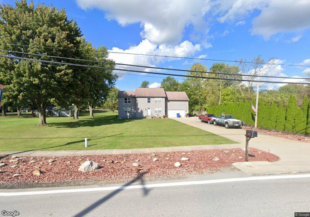
419 E Main St Lagrange, OH 44050
Estimated Value: $403,000 - $440,000
3
Beds
3
Baths
2,398
Sq Ft
$175/Sq Ft
Est. Value
About This Home
This home is located at 419 E Main St, Lagrange, OH 44050 and is currently estimated at $419,733, approximately $175 per square foot. 419 E Main St is a home with nearby schools including Keystone Elementary School, Keystone Middle School, and Keystone High School.
Ownership History
Date
Name
Owned For
Owner Type
Purchase Details
Closed on
Nov 22, 2010
Sold by
Norris Homes Inc
Bought by
Bauer Clinton D and Mcmarlin Angela F
Current Estimated Value
Home Financials for this Owner
Home Financials are based on the most recent Mortgage that was taken out on this home.
Original Mortgage
$199,121
Outstanding Balance
$132,045
Interest Rate
4.37%
Mortgage Type
FHA
Estimated Equity
$287,688
Purchase Details
Closed on
Apr 29, 2010
Sold by
Mclean John and Mclean Geraldine M
Bought by
Norris Homes Inc
Home Financials for this Owner
Home Financials are based on the most recent Mortgage that was taken out on this home.
Original Mortgage
$155,300
Interest Rate
5.16%
Mortgage Type
Future Advance Clause Open End Mortgage
Create a Home Valuation Report for This Property
The Home Valuation Report is an in-depth analysis detailing your home's value as well as a comparison with similar homes in the area
Home Values in the Area
Average Home Value in this Area
Purchase History
| Date | Buyer | Sale Price | Title Company |
|---|---|---|---|
| Bauer Clinton D | $201,900 | Old Republic | |
| Norris Homes Inc | $26,000 | Lawyers Title Co |
Source: Public Records
Mortgage History
| Date | Status | Borrower | Loan Amount |
|---|---|---|---|
| Open | Bauer Clinton D | $199,121 | |
| Closed | Norris Homes Inc | $155,300 |
Source: Public Records
Tax History
| Year | Tax Paid | Tax Assessment Tax Assessment Total Assessment is a certain percentage of the fair market value that is determined by local assessors to be the total taxable value of land and additions on the property. | Land | Improvement |
|---|---|---|---|---|
| 2024 | $4,882 | $115,080 | $20,930 | $94,150 |
| 2023 | $5,483 | $107,972 | $23,184 | $84,788 |
| 2022 | $5,446 | $107,972 | $23,184 | $84,788 |
| 2021 | $5,448 | $107,972 | $23,184 | $84,788 |
| 2020 | $4,971 | $87,780 | $18,850 | $68,930 |
| 2019 | $4,943 | $87,780 | $18,850 | $68,930 |
| 2018 | $4,649 | $87,780 | $18,850 | $68,930 |
| 2017 | $4,528 | $78,000 | $15,570 | $62,430 |
| 2016 | $4,497 | $78,000 | $15,570 | $62,430 |
| 2015 | $4,491 | $78,000 | $15,570 | $62,430 |
| 2014 | $3,477 | $68,420 | $13,660 | $54,760 |
| 2013 | $3,372 | $68,420 | $13,660 | $54,760 |
Source: Public Records
Map
Nearby Homes
- 0 Dill Ct Unit 5072837
- 317 Church St
- 110 Railroad St
- 516 Appomattox Ct
- 548 William St
- 305 W Main St
- 567 Vicksburg Ct
- 808 Buckingham Dr
- 800 Buckingham Dr
- 340 Granger Dr
- 801 Willich Ct
- 829 Robinson Dr
- 40260 Whitney Rd
- 42113 Meadow Ln
- 704 Black Bear Run
- 510 Arabian Ct
- 476 Stallion Ct
- 40175 Banks Rd
- 468 Stallion Ct
- 40163 Banks Rd
Your Personal Tour Guide
Ask me questions while you tour the home.