Estimated Value: $315,000 - $330,000
2
Beds
2
Baths
862
Sq Ft
$376/Sq Ft
Est. Value
About This Home
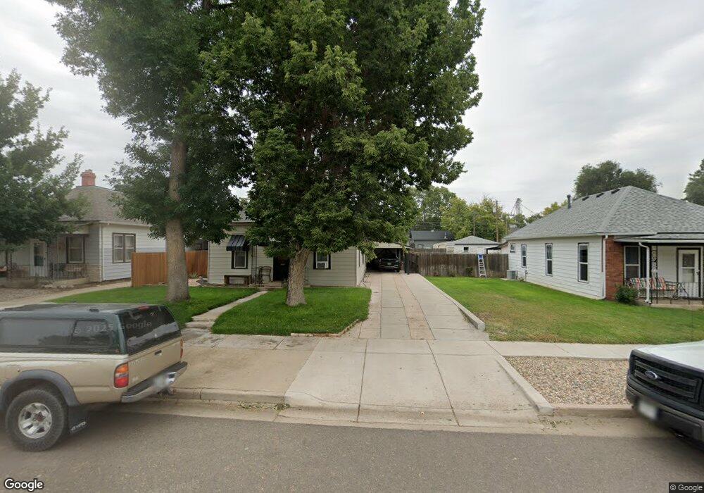
This home is located at 419 Maple Ave, Eaton, CO 80615 and is currently estimated at $323,685, approximately $375 per square foot. 419 Maple Ave is a home located in Weld County with nearby schools including Eaton High School and Northern Colorado Christian Academy.
Ownership History
Date
Name
Owned For
Owner Type
Purchase Details
Closed on
Aug 24, 2015
Sold by
Brown Jeff S
Bought by
Brown Jeff S and Brown Judy L
Current Estimated Value
Purchase Details
Closed on
Jan 9, 2006
Sold by
Brown Karen M and Brown Richard C
Bought by
Brown Jeff S
Home Financials for this Owner
Home Financials are based on the most recent Mortgage that was taken out on this home.
Original Mortgage
$96,000
Outstanding Balance
$53,831
Interest Rate
6.23%
Mortgage Type
Fannie Mae Freddie Mac
Estimated Equity
$269,854
Purchase Details
Closed on
Mar 31, 1998
Sold by
Magnusson Donald C and Magnusson Ann Joan
Bought by
Brown Karen M and Brown Richard C
Home Financials for this Owner
Home Financials are based on the most recent Mortgage that was taken out on this home.
Original Mortgage
$64,000
Interest Rate
7.04%
Purchase Details
Closed on
Nov 9, 1993
Purchase Details
Closed on
Apr 1, 1950
Create a Home Valuation Report for This Property
The Home Valuation Report is an in-depth analysis detailing your home's value as well as a comparison with similar homes in the area
Home Values in the Area
Average Home Value in this Area
Purchase History
| Date | Buyer | Sale Price | Title Company |
|---|---|---|---|
| Brown Jeff S | -- | None Available | |
| Brown Jeff S | $120,000 | Security Title | |
| Brown Karen M | $80,000 | -- | |
| -- | -- | -- | |
| -- | -- | -- |
Source: Public Records
Mortgage History
| Date | Status | Borrower | Loan Amount |
|---|---|---|---|
| Open | Brown Jeff S | $96,000 | |
| Previous Owner | Brown Karen M | $64,000 |
Source: Public Records
Tax History Compared to Growth
Tax History
| Year | Tax Paid | Tax Assessment Tax Assessment Total Assessment is a certain percentage of the fair market value that is determined by local assessors to be the total taxable value of land and additions on the property. | Land | Improvement |
|---|---|---|---|---|
| 2025 | $1,467 | $19,360 | $3,310 | $16,050 |
| 2024 | $1,467 | $19,360 | $3,310 | $16,050 |
| 2023 | $1,308 | $21,480 | $4,670 | $16,810 |
| 2022 | $1,303 | $16,230 | $3,670 | $12,560 |
| 2021 | $1,511 | $16,710 | $3,780 | $12,930 |
| 2020 | $1,237 | $15,340 | $2,670 | $12,670 |
| 2019 | $1,302 | $15,340 | $2,670 | $12,670 |
| 2018 | $842 | $11,600 | $2,160 | $9,440 |
| 2017 | $868 | $11,600 | $2,160 | $9,440 |
| 2016 | $788 | $10,640 | $2,200 | $8,440 |
| 2015 | $735 | $10,640 | $2,200 | $8,440 |
| 2014 | $512 | $7,610 | $1,500 | $6,110 |
Source: Public Records
Map
Nearby Homes
- 516 Elm Ave
- 410 Cottonwood Ave
- 435 Birch Ave
- 121 Elm Ave
- 425 Spruce Ave
- 1250 5th St
- 1240 3rd St
- 253 Buckeye Ave
- 1135 Huckleberry Ln Unit 2
- 105 Walnut Ave
- 356 Sycamore Ave
- 1330 3rd St
- 1155 Black Hawk Rd
- 910 E 3rd St
- 1230 Swainson Rd
- 1220 Swainson Rd
- 655 Red Tail Dr
- 360 Peregrine Point
- 29 Pioneer Place
- 340 Peregrine Point