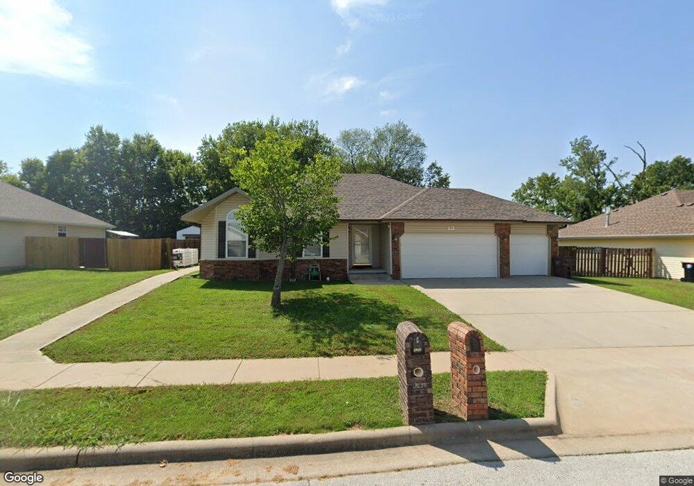
419 N Butternut Rd Republic, MO 65738
Estimated Value: $261,675 - $266,000
4
Beds
2
Baths
1,476
Sq Ft
$179/Sq Ft
Est. Value
About This Home
This home is located at 419 N Butternut Rd, Republic, MO 65738 and is currently estimated at $264,419, approximately $179 per square foot. 419 N Butternut Rd is a home located in Greene County with nearby schools including Schofield Elementary School, Republic Middle School, and Republic High School.
Ownership History
Date
Name
Owned For
Owner Type
Purchase Details
Closed on
Jul 1, 2025
Sold by
Rice Robert Todd and Jewell Ann
Bought by
Bledsoe Alanna
Current Estimated Value
Home Financials for this Owner
Home Financials are based on the most recent Mortgage that was taken out on this home.
Original Mortgage
$260,200
Outstanding Balance
$259,537
Interest Rate
6.86%
Mortgage Type
FHA
Estimated Equity
$4,882
Purchase Details
Closed on
Nov 13, 2019
Sold by
The David B Byrd Revocable Trust
Bought by
Rice Robert and Rice Jewell
Purchase Details
Closed on
Aug 5, 2011
Sold by
Rice Elizabeth Marie and Mauerman Elizabeth Marie
Bought by
Rice Robert T
Purchase Details
Closed on
Feb 7, 2011
Sold by
Rice Jewell Ann
Bought by
Rice Robert Todd
Create a Home Valuation Report for This Property
The Home Valuation Report is an in-depth analysis detailing your home's value as well as a comparison with similar homes in the area
Home Values in the Area
Average Home Value in this Area
Purchase History
| Date | Buyer | Sale Price | Title Company |
|---|---|---|---|
| Bledsoe Alanna | -- | None Listed On Document | |
| Bledsoe Alanna | -- | None Listed On Document | |
| Rice Robert | -- | Waco Title Co | |
| Rice Robert T | -- | None Available | |
| Rice Robert Todd | -- | None Available |
Source: Public Records
Mortgage History
| Date | Status | Borrower | Loan Amount |
|---|---|---|---|
| Open | Bledsoe Alanna | $260,200 | |
| Closed | Bledsoe Alanna | $260,200 |
Source: Public Records
Tax History
| Year | Tax Paid | Tax Assessment Tax Assessment Total Assessment is a certain percentage of the fair market value that is determined by local assessors to be the total taxable value of land and additions on the property. | Land | Improvement |
|---|---|---|---|---|
| 2025 | $2,039 | $38,400 | $5,700 | $32,700 |
| 2024 | $1,858 | $33,270 | $4,750 | $28,520 |
| 2023 | $0 | $33,270 | $4,750 | $28,520 |
| 2022 | $1,512 | $27,470 | $4,750 | $22,720 |
| 2021 | $1,503 | $27,470 | $4,750 | $22,720 |
| 2020 | $1,439 | $25,880 | $4,750 | $21,130 |
| 2019 | $1,434 | $25,880 | $4,750 | $21,130 |
| 2018 | $1,292 | $22,530 | $3,800 | $18,730 |
| 2017 | $0 | $21,070 | $3,800 | $17,270 |
| 2016 | $1,211 | $21,070 | $3,800 | $17,270 |
| 2015 | $1,207 | $21,070 | $3,800 | $17,270 |
| 2014 | $1,214 | $21,000 | $3,800 | $17,200 |
Source: Public Records
Map
Nearby Homes
- 393 N Ladera Dr
- 114 S Eagan St
- 421 W Elm St
- 413 W Elm St
- 347 W Elm St
- 411 N College Ave
- 319 W Hines St
- 626 N Phelps Ave
- 548 S Buxton Ln
- 566 S Buxton Ln
- 401 S West Ave
- 0 Highway 60 Unit 60308100
- 0 Highway 60 Unit 60308095
- 000 W Crestview Ln
- 1213 N London Place
- 1001 W Broad St
- 1135 W Broad St
- 473 S Michelle Ave
- 609 S Mckee Ave
- 2450 Highway 60
- 425 N Butternut Rd
- 413 N Butternut Rd
- 425 N Butternut Ave
- 431 N Butternut Ave
- 431 N Butternut Rd
- 420 N Butternut Rd
- 420 N Butternut Ave
- 414 N Butternut Rd
- 426 N Butternut Rd
- 426 N Butternut Ave
- 408 N Butternut Ave
- 408 N Butternut Rd
- 501 N Butternut Rd
- 540 Meadows Dr
- 432 N Butternut Rd
- 540 W Meadows Dr
- 432 N Butternut Ave
- 532 Meadows Dr
- 402 N Butternut Rd
- 502 N Butternut Rd
Your Personal Tour Guide
Ask me questions while you tour the home.