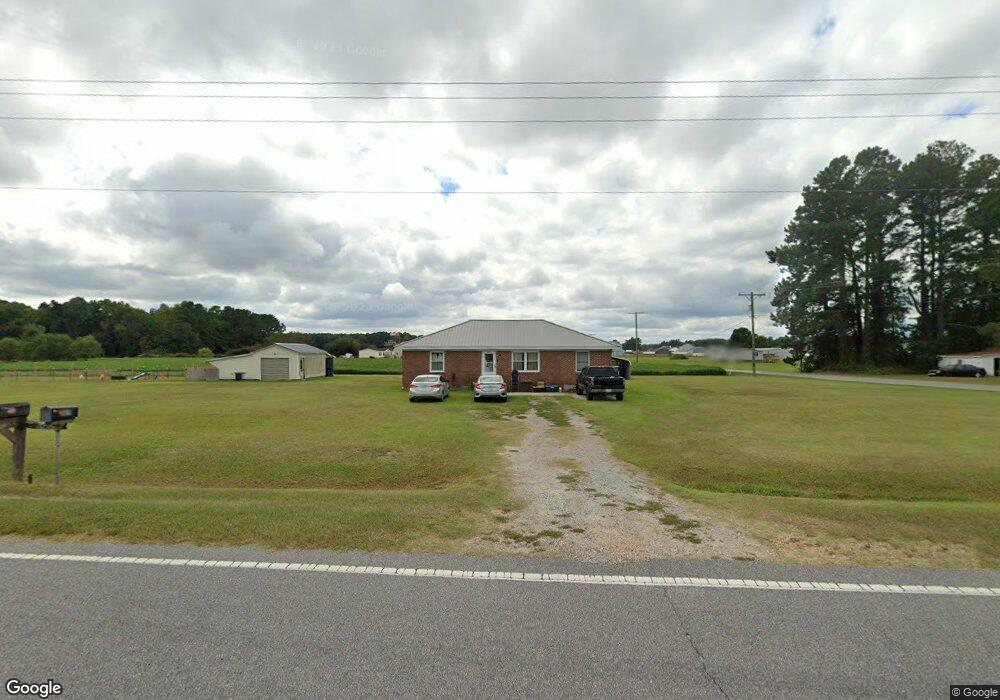
419 N Sandy Hook Rd Shawboro, NC 27973
Estimated Value: $195,000 - $326,000
2
Beds
1
Bath
1,363
Sq Ft
$197/Sq Ft
Est. Value
About This Home
This home is located at 419 N Sandy Hook Rd, Shawboro, NC 27973 and is currently estimated at $268,691, approximately $197 per square foot. 419 N Sandy Hook Rd is a home located in Camden County with nearby schools including Grandy Primary School, Camden Intermediate School, and Camden Middle School.
Ownership History
Date
Name
Owned For
Owner Type
Purchase Details
Closed on
Aug 18, 2020
Sold by
Floyd Florence Kight
Bought by
Stark Crystal Lynn
Current Estimated Value
Home Financials for this Owner
Home Financials are based on the most recent Mortgage that was taken out on this home.
Original Mortgage
$142,450
Outstanding Balance
$125,551
Interest Rate
2.9%
Mortgage Type
New Conventional
Estimated Equity
$143,140
Create a Home Valuation Report for This Property
The Home Valuation Report is an in-depth analysis detailing your home's value as well as a comparison with similar homes in the area
Purchase History
| Date | Buyer | Sale Price | Title Company |
|---|---|---|---|
| Stark Crystal Lynn | $140,000 | None Available |
Source: Public Records
Mortgage History
| Date | Status | Borrower | Loan Amount |
|---|---|---|---|
| Open | Stark Crystal Lynn | $142,450 |
Source: Public Records
Tax History
| Year | Tax Paid | Tax Assessment Tax Assessment Total Assessment is a certain percentage of the fair market value that is determined by local assessors to be the total taxable value of land and additions on the property. | Land | Improvement |
|---|---|---|---|---|
| 2025 | $1,421 | $175,196 | $90,208 | $84,988 |
| 2024 | $1,401 | $175,196 | $90,208 | $84,988 |
| 2023 | $1,212 | $175,196 | $90,208 | $84,988 |
| 2022 | $1,212 | $137,769 | $70,465 | $67,304 |
| 2021 | $1,212 | $137,769 | $70,465 | $67,304 |
| 2020 | $1,033 | $137,769 | $70,465 | $67,304 |
| 2019 | $1,019 | $137,769 | $70,465 | $67,304 |
| 2018 | $992 | $137,769 | $70,465 | $67,304 |
| 2017 | $992 | $137,769 | $70,465 | $67,304 |
| 2016 | $963 | $137,769 | $70,465 | $67,304 |
| 2015 | -- | $137,769 | $70,465 | $67,304 |
| 2014 | $995 | $165,784 | $85,879 | $79,905 |
Source: Public Records
Map
Nearby Homes
- 104 Gates Dr Unit (Model Home)
- 104 Gates Dr
- 104 Gates Dr Unit Lot 1
- 204 Halifax Ct
- 204 Halifax Ct Unit Lot 22
- 206 Halifax Ct
- 206 Halifax Ct Unit Lot 21
- 210 Halifax Ct
- 210 Halifax Ct Unit Lot 19
- 001 Yadkin Dr Unit Lot 0
- 001 Yadkin Dr
- 110 Yadkin Dr
- 110 Yadkin Dr Unit Lot 80
- 113 Neuse Dr Unit Lot 3
- 113 Neuse Dr
- 002 Yadkin Dr Unit Lot 0
- 002 Yadkin Dr
- 02 Yadkin Dr
- 02 Yadkin Dr Unit Lot 0
- 108 Cape Fear Dr
- 415 N Sandy Hook Rd
- 414 N Sandy Hook Rd
- 122 Cape Fear Dr
- 429 S Indian Town Rd
- 410 N Sandy Hook Rd
- 124 Cape Fear Dr
- 120 Cape Fear Dr
- 408 N Sandy Hook Rd
- 156 Ditch Bank Rd
- 118 Cape Fear Dr
- 431 N Sandy Hook Rd
- 154 Ditch Bank Rd
- 116 Cape Fear Dr
- 137 Ditch Bank Rd
- 114 Cape Fear Dr
- 104 Pungo Dr
- 112 Cape Fear Dr
- 133 Ditch Bank Rd
- 100 Perquimans Dr
- 447 N Sandy Hook Rd
Your Personal Tour Guide
Ask me questions while you tour the home.