Estimated Value: $289,321 - $315,000
2
Beds
1
Bath
1,057
Sq Ft
$284/Sq Ft
Est. Value
About This Home
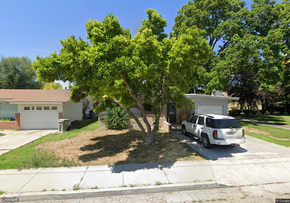
This home is located at 419 S Powerline Rd, Nampa, ID 83686 and is currently estimated at $300,330, approximately $284 per square foot. 419 S Powerline Rd is a home located in Canyon County with nearby schools including Kamali'i Elementary School, Waikele Elementary School, and Sherman Elementary School.
Ownership History
Date
Name
Owned For
Owner Type
Purchase Details
Closed on
Jun 18, 2021
Sold by
Bailey Anjuli
Bought by
Bailey Anjuli Kathlynn and Bailey Ryan
Current Estimated Value
Home Financials for this Owner
Home Financials are based on the most recent Mortgage that was taken out on this home.
Original Mortgage
$208,000
Outstanding Balance
$188,318
Interest Rate
2.9%
Mortgage Type
New Conventional
Estimated Equity
$112,012
Purchase Details
Closed on
Jul 27, 2015
Sold by
Merrell Phil D and Koberstein Anthony J
Bought by
City Of Nampa
Purchase Details
Closed on
Dec 6, 2011
Sold by
Home Buying Solutions Llc and Greenwalt Jay
Bought by
Sharp Executive Property Llc
Create a Home Valuation Report for This Property
The Home Valuation Report is an in-depth analysis detailing your home's value as well as a comparison with similar homes in the area
Home Values in the Area
Average Home Value in this Area
Purchase History
| Date | Buyer | Sale Price | Title Company |
|---|---|---|---|
| Bailey Anjuli Kathlynn | -- | Pioneer Title Canyon | |
| City Of Nampa | -- | None Available | |
| Sharp Executive Property Llc | -- | None Available |
Source: Public Records
Mortgage History
| Date | Status | Borrower | Loan Amount |
|---|---|---|---|
| Open | Bailey Anjuli Kathlynn | $208,000 |
Source: Public Records
Tax History Compared to Growth
Tax History
| Year | Tax Paid | Tax Assessment Tax Assessment Total Assessment is a certain percentage of the fair market value that is determined by local assessors to be the total taxable value of land and additions on the property. | Land | Improvement |
|---|---|---|---|---|
| 2025 | $1,840 | $275,600 | $108,000 | $167,600 |
| 2024 | $1,840 | $257,300 | $96,000 | $161,300 |
| 2023 | $1,930 | $256,200 | $96,000 | $160,200 |
| 2022 | $1,112 | $275,600 | $108,000 | $167,600 |
| 2021 | $1,145 | $194,400 | $56,500 | $137,900 |
| 2020 | $2,165 | $167,200 | $45,000 | $122,200 |
| 2019 | $2,309 | $143,900 | $39,000 | $104,900 |
| 2018 | $2,224 | $0 | $0 | $0 |
| 2017 | $2,019 | $0 | $0 | $0 |
| 2016 | $1,822 | $0 | $0 | $0 |
| 2015 | $1,657 | $0 | $0 | $0 |
| 2014 | $1,423 | $73,000 | $17,000 | $56,000 |
Source: Public Records
Map
Nearby Homes
- 416 S Powerline Rd
- 216 S Powerline Rd
- 1207 E Sheridan Ave
- 1716 Nixon Ave
- 111 S Almond St
- 618 Dufur St
- 1810 E Sherman Ave
- 1115 E Clark Ave
- 516 20th Ave S
- 507 20th Ave S
- 511 20th Ave S
- 223 S Elder St
- 512 19th Ave S
- 912 E Amity Ave
- 2024 2nd St S
- 1047 S 20th St
- 615 18th Ave S
- 1426 E Sharons Loop
- 1157 S Powerline Rd
- 1711 1st St S Unit 2, Ground Floor SW s
- 423 S Powerline Rd
- 411 S Powerline Rd
- 503 S Powerline Rd
- 408 S
- 420 Almond St
- 424 Almond St
- 416 Almond St
- 1415 E Sherman Ave
- 1423 E Sherman Ave
- 428 S Almond St
- 428 Almond St
- 408 Almond St
- 408 S Powerline Rd
- 505 S Powerline Rd
- 418 & 420 S Powerline Rd
- 418/420 S Powerline Rd
- 1411 E Sherman Ave
- 418 S Powerline Rd
- 508 S Powerline Rd
- 504 Almond St