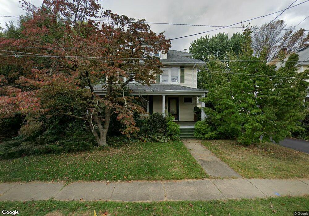
419 Stockton St Hightstown, NJ 08520
Estimated Value: $468,000 - $614,000
4
Beds
2
Baths
2,200
Sq Ft
$246/Sq Ft
Est. Value
About This Home
This home is located at 419 Stockton St, Hightstown, NJ 08520 and is currently estimated at $540,455, approximately $245 per square foot. 419 Stockton St is a home located in Mercer County with nearby schools including Melvin H. Kreps Middle School, Hightstown High School, and SciCore Academy.
Ownership History
Date
Name
Owned For
Owner Type
Purchase Details
Closed on
Jul 25, 2002
Current Estimated Value
Purchase Details
Closed on
Aug 30, 2001
Sold by
Rufno Douglas
Bought by
Denk Peter and Denk Jillian
Home Financials for this Owner
Home Financials are based on the most recent Mortgage that was taken out on this home.
Original Mortgage
$198,000
Interest Rate
7.05%
Purchase Details
Closed on
Nov 24, 1992
Sold by
Gentile Andrew
Bought by
Rufino Douglas and Rufino Diane
Purchase Details
Closed on
Jun 10, 1989
Sold by
Murray Lawrence A and Murray Carol A
Bought by
Gentile Andrew and Gentile Diane
Create a Home Valuation Report for This Property
The Home Valuation Report is an in-depth analysis detailing your home's value as well as a comparison with similar homes in the area
Home Values in the Area
Average Home Value in this Area
Purchase History
| Date | Buyer | Sale Price | Title Company |
|---|---|---|---|
| -- | $260,000 | -- | |
| Denk Peter | $225,000 | -- | |
| Rufino Douglas | -- | -- | |
| Gentile Andrew | -- | -- | |
| Gentile Andrew | $162,000 | -- |
Source: Public Records
Mortgage History
| Date | Status | Borrower | Loan Amount |
|---|---|---|---|
| Previous Owner | Denk Peter | $198,000 |
Source: Public Records
Tax History Compared to Growth
Tax History
| Year | Tax Paid | Tax Assessment Tax Assessment Total Assessment is a certain percentage of the fair market value that is determined by local assessors to be the total taxable value of land and additions on the property. | Land | Improvement |
|---|---|---|---|---|
| 2025 | $12,483 | $254,600 | $73,600 | $181,000 |
| 2024 | $12,356 | $254,600 | $73,600 | $181,000 |
| 2023 | $12,356 | $254,600 | $73,600 | $181,000 |
| 2022 | $11,928 | $254,600 | $73,600 | $181,000 |
| 2021 | $11,498 | $254,600 | $73,600 | $181,000 |
| 2020 | $11,236 | $254,600 | $73,600 | $181,000 |
| 2019 | $10,922 | $254,600 | $73,600 | $181,000 |
| 2018 | $10,604 | $254,600 | $73,600 | $181,000 |
| 2017 | $10,495 | $254,600 | $73,600 | $181,000 |
| 2016 | $10,403 | $254,600 | $73,600 | $181,000 |
| 2015 | $10,337 | $254,600 | $73,600 | $181,000 |
| 2014 | $10,403 | $254,600 | $73,600 | $181,000 |
Source: Public Records
Map
Nearby Homes
- 400 Stockton St
- 365 Stockton St
- 336 Stockton St
- 107 Hausser Ave
- 145 Lincoln Ave
- 141 Lincoln Ave
- 201 Morrison Ave
- 309 Lincoln Ave
- 104 1st Ave
- 0 Route 130
- 102 Teal Ct
- 1 Sterling Ct
- 15 Brownstone Rd
- 5 Forest Dr
- 302 S Main St
- 17 South Dr
- 4 South Dr
- 132 The Orchard Unit L
- 104 One Mile Rd
- 121 The Orchard Unit I
- 413 Stockton St
- 110 Dutch Neck Rd
- 425 Stockton St
- 401 Stockton St
- 114 Dutch Neck Rd
- 433 Stockton St
- 100 Harron Ave
- 420 Stockton St
- 416 Stockton St
- 414 Stockton St
- 424 Stockton St
- 107 Dutch Neck Rd
- 437 Stockton St
- 426 Stockton St
- 116 Dutch Neck Rd
- 104 Harron Ave
- 434 Stockton St
- 109 Dutch Neck Rd
- 439 Stockton St
- 436 Stockton St