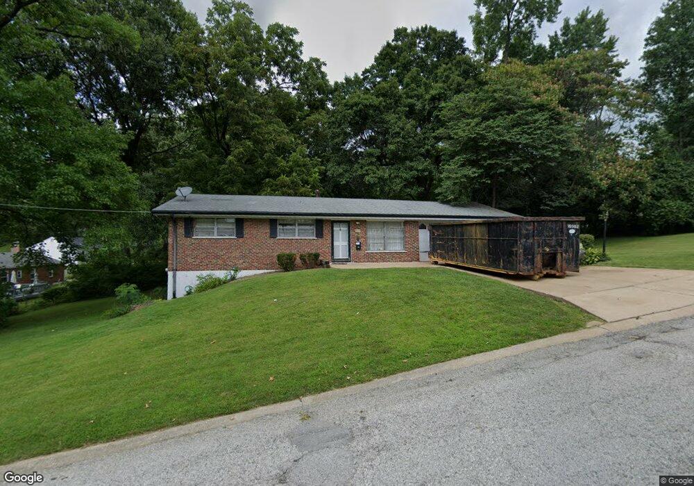
419 Thoroughman Ave Saint Louis, MO 63135
Estimated Value: $137,490 - $154,000
3
Beds
2
Baths
1,140
Sq Ft
$129/Sq Ft
Est. Value
About This Home
This home is located at 419 Thoroughman Ave, Saint Louis, MO 63135 and is currently estimated at $146,623, approximately $128 per square foot. 419 Thoroughman Ave is a home located in St. Louis County with nearby schools including Lee Hamilton Elementary School, Ferguson Middle School, and McCluer High School.
Ownership History
Date
Name
Owned For
Owner Type
Purchase Details
Closed on
Oct 24, 2013
Sold by
Sharamitaro John J
Bought by
Martin Karla
Current Estimated Value
Home Financials for this Owner
Home Financials are based on the most recent Mortgage that was taken out on this home.
Original Mortgage
$46,000
Interest Rate
4.62%
Mortgage Type
Purchase Money Mortgage
Create a Home Valuation Report for This Property
The Home Valuation Report is an in-depth analysis detailing your home's value as well as a comparison with similar homes in the area
Home Values in the Area
Average Home Value in this Area
Purchase History
| Date | Buyer | Sale Price | Title Company |
|---|---|---|---|
| Martin Karla | $65,000 | Us Title Main | |
| Martin Karla | $65,000 | Us Title Main |
Source: Public Records
Mortgage History
| Date | Status | Borrower | Loan Amount |
|---|---|---|---|
| Closed | Martin Karla | $46,000 |
Source: Public Records
Tax History
| Year | Tax Paid | Tax Assessment Tax Assessment Total Assessment is a certain percentage of the fair market value that is determined by local assessors to be the total taxable value of land and additions on the property. | Land | Improvement |
|---|---|---|---|---|
| 2025 | $1,881 | $28,390 | $3,880 | $24,510 |
| 2024 | $1,881 | $26,000 | $3,480 | $22,520 |
| 2023 | $1,881 | $26,000 | $3,480 | $22,520 |
| 2022 | $1,910 | $23,150 | $4,450 | $18,700 |
| 2021 | $1,848 | $23,150 | $4,450 | $18,700 |
| 2020 | $1,468 | $16,460 | $3,080 | $13,380 |
| 2019 | $1,440 | $16,460 | $3,080 | $13,380 |
| 2018 | $1,416 | $14,440 | $2,770 | $11,670 |
| 2017 | $1,389 | $14,440 | $2,770 | $11,670 |
| 2016 | $1,545 | $15,840 | $2,770 | $13,070 |
| 2015 | $1,555 | $15,840 | $2,770 | $13,070 |
| 2014 | $1,473 | $14,820 | $3,000 | $11,820 |
Source: Public Records
Map
Nearby Homes
- 509 Royal Ave
- 410 Robert Ave
- 212 Millman Dr
- 127 Thoroughman Ave
- 700 N Elizabeth Ave
- 308 Superior Dr
- 426 Darst Rd
- 26 N Maple Ave
- 631 Robert Ave
- 610 Superior Dr
- 35 Robert Ave
- 820 N Elizabeth Ave
- 705 Palace Ct
- 512 Coppinger Dr
- 6 Sandringham Ln
- 511 Averill Ave
- 11 Miller Place
- 439 Warford Ave
- 411 Warford Ave
- 506 Averill Ave
- 402 N Clay Ave
- 410 N Clay Ave
- 411 N Elizabeth Ave
- 418 Thoroughman Ave
- 420 Thoroughman Ave
- 414 Thoroughman Ave
- 405 N Elizabeth Ave
- 410 Thoroughman Ave
- 420 N Clay Ave
- 404 Thoroughman Ave
- 400 Thoroughman Ave
- 325 N Elizabeth Ave
- 419 N Elizabeth Ave
- 318 Thoroughman Ave
- 317 N Elizabeth Ave
- 426 N Clay Ave
- 411 N Clay Ave
- 397 Royal Ave
- 425 N Elizabeth Ave
- 311 Royal Ave
Your Personal Tour Guide
Ask me questions while you tour the home.