Estimated Value: $274,900 - $289,000
3
Beds
1
Bath
1
Sq Ft
$280,725/Sq Ft
Est. Value
About This Home
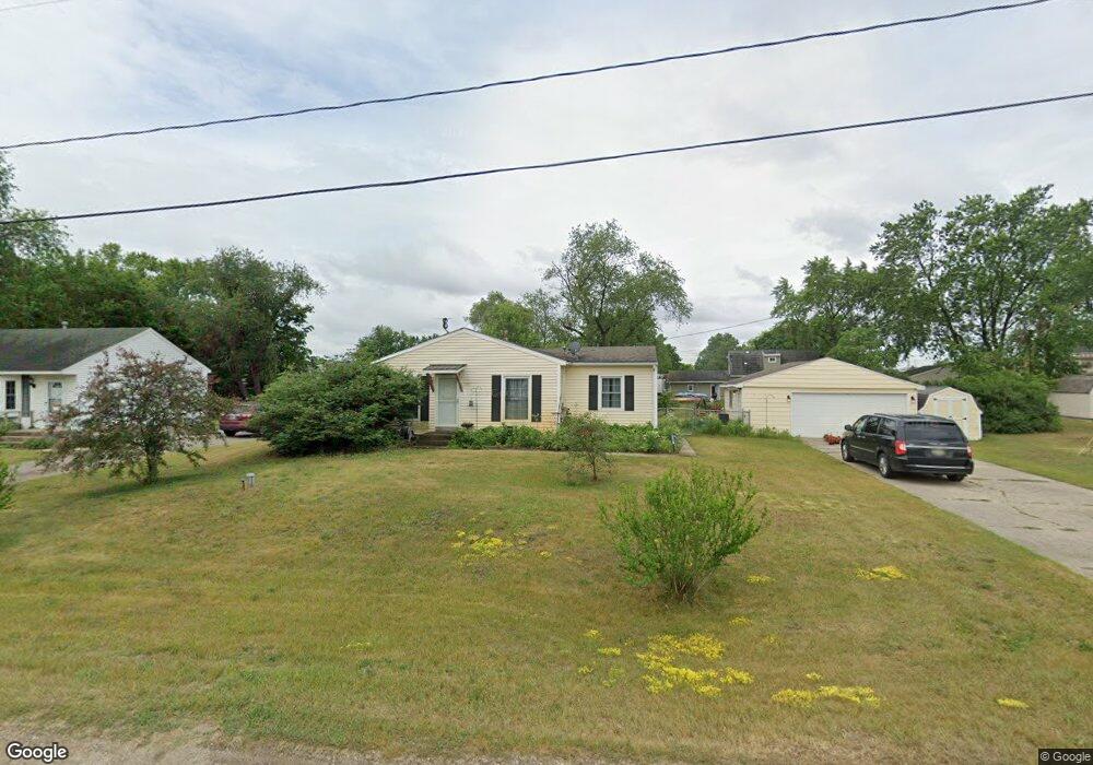
This home is located at 4190 Litchfield Dr, Dorr, MI 49323 and is currently estimated at $280,725, approximately $280,725 per square foot. 4190 Litchfield Dr is a home located in Allegan County with nearby schools including Wayland High School, Moline Christian School, and St. Stanislaus School.
Ownership History
Date
Name
Owned For
Owner Type
Purchase Details
Closed on
Mar 31, 2004
Sold by
Pieczynski Gary A and Pieczynski Lori L
Bought by
Raya Cathleen M
Current Estimated Value
Home Financials for this Owner
Home Financials are based on the most recent Mortgage that was taken out on this home.
Original Mortgage
$107,310
Outstanding Balance
$49,698
Interest Rate
5.65%
Mortgage Type
VA
Estimated Equity
$231,027
Create a Home Valuation Report for This Property
The Home Valuation Report is an in-depth analysis detailing your home's value as well as a comparison with similar homes in the area
Home Values in the Area
Average Home Value in this Area
Purchase History
| Date | Buyer | Sale Price | Title Company |
|---|---|---|---|
| Raya Cathleen M | $105,000 | Land America Trans Gr |
Source: Public Records
Mortgage History
| Date | Status | Borrower | Loan Amount |
|---|---|---|---|
| Open | Raya Cathleen M | $107,310 |
Source: Public Records
Tax History
| Year | Tax Paid | Tax Assessment Tax Assessment Total Assessment is a certain percentage of the fair market value that is determined by local assessors to be the total taxable value of land and additions on the property. | Land | Improvement |
|---|---|---|---|---|
| 2025 | $2,178 | $110,800 | $46,600 | $64,200 |
| 2024 | $1,976 | $100,400 | $40,700 | $59,700 |
| 2023 | $2,023 | $89,600 | $37,600 | $52,000 |
| 2022 | $1,976 | $78,000 | $31,600 | $46,400 |
| 2021 | $1,854 | $74,400 | $30,400 | $44,000 |
| 2020 | $1,774 | $72,200 | $29,000 | $43,200 |
| 2019 | $1,774 | $64,900 | $26,300 | $38,600 |
| 2018 | $1,736 | $59,900 | $16,000 | $43,900 |
| 2017 | $0 | $62,300 | $16,000 | $46,300 |
| 2016 | $0 | $54,600 | $16,000 | $38,600 |
| 2015 | -- | $54,600 | $16,000 | $38,600 |
| 2014 | -- | $52,600 | $16,500 | $36,100 |
| 2013 | -- | $51,400 | $16,500 | $34,900 |
Source: Public Records
Map
Nearby Homes
- 1341 142nd Ave
- 4087 Gene Ct
- Lots A&B 142nd Ave
- 4035 Patti Rd
- 4069 21st St
- 4335 Tavistock Dr
- 4316 Sussex Place
- 1125 Russell St
- 4273 Highpoint Dr Unit 112
- 4269 Highpoint Dr Unit 114
- 4271 Highpoint Dr Unit 113
- 4294 Highpoint Dr Unit 103
- 1069 Sunnyside Dr
- 4279 Highpoint Dr
- 4243 Butternut Dr
- 4245 Butternut Dr
- 4249 Butternut Dr
- Lot 120 Old Farm Dr
- Lot 131 Butternut Dr
- 4286 Butternut Dr
- 4186 Litchfield Dr
- 4193 Ranchero Dr
- 4194 Litchfield Dr
- 4189 Ranchero Dr
- 4195 Litchfield Dr
- 4182 Litchfield Dr
- 4189 Litchfield Dr
- 4197 Ranchero Dr
- 4185 Ranchero Dr
- 4178 Litchfield Dr
- 4196 Ranchero Dr
- 1685 Stratford Ave
- 4192 Ranchero Dr
- 1691 Stratford Ave
- 4188 Ranchero Dr
- 4181 Ranchero Dr
- 1686 Stratford Ave
- 4174 Litchfield Dr
- 4184 Ranchero Dr
- 1681 Stratford Ave
Your Personal Tour Guide
Ask me questions while you tour the home.