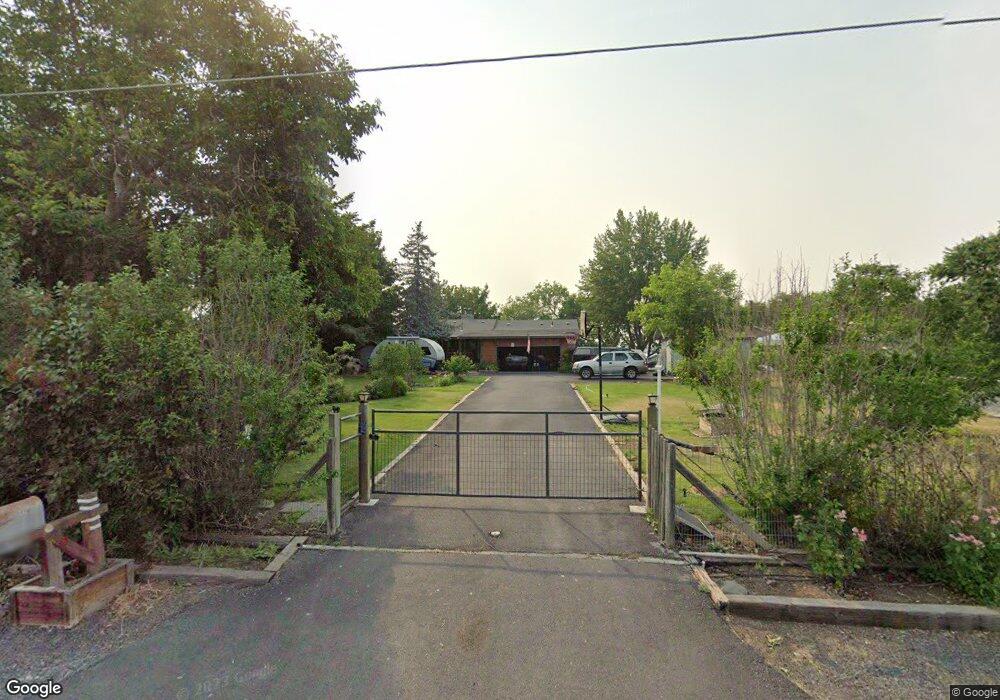
4190 Shorecrest Dr NE Moses Lake, WA 98837
Estimated Value: $500,000 - $700,000
1
Bed
2
Baths
1,214
Sq Ft
$475/Sq Ft
Est. Value
About This Home
This home is located at 4190 Shorecrest Dr NE, Moses Lake, WA 98837 and is currently estimated at $576,390, approximately $474 per square foot. 4190 Shorecrest Dr NE is a home located in Grant County with nearby schools including Larson Heights Elementary School, Endeavor Middle School, and Moses Lake High School.
Ownership History
Date
Name
Owned For
Owner Type
Purchase Details
Closed on
Aug 18, 2005
Sold by
Thrasher William A and Thrasher Katie Jones
Bought by
Berg Arne G and Berg Gail J
Current Estimated Value
Home Financials for this Owner
Home Financials are based on the most recent Mortgage that was taken out on this home.
Original Mortgage
$188,000
Outstanding Balance
$98,123
Interest Rate
5.56%
Mortgage Type
Fannie Mae Freddie Mac
Estimated Equity
$478,267
Create a Home Valuation Report for This Property
The Home Valuation Report is an in-depth analysis detailing your home's value as well as a comparison with similar homes in the area
Home Values in the Area
Average Home Value in this Area
Purchase History
| Date | Buyer | Sale Price | Title Company |
|---|---|---|---|
| Berg Arne G | $235,000 | Chicago Title Ins Co |
Source: Public Records
Mortgage History
| Date | Status | Borrower | Loan Amount |
|---|---|---|---|
| Open | Berg Arne G | $188,000 |
Source: Public Records
Tax History Compared to Growth
Tax History
| Year | Tax Paid | Tax Assessment Tax Assessment Total Assessment is a certain percentage of the fair market value that is determined by local assessors to be the total taxable value of land and additions on the property. | Land | Improvement |
|---|---|---|---|---|
| 2024 | $4,490 | $370,347 | $143,000 | $227,347 |
| 2023 | $4,003 | $321,685 | $143,000 | $178,685 |
| 2022 | $3,757 | $321,685 | $143,000 | $178,685 |
| 2021 | $2,712 | $321,685 | $143,000 | $178,685 |
| 2020 | $3,348 | $222,615 | $143,000 | $79,615 |
| 2019 | $3,339 | $236,275 | $134,000 | $102,275 |
| 2018 | $3,743 | $243,760 | $134,000 | $109,760 |
| 2017 | $3,672 | $237,660 | $134,000 | $103,660 |
| 2016 | $3,772 | $239,425 | $134,000 | $105,425 |
| 2013 | -- | $170,440 | $100,000 | $70,440 |
Source: Public Records
Map
Nearby Homes
- 4114 Shorecrest Dr NE
- 6401 Farrer Way
- 4898 Shorecrest Dr NE
- 7887 Dahl Rd NE
- 4926 Shorecrest Dr NE
- 3406 Wild Goose Rd NE
- 6354 Murray Way NE
- 7613 Cox St NE
- 4268 Hedman Ct
- 7322 Blue Goose Rd NE
- 4095 Quinn Dr NE Unit A-4
- 3348 Westshore Dr NE
- 4815 Airway Dr NE Unit 12
- 4815 Airway Dr NE Unit 105
- 8334 8336 Terminal St NE
- 3071 Westshore Dr NE
- 9035 Forrestal Ln
- 3064 Westshore Dr NE
- 2873 Wild Goose Rd NE
- 6479 Road 3 NE
- 4172 Shorecrest Dr NE
- 4152 Shorecrest Dr NE
- 0 NNA Shorecrest Dr NE
- 0 LOT 7 Shorecrest Dr NE
- 4226 Shorecrest Dr NE
- 4134 Shorecrest Dr NE
- 4244 Shorecrest Dr NE
- 4213 Shorecrest Dr NE
- 4260 Shorecrest Dr NE
- 4247 Shorecrest Dr NE
- 4177 Shorecrest Dr NE
- 4096 Shorecrest Dr NE
- 4276 Shorecrest Dr NE
- 4143 Shorecrest Dr NE
- 4080 Shorecrest Dr NE
- 4296 Shorecrest Dr NE
- 4283 Shorecrest Dr NE
- 4056 Shorecrest Dr NE
- 4310 Shorecrest Dr NE
- 4093 Shorecrest Dr NE