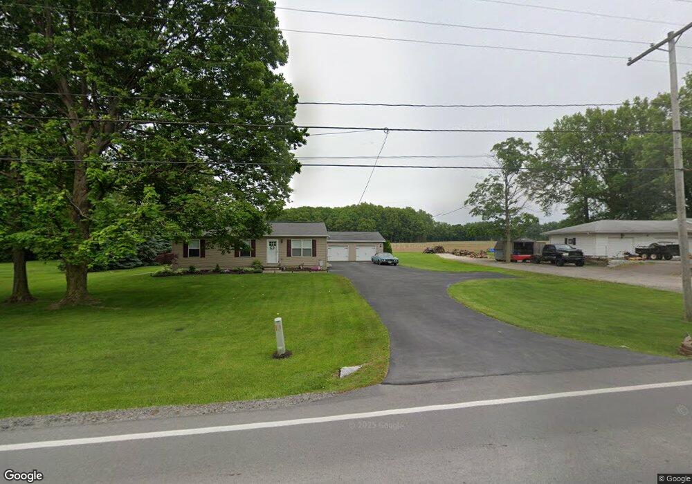
4190 State Route 601 Norwalk, OH 44857
Estimated Value: $165,000 - $211,000
3
Beds
1
Bath
1,008
Sq Ft
$185/Sq Ft
Est. Value
About This Home
This home is located at 4190 State Route 601, Norwalk, OH 44857 and is currently estimated at $186,723, approximately $185 per square foot. 4190 State Route 601 is a home located in Huron County with nearby schools including Western Reserve Elementary School, Western Reserve Middle School, and Western Reserve High School.
Ownership History
Date
Name
Owned For
Owner Type
Purchase Details
Closed on
Jun 2, 2003
Bought by
Comer Stephen E and Comer Amanda J
Current Estimated Value
Purchase Details
Closed on
May 14, 1998
Bought by
Horvath Wayne S
Purchase Details
Closed on
Oct 27, 1994
Sold by
Parcher Raymond R
Bought by
Gadd Jeffrey M and Gadd Jeanine D
Home Financials for this Owner
Home Financials are based on the most recent Mortgage that was taken out on this home.
Original Mortgage
$68,000
Interest Rate
8%
Mortgage Type
New Conventional
Create a Home Valuation Report for This Property
The Home Valuation Report is an in-depth analysis detailing your home's value as well as a comparison with similar homes in the area
Home Values in the Area
Average Home Value in this Area
Purchase History
| Date | Buyer | Sale Price | Title Company |
|---|---|---|---|
| Comer Stephen E | $91,000 | -- | |
| Horvath Wayne S | $61,000 | -- | |
| Gadd Jeffrey M | $12,000 | -- | |
| Gadd Jeffrey M | $12,000 | -- |
Source: Public Records
Mortgage History
| Date | Status | Borrower | Loan Amount |
|---|---|---|---|
| Previous Owner | Gadd Jeffrey M | $68,000 |
Source: Public Records
Tax History Compared to Growth
Tax History
| Year | Tax Paid | Tax Assessment Tax Assessment Total Assessment is a certain percentage of the fair market value that is determined by local assessors to be the total taxable value of land and additions on the property. | Land | Improvement |
|---|---|---|---|---|
| 2024 | $1,313 | $43,970 | $6,140 | $37,830 |
| 2023 | $1,313 | $34,850 | $4,900 | $29,950 |
| 2022 | $1,047 | $34,850 | $4,900 | $29,950 |
| 2021 | $1,085 | $34,850 | $4,900 | $29,950 |
| 2020 | $979 | $30,030 | $4,900 | $25,130 |
| 2019 | $974 | $30,030 | $4,900 | $25,130 |
| 2018 | $961 | $30,030 | $4,900 | $25,130 |
| 2017 | $899 | $28,580 | $4,900 | $23,680 |
| 2016 | $880 | $28,580 | $4,900 | $23,680 |
| 2015 | $870 | $28,590 | $4,900 | $23,690 |
| 2014 | $869 | $28,560 | $4,900 | $23,660 |
| 2013 | $858 | $28,560 | $4,900 | $23,660 |
Source: Public Records
Map
Nearby Homes
- 3713 Medusa Rd
- 27 Whitefield Blvd
- 14 Whitefield Blvd
- 121 Leisure Ln
- 112 State Route 61 Unit 25
- 0 Cleveland Rd
- 17 Sara Dr
- 34 Old State Rd N
- 5054 State Route 601
- 4925 Old State Rd N
- 203 Spino St
- 173 Saint Marys St
- 10 Parsons St
- 431 Old State Rd S
- 120 Woodlawn Ave
- 3257 Hartland Center Rd
- 45 Grove Ave
- 6 Blossom Dr Unit B
- 85 Woodlawn Ave
- 37 S Garden St
- 4176 State Route 601
- 4210 State Route 601
- 4224 Ohio 601
- 4224 State Route 601
- 4213 State Route 601
- 4154 State Route 601
- 4177 State Route 601
- 4246 State Route 601
- 4246 Ohio 601
- 4116 State Route 601
- 4116 State Route 601
- 4268 State Route 601
- 4268 State Route 601
- 4278 Ohio 601
- 4290 State Route 601
- 4079 State Route 601
- 4053 State Route 601
- 4296 State Route 601
- 4290 Oh-601 Unit 211 A
- 4290 Oh-601