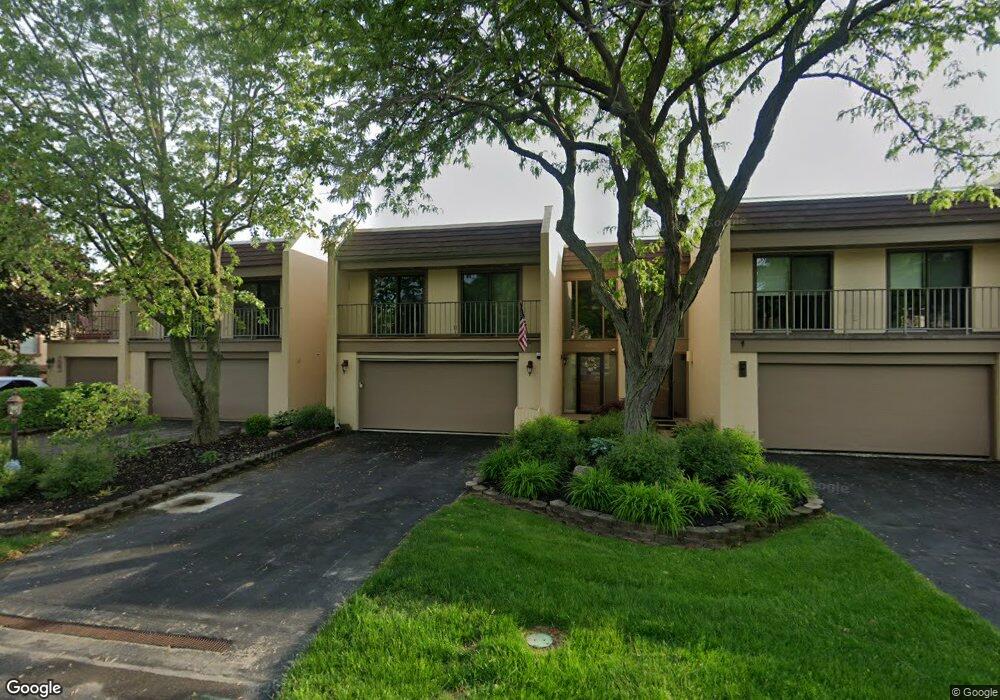
4192 E Mooresdock Rd Unit D23 Port Clinton, OH 43452
Estimated Value: $708,000 - $803,000
3
Beds
3
Baths
1,914
Sq Ft
$391/Sq Ft
Est. Value
About This Home
This home is located at 4192 E Mooresdock Rd Unit D23, Port Clinton, OH 43452 and is currently estimated at $748,332, approximately $390 per square foot. 4192 E Mooresdock Rd Unit D23 is a home located in Ottawa County with nearby schools including Bataan Memorial Primary School, Bataan Memorial Intermediate School, and Port Clinton Middle School.
Ownership History
Date
Name
Owned For
Owner Type
Purchase Details
Closed on
Jan 27, 2021
Sold by
Tagliavoni Mark D and Tagliavoni Marlene A
Bought by
Larue David and Tagliavoni Heritage Irrevocabl
Current Estimated Value
Purchase Details
Closed on
Aug 8, 2011
Sold by
Rowe Garry L and Rowe Pamela S
Bought by
Tagliavoni Mark D and Tagliavoni Marlene A
Purchase Details
Closed on
May 14, 2005
Sold by
Kocian Jeffrey L and Kocian Clifford G
Bought by
Rowe Garry L and Rowe Pamela S
Home Financials for this Owner
Home Financials are based on the most recent Mortgage that was taken out on this home.
Original Mortgage
$295,000
Interest Rate
3.25%
Mortgage Type
Fannie Mae Freddie Mac
Create a Home Valuation Report for This Property
The Home Valuation Report is an in-depth analysis detailing your home's value as well as a comparison with similar homes in the area
Home Values in the Area
Average Home Value in this Area
Purchase History
| Date | Buyer | Sale Price | Title Company |
|---|---|---|---|
| Larue David | -- | None Available | |
| Tagliavoni Mark D | $400,000 | Hartung Title | |
| Rowe Garry L | $395,000 | -- |
Source: Public Records
Mortgage History
| Date | Status | Borrower | Loan Amount |
|---|---|---|---|
| Previous Owner | Rowe Garry L | $295,000 |
Source: Public Records
Tax History Compared to Growth
Tax History
| Year | Tax Paid | Tax Assessment Tax Assessment Total Assessment is a certain percentage of the fair market value that is determined by local assessors to be the total taxable value of land and additions on the property. | Land | Improvement |
|---|---|---|---|---|
| 2024 | $6,925 | $203,445 | $78,750 | $124,695 |
| 2023 | $6,596 | $160,815 | $78,750 | $82,065 |
| 2022 | $5,729 | $160,815 | $78,750 | $82,065 |
| 2021 | $5,720 | $160,810 | $78,750 | $82,060 |
| 2020 | $5,308 | $143,570 | $63,000 | $80,570 |
| 2019 | $5,255 | $143,570 | $63,000 | $80,570 |
| 2018 | $5,246 | $143,570 | $63,000 | $80,570 |
| 2017 | $5,277 | $142,320 | $63,000 | $79,320 |
| 2016 | $5,290 | $142,320 | $63,000 | $79,320 |
| 2015 | $5,311 | $142,320 | $63,000 | $79,320 |
| 2014 | $4,977 | $136,450 | $63,000 | $73,450 |
| 2013 | $4,992 | $136,450 | $63,000 | $73,450 |
Source: Public Records
Map
Nearby Homes
- 3305 N Stonehouse Dr Unit 7
- 3425 N Karwood Dr
- 4434 E Harbors Edge Dr Unit 25
- 2950 N Bluff Ridge Dr
- 4520 E Harbors Edge Dr Unit 61
- 3737 N Karwood Dr
- 4866 Westwinds Dr
- 3778 N Cliff Rd
- 3983 Coachmans Trail
- 4862 Tradewinds Dr
- 2855 N Canterbury Cir Unit A
- 2901 Villa Ct Unit C
- 2769 Canterbury Cir
- 2750 Canterbury Cir Unit C
- 2769 N Canterbury Cir Unit B
- 4376 E Cliff Rd
- 4446 Marin Harbor Unit G
- 4446 Marin Harbor Rd
- 4446 E Marin Harbor
- 4475 Marin Harbor Unit H
- 4192 E Moores Dock Rd
- 4194 E Mooresdock Rd
- 4188 E Mooresdock Rd Unit D25
- 4188 E Moores Dock Rd
- 4190 E Mooresdock Rd
- 4196 E Mooresdock Rd
- 4204 E Mooresdock Rd Unit 11
- 4204 E Moores Dock Rd
- 4184 E Mooresdock Rd
- 4180 E Mooresdock Rd Unit D13
- 4208 E Mooresdock Rd Unit 12
- 3292 N Stonehouse Dr
- 3294 N Stonehouse Dr Unit C2
- 4182 E Mooresdock Rd
- 4212 E Mooresdock Rd Unit 13
- 3296 N Stonehouse Dr
- 3298 N Stonehouse Dr
- 4180 E Moores Dock Rd
- 3300 Stonehouse(unit C-5)
- 4218 E Mooresdock Rd Unit 24