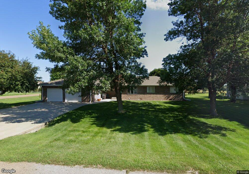
4196 Nevada Ave Grand Island, NE 68803
Estimated Value: $330,000 - $384,000
3
Beds
3
Baths
1,710
Sq Ft
$208/Sq Ft
Est. Value
About This Home
This home is located at 4196 Nevada Ave, Grand Island, NE 68803 and is currently estimated at $355,945, approximately $208 per square foot. 4196 Nevada Ave is a home located in Hall County with nearby schools including Engleman Elementary School, Westridge Middle School, and Grand Island Senior High School.
Ownership History
Date
Name
Owned For
Owner Type
Purchase Details
Closed on
Aug 25, 2016
Sold by
Matejka Elaine L
Bought by
Kneeland David E and Kneeland Danielle E
Current Estimated Value
Home Financials for this Owner
Home Financials are based on the most recent Mortgage that was taken out on this home.
Original Mortgage
$100,000
Outstanding Balance
$79,927
Interest Rate
3.45%
Mortgage Type
New Conventional
Estimated Equity
$276,018
Purchase Details
Closed on
Feb 7, 2008
Sold by
Matejka Elaine L
Bought by
Matejka Elaine L
Create a Home Valuation Report for This Property
The Home Valuation Report is an in-depth analysis detailing your home's value as well as a comparison with similar homes in the area
Home Values in the Area
Average Home Value in this Area
Purchase History
| Date | Buyer | Sale Price | Title Company |
|---|---|---|---|
| Kneeland David E | $195,000 | Grand Island Abstract Escrow | |
| Matejka Elaine L | -- | -- | |
| Matejka Elaine L | -- | -- |
Source: Public Records
Mortgage History
| Date | Status | Borrower | Loan Amount |
|---|---|---|---|
| Open | Kneeland David E | $100,000 |
Source: Public Records
Tax History Compared to Growth
Tax History
| Year | Tax Paid | Tax Assessment Tax Assessment Total Assessment is a certain percentage of the fair market value that is determined by local assessors to be the total taxable value of land and additions on the property. | Land | Improvement |
|---|---|---|---|---|
| 2024 | $4,332 | $297,354 | $43,853 | $253,501 |
| 2023 | $5,300 | $291,694 | $43,853 | $247,841 |
| 2022 | $4,080 | $203,001 | $20,114 | $182,887 |
| 2021 | $4,140 | $203,001 | $20,114 | $182,887 |
| 2020 | $4,926 | $203,001 | $20,114 | $182,887 |
| 2019 | $4,960 | $235,304 | $20,114 | $215,190 |
| 2017 | $4,871 | $225,057 | $20,114 | $204,943 |
| 2016 | $4,603 | $220,917 | $20,114 | $200,803 |
| 2015 | $4,674 | $220,917 | $20,114 | $200,803 |
| 2014 | $4,275 | $194,724 | $20,114 | $174,610 |
Source: Public Records
Map
Nearby Homes
- 4213 Amble Way
- 4203 Amble Way
- 4223 Amble Way
- 4233 Amble Way
- 4243 Amble Way
- 4204 Amble Way
- 4214 Amble Way
- 4224 Amble Way
- 4234 Amble Way
- 4244 Amble Way
- 4209 Wilder Ave
- 2931 Lee St
- 4306 Saddle Horse Ct
- 4048 Northview Dr
- 4035 W Airport Rd
- 629 N White
- 4204 W Capital Ave
- 2203 Macron St
- 2110 Topeka Cir
- 4019 Sacramento Cir
- 4188 Nevada Ave
- 2931 Independence Ave
- 4204 Nevada Ave
- 4187 Nevada Ave
- 4210 Nevada Ave
- 4209 Nevada Ave
- 4180 Nevada Ave
- 4179 Nevada Ave
- 4203 Utah Ave
- 4172 Nevada Ave
- 4202 Utah Ave
- 4171 Nevada Ave
- 4209 Utah Ave
- 4216 Nevada Ave
- 2912 Independence Ave
- 4196 Arizona Ave
- 4215 Nevada Ave
- 4188 Arizona Ave
- 4204 Utah Ave
- 4215 Utah Ave