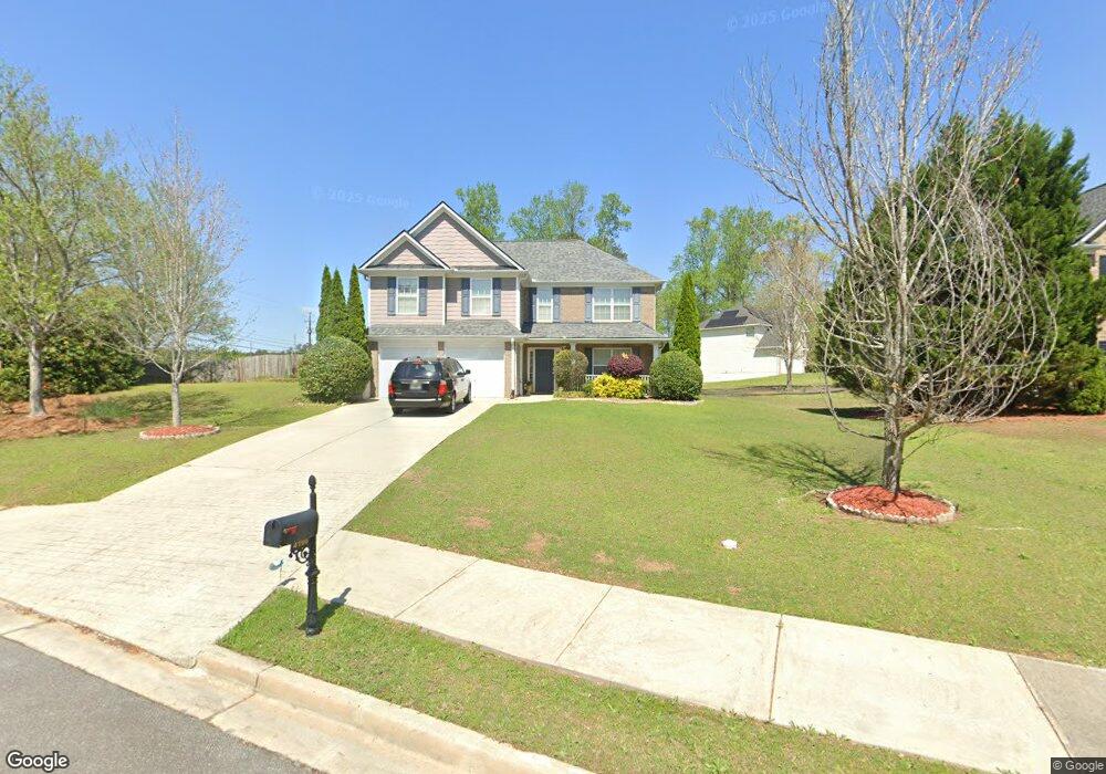
4198 Mcbride Dr Powder Springs, GA 30127
Estimated Value: $408,000 - $428,000
4
Beds
3
Baths
2,224
Sq Ft
$187/Sq Ft
Est. Value
About This Home
This home is located at 4198 Mcbride Dr, Powder Springs, GA 30127 and is currently estimated at $416,403, approximately $187 per square foot. 4198 Mcbride Dr is a home located in Cobb County with nearby schools including Tapp Middle School, McEachern High School, and Riverstone Montessori Academy.
Ownership History
Date
Name
Owned For
Owner Type
Purchase Details
Closed on
May 17, 2005
Sold by
Mcbride & Son Hms Atl Llc
Bought by
Gajahdar Curtis M and Gajahdar Sharon
Current Estimated Value
Home Financials for this Owner
Home Financials are based on the most recent Mortgage that was taken out on this home.
Original Mortgage
$198,331
Outstanding Balance
$101,748
Interest Rate
5.69%
Mortgage Type
VA
Estimated Equity
$314,655
Create a Home Valuation Report for This Property
The Home Valuation Report is an in-depth analysis detailing your home's value as well as a comparison with similar homes in the area
Home Values in the Area
Average Home Value in this Area
Purchase History
| Date | Buyer | Sale Price | Title Company |
|---|---|---|---|
| Gajahdar Curtis M | $199,900 | -- |
Source: Public Records
Mortgage History
| Date | Status | Borrower | Loan Amount |
|---|---|---|---|
| Open | Gajahdar Curtis M | $198,331 |
Source: Public Records
Tax History Compared to Growth
Tax History
| Year | Tax Paid | Tax Assessment Tax Assessment Total Assessment is a certain percentage of the fair market value that is determined by local assessors to be the total taxable value of land and additions on the property. | Land | Improvement |
|---|---|---|---|---|
| 2025 | $3,787 | $155,276 | $20,000 | $135,276 |
| 2024 | $3,790 | $155,276 | $20,000 | $135,276 |
| 2023 | $3,247 | $155,276 | $20,000 | $135,276 |
| 2022 | $2,781 | $107,848 | $18,000 | $89,848 |
| 2021 | $2,781 | $107,848 | $18,000 | $89,848 |
| 2020 | $2,551 | $97,368 | $18,000 | $79,368 |
| 2019 | $2,551 | $97,368 | $18,000 | $79,368 |
| 2018 | $2,323 | $86,952 | $14,000 | $72,952 |
| 2017 | $1,985 | $77,976 | $16,000 | $61,976 |
| 2016 | $1,856 | $73,456 | $18,000 | $55,456 |
| 2015 | $1,854 | $71,776 | $18,000 | $53,776 |
| 2014 | $1,870 | $71,776 | $0 | $0 |
Source: Public Records
Map
Nearby Homes
- Yellowstone Plan at Linden Grove
- Winthrop Plan at Linden Grove
- Valen Plan at Linden Grove
- Tilden Plan at Linden Grove
- Liston Plan at Linden Grove
- Frazier Plan at Linden Grove
- 2015 Augustine Trace
- 1960 Lost Mountain Rd
- 3837 Thackary Dr
- 2545 Melville Place
- 2526 New MacLand Rd
- 2159 Belmont Trace
- 4545 Gaydon Rd
- 1830 Lost Mountain Rd
- 2419 Old Lost Mountain Rd
- 4458 Spring Mountain Ln
- 2337 Old Lost Mountain Rd
- 2740 Creekside Manor Dr
- 2710 Braemore Glen
- 2298 Clonts Ct
- 0 Clonts Ct Unit 7269458
- 0 Clonts Ct Unit 7130750
- 0 Clonts Ct Unit 8552656
- 0 Clonts Ct Unit 8099053
- 0 Clonts Ct Unit 8047227
- 0 Clonts Ct
- 4199 Mcbride Dr
- 2294 Clonts Ct
- 2290 Clonts Ct
- 4187 Mcbride Dr
- 2295 Clonts Ct
- 2240 New MacLand Rd
- 2291 Clonts Ct
- 2299 Clonts Ct
- 4175 Mcbride Dr
- 4182 Mcbride Dr
- 4250 McMichen Ct
- 4178 Mcbride Dr
- 4174 Mcbride Dr