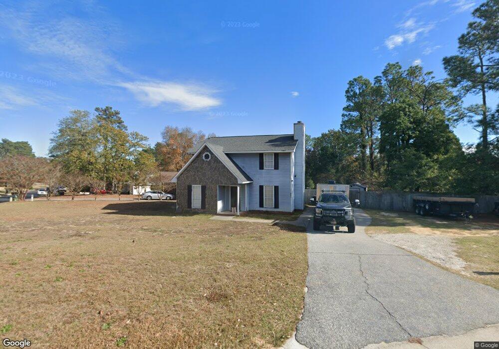
4199 Matson St Augusta, GA 30907
Estimated Value: $241,386 - $281,000
3
Beds
3
Baths
1,737
Sq Ft
$149/Sq Ft
Est. Value
About This Home
This home is located at 4199 Matson St, Augusta, GA 30907 and is currently estimated at $259,347, approximately $149 per square foot. 4199 Matson St is a home located in Columbia County with nearby schools including Westmont Elementary School, Evans Middle School, and Evans High School.
Ownership History
Date
Name
Owned For
Owner Type
Purchase Details
Closed on
Feb 25, 2011
Sold by
Michaels Kalyn
Bought by
Maner Misty Hughes
Current Estimated Value
Purchase Details
Closed on
Oct 5, 2010
Sold by
Wells Fargo Bank
Bought by
The Sec Of Veterans Affa
Purchase Details
Closed on
Nov 30, 2006
Sold by
Deas Randall A
Bought by
Davis Gary L
Home Financials for this Owner
Home Financials are based on the most recent Mortgage that was taken out on this home.
Original Mortgage
$137,800
Interest Rate
6.29%
Mortgage Type
VA
Create a Home Valuation Report for This Property
The Home Valuation Report is an in-depth analysis detailing your home's value as well as a comparison with similar homes in the area
Home Values in the Area
Average Home Value in this Area
Purchase History
| Date | Buyer | Sale Price | Title Company |
|---|---|---|---|
| Maner Misty Hughes | -- | -- | |
| Michaels Kalyn | $96,500 | -- | |
| The Sec Of Veterans Affa | -- | -- | |
| Wells Fargo Bank | -- | -- | |
| Davis Gary L | $134,900 | -- |
Source: Public Records
Mortgage History
| Date | Status | Borrower | Loan Amount |
|---|---|---|---|
| Previous Owner | Davis Gary L | $137,800 |
Source: Public Records
Tax History
| Year | Tax Paid | Tax Assessment Tax Assessment Total Assessment is a certain percentage of the fair market value that is determined by local assessors to be the total taxable value of land and additions on the property. | Land | Improvement |
|---|---|---|---|---|
| 2025 | $2,168 | $88,434 | $19,604 | $68,830 |
| 2024 | $2,214 | $86,256 | $18,404 | $67,852 |
| 2023 | $2,214 | $80,464 | $17,604 | $62,860 |
| 2022 | $1,887 | $70,343 | $15,104 | $55,239 |
| 2021 | $1,709 | $60,679 | $13,204 | $47,475 |
| 2020 | $1,659 | $57,633 | $12,604 | $45,029 |
| 2019 | $1,582 | $54,860 | $10,904 | $43,956 |
| 2018 | $1,638 | $56,699 | $12,004 | $44,695 |
| 2017 | $1,611 | $55,513 | $11,604 | $43,909 |
| 2016 | $1,486 | $52,931 | $10,980 | $41,951 |
| 2015 | $1,439 | $51,099 | $11,380 | $39,719 |
| 2014 | $1,350 | $47,214 | $10,780 | $36,434 |
Source: Public Records
Map
Nearby Homes
- 4096 Spencer St
- 211 Kestwick Dr W
- 245 Kestwick Dr W
- 4127 Meriden Dr
- 618 Matheny Cut
- 522 Gray Dr
- 4357 Quail Creek Rd
- 4130 Knollcrest Cir N
- 4367 Quail Creek Rd
- 4350 Quail Creek Rd
- 511 Merrymont Dr
- 213 S Belair Rd
- 373 Park Way Dr
- 4225 Spruce Ln
- 245 Hillbrook Dr
- 361 Paces Ferry Rd
- 4524 Oakley Pirkle Rd
- 4222 Green Ivy Cir
- 4507 Colonial Rd
- 4520 Shawnee Dr
- 634 Clinton Way W
- 628 Clinton Way W
- 634 Clinton Way E
- 205 Kestwick Dr W
- 626 Clinton Way W
- 627 Clinton Way W
- 629 Clinton Way W
- 203 Kestwick Dr W
- 636 Clinton Way W
- 631 Clinton Way W
- 625 Clinton Way W
- 209 Kestwick Dr W
- 4098 Spencer St
- 203 Kestwick Dr
- 623 Clinton Way W
- 633 Clinton Way W
- 638 Clinton Way W
- 4094 Spencer St
- 201 Kestwick Dr W
- 4104 Spencer St