Estimated Value: $462,000 - $480,000
2
Beds
1
Bath
1,104
Sq Ft
$427/Sq Ft
Est. Value
About This Home
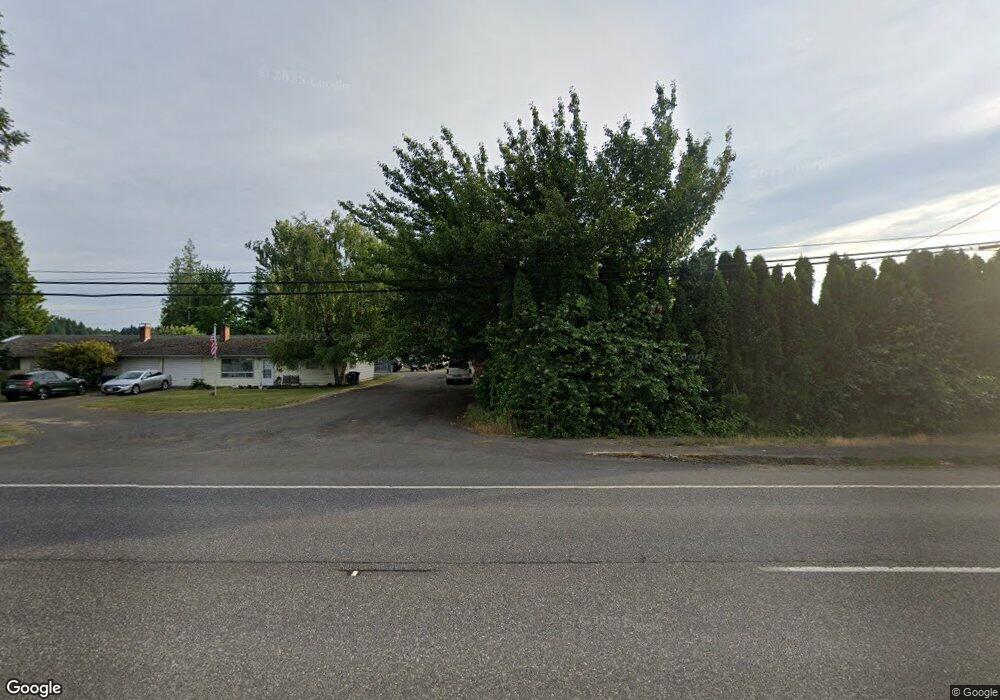
This home is located at 41990 SE Highway 26, Sandy, OR 97055 and is currently estimated at $471,696, approximately $427 per square foot. 41990 SE Highway 26 is a home located in Clackamas County with nearby schools including Firwood Elementary School, Cedar Ridge Middle School, and Sandy High School.
Ownership History
Date
Name
Owned For
Owner Type
Purchase Details
Closed on
Apr 2, 2025
Sold by
Hanson Darrell H
Bought by
Hanson Family Trust and Hanson
Current Estimated Value
Purchase Details
Closed on
Aug 31, 2009
Sold by
Hanson Darrel H and Hanson Georgine E
Bought by
Hanson Darrel H
Purchase Details
Closed on
Jan 7, 1999
Sold by
Obrist Michael W and Obrist Ardele S
Bought by
Hanson Darrel H and Hanson Georgine E
Create a Home Valuation Report for This Property
The Home Valuation Report is an in-depth analysis detailing your home's value as well as a comparison with similar homes in the area
Home Values in the Area
Average Home Value in this Area
Purchase History
| Date | Buyer | Sale Price | Title Company |
|---|---|---|---|
| Hanson Family Trust | -- | None Listed On Document | |
| Hanson Darrel H | -- | None Available | |
| Hanson Darrel H | $127,595 | -- |
Source: Public Records
Tax History Compared to Growth
Tax History
| Year | Tax Paid | Tax Assessment Tax Assessment Total Assessment is a certain percentage of the fair market value that is determined by local assessors to be the total taxable value of land and additions on the property. | Land | Improvement |
|---|---|---|---|---|
| 2025 | $3,022 | $216,241 | -- | -- |
| 2024 | $2,876 | $209,943 | -- | -- |
| 2023 | $2,876 | $203,829 | $0 | $0 |
| 2022 | $2,731 | $197,893 | $0 | $0 |
| 2021 | $2,636 | $192,130 | $0 | $0 |
| 2020 | $2,568 | $186,534 | $0 | $0 |
| 2019 | $2,557 | $181,101 | $0 | $0 |
| 2018 | $2,488 | $175,826 | $0 | $0 |
| 2017 | $2,432 | $170,705 | $0 | $0 |
| 2016 | $2,348 | $165,733 | $0 | $0 |
| 2015 | $2,283 | $160,906 | $0 | $0 |
| 2014 | $2,227 | $156,219 | $0 | $0 |
Source: Public Records
Map
Nearby Homes
- The Brightwood Plan at Hoodview Heights
- The Rock Creek Plan at Hoodview Heights
- 41800 Deschutes Ave Unit 86A
- The Hoodland Plan at Hoodview Heights
- 19025 Ochoco Ct Unit 67
- 18855 Crooked River St Unit 41
- 18905 Crooked River St Unit 46
- 41865 Deschutes Ave Unit 61
- 18935 Crooked River St Unit 49
- 41855 Deschutes Ave Unit 60
- The Cedar Creek Plan at Hoodview Heights
- 41820 Deschutes Ave Unit Lot 85B
- The Wildcat Plan at Hoodview Heights
- 19100 Ochoco Ct Unit Lot 70
- 41900 Deschutes Ave Unit 81B
- 42125 SE Luzon Ln
- 41830 Deschutes Ave Unit 85A
- 41810 Deschutes Ave Unit 86B
- 18815 Crooked River St
- 18865 Crooked River St Unit 42
- 42000 SE Highway 26 Unit 3
- 42000 SE Highway 26
- 41880 SE Highway 26
- 42042 SE Highway 26
- 41880 SE Highway 26
- 19015 Ochoco Ct
- 18855 Crooked River St
- 18935 Crooked River St
- 41855 Deschutes Ave
- 41925 Deschutes Ave
- 41900 Deschutes Ave Unit 81A
- 41900 Deschutes Ave
- 41785 Deschutes Ave
- 41951 SE Hwy 26
- 41850 U S 26
- 42025 SE Lauzon Ln
- 42130 SE Lauzon Ln
- 42095 SE Luzon Ln
- 42055 SE Lauzon Ln
- 42125 SE Lauzon Ln