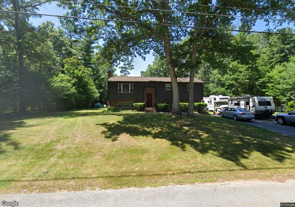
42 Anthony Rd Raynham, MA 02767
Estimated Value: $581,000 - $609,000
3
Beds
2
Baths
2,038
Sq Ft
$293/Sq Ft
Est. Value
About This Home
This home is located at 42 Anthony Rd, Raynham, MA 02767 and is currently estimated at $597,239, approximately $293 per square foot. 42 Anthony Rd is a home located in Bristol County with nearby schools including LaLiberte Elementary School, Merrill Elementary School, and Williams Intermediate School.
Ownership History
Date
Name
Owned For
Owner Type
Purchase Details
Closed on
Apr 27, 1995
Sold by
Cleary Joseph R and Cleary Paula M
Bought by
Doucette Robin T and Doucette Steven
Current Estimated Value
Home Financials for this Owner
Home Financials are based on the most recent Mortgage that was taken out on this home.
Original Mortgage
$141,795
Interest Rate
8.33%
Mortgage Type
Purchase Money Mortgage
Create a Home Valuation Report for This Property
The Home Valuation Report is an in-depth analysis detailing your home's value as well as a comparison with similar homes in the area
Home Values in the Area
Average Home Value in this Area
Purchase History
| Date | Buyer | Sale Price | Title Company |
|---|---|---|---|
| Doucette Robin T | $138,000 | -- |
Source: Public Records
Mortgage History
| Date | Status | Borrower | Loan Amount |
|---|---|---|---|
| Open | Doucette Robin T | $143,281 | |
| Closed | Doucette Robin T | $141,795 | |
| Previous Owner | Doucette Robin T | $15,000 |
Source: Public Records
Tax History
| Year | Tax Paid | Tax Assessment Tax Assessment Total Assessment is a certain percentage of the fair market value that is determined by local assessors to be the total taxable value of land and additions on the property. | Land | Improvement |
|---|---|---|---|---|
| 2025 | $6,360 | $525,600 | $199,800 | $325,800 |
| 2024 | $6,432 | $517,900 | $192,100 | $325,800 |
| 2023 | $5,926 | $435,700 | $172,900 | $262,800 |
| 2022 | $5,754 | $388,000 | $153,700 | $234,300 |
| 2021 | $5,457 | $371,500 | $146,000 | $225,500 |
| 2020 | $5,254 | $364,600 | $146,000 | $218,600 |
| 2019 | $5,188 | $364,600 | $146,000 | $218,600 |
| 2018 | $4,981 | $334,300 | $146,000 | $188,300 |
| 2017 | $4,664 | $310,300 | $138,300 | $172,000 |
| 2016 | $4,603 | $307,300 | $135,300 | $172,000 |
| 2015 | $4,122 | $270,500 | $136,500 | $134,000 |
Source: Public Records
Map
Nearby Homes
- 173 Titicut Rd
- 84 Diniz Dr
- 33 White St
- 26 Nottingham Dr
- 21 Sully Rd
- 30 Edward Rd
- 36 Stony Brook Rd
- 2 Maplewood Ln Unit 21-1
- 0 Maplewood Unit 21.3 73426136
- 40 Country Club Dr
- 4-B High Ridge Dr
- 53 Queens Cir
- 123 Center St
- 000 Old Pleasant St
- 314 Britton St
- 935 King St
- 646 Broadway
- 634 Broadway
- 658 Broadway
- 110 Cobblestone Ln
- 56 Anthony Rd
- 34 Anthony Rd
- 260 Ramblewood Dr
- 43 Anthony Rd
- 246 Ramblewood Dr
- 57 Anthony Rd
- 68 Anthony Rd
- 31 Anthony Rd
- 270 Ramblewood Dr
- 20 Anthony Rd
- 232 Ramblewood Dr
- 164 Ramblewood Dr
- 10 Anthony Rd
- 282 Ramblewood Dr
- 15 Anthony Rd
- 146 Carl Rd
- 253 Ramblewood Dr
- 200 Carl Rd
- 239 Ramblewood Dr
- 132 Carl Rd
Your Personal Tour Guide
Ask me questions while you tour the home.